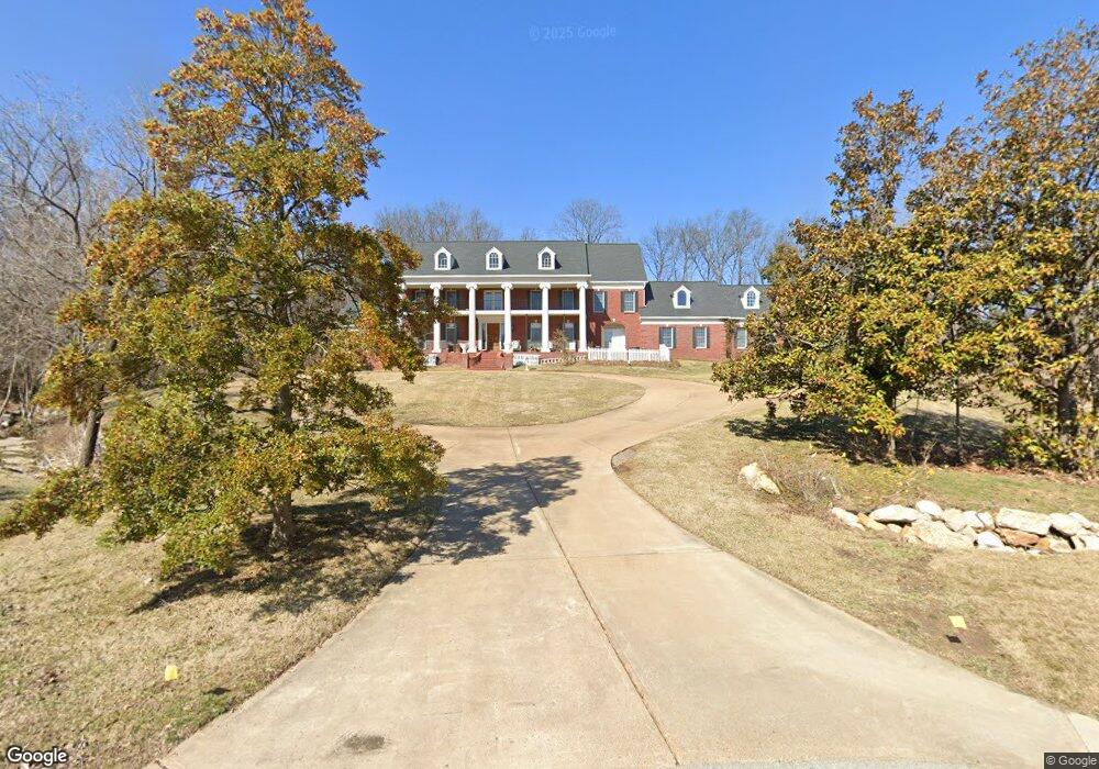
12715 Post Oak Rd Saint Louis, MO 63131
Estimated Value: $2,594,736 - $3,459,000
5
Beds
7
Baths
7,946
Sq Ft
$378/Sq Ft
Est. Value
About This Home
This home is located at 12715 Post Oak Rd, Saint Louis, MO 63131 and is currently estimated at $3,001,912, approximately $377 per square foot. 12715 Post Oak Rd is a home located in St. Louis County with nearby schools including Mason Ridge Elementary School, Parkway West Middle School, and Parkway West High School.
Ownership History
Date
Name
Owned For
Owner Type
Purchase Details
Closed on
Apr 10, 2012
Sold by
Branson Pamela
Bought by
Branson Kent D
Current Estimated Value
Home Financials for this Owner
Home Financials are based on the most recent Mortgage that was taken out on this home.
Original Mortgage
$1,276,700
Outstanding Balance
$848,284
Interest Rate
3.12%
Mortgage Type
New Conventional
Estimated Equity
$2,153,628
Purchase Details
Closed on
Jun 14, 2007
Sold by
Branson Pamela
Bought by
Branson Kent D
Home Financials for this Owner
Home Financials are based on the most recent Mortgage that was taken out on this home.
Original Mortgage
$1,410,000
Interest Rate
6.16%
Mortgage Type
Purchase Money Mortgage
Purchase Details
Closed on
Dec 7, 2004
Sold by
Branson Kent D and Branson Pamela J
Bought by
Branson Kent D
Home Financials for this Owner
Home Financials are based on the most recent Mortgage that was taken out on this home.
Original Mortgage
$960,000
Interest Rate
5.7%
Mortgage Type
New Conventional
Create a Home Valuation Report for This Property
The Home Valuation Report is an in-depth analysis detailing your home's value as well as a comparison with similar homes in the area
Home Values in the Area
Average Home Value in this Area
Purchase History
| Date | Buyer | Sale Price | Title Company |
|---|---|---|---|
| Branson Kent D | -- | Integrity Land Title Co Inc | |
| Branson Kent D | -- | Your Home Title Llc | |
| Branson Kent D | -- | -- |
Source: Public Records
Mortgage History
| Date | Status | Borrower | Loan Amount |
|---|---|---|---|
| Open | Branson Kent D | $1,276,700 | |
| Closed | Branson Kent D | $1,410,000 | |
| Previous Owner | Branson Kent D | $960,000 |
Source: Public Records
Tax History
| Year | Tax Paid | Tax Assessment Tax Assessment Total Assessment is a certain percentage of the fair market value that is determined by local assessors to be the total taxable value of land and additions on the property. | Land | Improvement |
|---|---|---|---|---|
| 2025 | $20,942 | $385,640 | $119,830 | $265,810 |
| 2024 | $20,942 | $359,990 | $106,510 | $253,480 |
| 2023 | $19,819 | $359,990 | $106,510 | $253,480 |
| 2022 | $22,615 | $373,290 | $119,830 | $253,460 |
| 2021 | $22,428 | $373,290 | $119,830 | $253,460 |
| 2020 | $19,591 | $311,790 | $102,680 | $209,110 |
| 2019 | $19,315 | $311,790 | $102,680 | $209,110 |
| 2018 | $21,088 | $314,680 | $91,280 | $223,400 |
| 2016 | $22,049 | $317,080 | $79,880 | $237,200 |
Source: Public Records
Map
Nearby Homes
- 12439 Springdale Ln Unit TBB
- 12897 Thornhill Ct
- 2056 N Ballas Rd
- 2062 N Ballas Rd
- 1821 Topping Rd
- 2030 N Ballas Rd
- TBB
- TBB Ballas Ridge Roclare II
- TBB Ballas Ridge Westchester IV
- TBB
- TBB Ballas Ridge Hawthorne II
- 1121 Westmoor Place
- 0 Unknown Unit 22071090
- 12467 Ballas Meadows Dr
- 9 Kirken Knoll Dr
- 12861 White Rock Ct
- 822 Town and Country Estates Dr
- 12597 Durrow Ct
- 13354 Thornhill Dr
- 2046 Willow Leaf Dr
- 12854 Horton Ln
- 12711 Post Oak Rd
- 12733 Post Oak Rd
- 12848 Horton Ln
- 12860 Horton Ln
- 12739 Post Oak Rd
- 12701 Post Oak Rd
- 12842 Horton Ln
- 12830 Horton Ln
- 12849 Horton Ln
- 12836 Horton Ln
- 12747 Post Oak Rd
- 12886 Horton Ln
- 12740 Post Oak Rd
- 0Lot Horton Ln
- 12866 Horton Ln
- 12718 Post Oak Rd
- 12760 Post Oak Rd
- 12843 Horton Ln
- 12872 Horton Ln
Your Personal Tour Guide
Ask me questions while you tour the home.