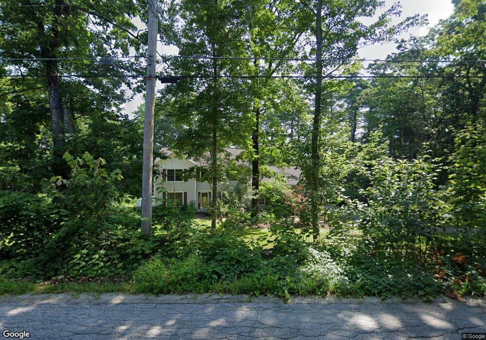
1272 Briar Hill Rd Contoocook, NH 03229
Estimated Value: $597,688 - $677,000
4
Beds
3
Baths
2,407
Sq Ft
$266/Sq Ft
Est. Value
About This Home
This home is located at 1272 Briar Hill Rd, Contoocook, NH 03229 and is currently estimated at $641,422, approximately $266 per square foot. 1272 Briar Hill Rd is a home located in Merrimack County with nearby schools including Harold Martin School and Hopkinton Middle School.
Ownership History
Date
Name
Owned For
Owner Type
Purchase Details
Closed on
Jul 5, 2006
Sold by
Smith Nash Rlty
Bought by
Leeming Rupert P and Leeming Joanne E
Current Estimated Value
Home Financials for this Owner
Home Financials are based on the most recent Mortgage that was taken out on this home.
Original Mortgage
$120,000
Outstanding Balance
$33,704
Interest Rate
6.6%
Mortgage Type
Purchase Money Mortgage
Estimated Equity
$607,718
Create a Home Valuation Report for This Property
The Home Valuation Report is an in-depth analysis detailing your home's value as well as a comparison with similar homes in the area
Home Values in the Area
Average Home Value in this Area
Purchase History
| Date | Buyer | Sale Price | Title Company |
|---|---|---|---|
| Leeming Rupert P | $370,000 | -- | |
| Leeming Rupert P | $370,000 | -- |
Source: Public Records
Mortgage History
| Date | Status | Borrower | Loan Amount |
|---|---|---|---|
| Open | Leeming Rupert P | $25,000 | |
| Open | Leeming Rupert P | $120,000 | |
| Closed | Leeming Rupert P | $120,000 |
Source: Public Records
Tax History Compared to Growth
Tax History
| Year | Tax Paid | Tax Assessment Tax Assessment Total Assessment is a certain percentage of the fair market value that is determined by local assessors to be the total taxable value of land and additions on the property. | Land | Improvement |
|---|---|---|---|---|
| 2024 | $13,108 | $598,800 | $211,800 | $387,000 |
| 2023 | $11,466 | $327,400 | $100,000 | $227,400 |
| 2022 | $10,559 | $327,400 | $100,000 | $227,400 |
| 2020 | $9,576 | $327,400 | $100,000 | $227,400 |
| 2019 | $9,534 | $327,400 | $100,000 | $227,400 |
| 2018 | $9,029 | $259,900 | $67,100 | $192,800 |
| 2017 | $8,912 | $259,900 | $67,100 | $192,800 |
| 2016 | $8,720 | $259,900 | $67,100 | $192,800 |
| 2015 | $8,738 | $259,900 | $67,100 | $192,800 |
| 2014 | $8,462 | $259,900 | $67,100 | $192,800 |
| 2013 | $8,415 | $292,800 | $72,200 | $220,600 |
Source: Public Records
Map
Nearby Homes
- 38 Woodwells Garrison Rd
- 356 E Penacook Rd
- 108 Maple St
- 455 Maple St
- 0 Bound Tree Rd Unit 50 5060705
- 104 River Grant Dr
- 148 Broad Cove Dr
- 89 Old Henniker Rd
- 155 Pamela Dr
- 656 Dolly Rd
- 106 Stacey Dr
- 102 Fieldstone Rd
- 95 Blackwater Rd
- 2 Granite Valley
- 256 Irish Hill Rd
- 541 South Rd
- 93-1 Pine St
- 0 Pine St Unit 38 5061613
- 0 Pine St Unit 50 5060731
- 00 Deer Meadow Rd Unit 26
- 1260 Briar Hill Rd
- 1331 Briar Hill Rd
- 1279 Briar Hill Rd
- 1257 Briar Hill Rd
- 1242 Briar Hill Rd
- 1221 Briar Hill Rd
- 1192 Briar Hill Rd
- 1375 Briar Hill Rd
- 1176 Briar Hill Rd
- 1399 Briar Hill Rd
- 1017 Broad Cove Rd
- 1158 Briar Hill Rd
- 991 Broad Cove Rd
- 963 Broad Cove Rd
- 1136 Briar Hill Rd
- 921 Broad Cove Rd
- 1061 Broad Cove Rd
- 1028 Broad Cove Rd
- 940 Broad Cove Rd
- 1460 Briar Hill Rd