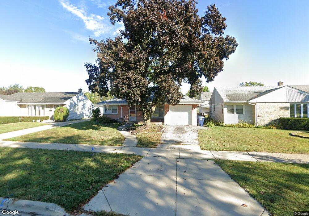
1272 Dennis Place Des Plaines, IL 60018
Estimated Value: $337,000 - $410,000
2
Beds
1
Bath
1,260
Sq Ft
$287/Sq Ft
Est. Value
About This Home
This home is located at 1272 Dennis Place, Des Plaines, IL 60018 and is currently estimated at $361,241, approximately $286 per square foot. 1272 Dennis Place is a home located in Cook County with nearby schools including Forest Elementary School, Algonquin Middle School, and Maine West High School.
Ownership History
Date
Name
Owned For
Owner Type
Purchase Details
Closed on
May 25, 2010
Sold by
Oneil Estelle B
Bought by
Salnis Regina
Current Estimated Value
Home Financials for this Owner
Home Financials are based on the most recent Mortgage that was taken out on this home.
Original Mortgage
$167,741
Outstanding Balance
$113,526
Interest Rate
5.25%
Mortgage Type
FHA
Estimated Equity
$247,715
Create a Home Valuation Report for This Property
The Home Valuation Report is an in-depth analysis detailing your home's value as well as a comparison with similar homes in the area
Home Values in the Area
Average Home Value in this Area
Purchase History
| Date | Buyer | Sale Price | Title Company |
|---|---|---|---|
| Salnis Regina | $170,000 | Attorneys Title Guaranty Fun |
Source: Public Records
Mortgage History
| Date | Status | Borrower | Loan Amount |
|---|---|---|---|
| Open | Salnis Regina | $167,741 |
Source: Public Records
Tax History Compared to Growth
Tax History
| Year | Tax Paid | Tax Assessment Tax Assessment Total Assessment is a certain percentage of the fair market value that is determined by local assessors to be the total taxable value of land and additions on the property. | Land | Improvement |
|---|---|---|---|---|
| 2024 | $5,981 | $26,001 | $4,394 | $21,607 |
| 2023 | $5,810 | $26,001 | $4,394 | $21,607 |
| 2022 | $5,810 | $26,001 | $4,394 | $21,607 |
| 2021 | $4,008 | $16,370 | $3,661 | $12,709 |
| 2020 | $4,009 | $16,370 | $3,661 | $12,709 |
| 2019 | $4,027 | $18,394 | $3,661 | $14,733 |
| 2018 | $5,073 | $20,398 | $3,221 | $17,177 |
| 2017 | $5,001 | $20,398 | $3,221 | $17,177 |
| 2016 | $4,974 | $20,398 | $3,221 | $17,177 |
| 2015 | $4,068 | $16,081 | $2,782 | $13,299 |
| 2014 | $3,999 | $16,081 | $2,782 | $13,299 |
| 2013 | $3,882 | $16,081 | $2,782 | $13,299 |
Source: Public Records
Map
Nearby Homes
- 1394 Carol Ln
- 991 Wicke Ave
- 1157 W Grant Dr
- 1056 E Villa Dr
- 1050 E Oakton St
- 1205 S Wolf Rd
- 807 Fairmont Ct
- 773 E Lincoln Ave
- 911 E Villa Dr
- 858 E Grant Dr
- 881 E Thacker St
- 505 Forest Ave
- 886 E Thacker St
- 915 Graceland Ave Unit 1E
- 714 E Thacker St
- 1380 Oakwood Ave Unit 306
- 906 Alfini Dr
- 1783 Lee St
- 1365 Ashland Ave Unit 302
- 1489 E Algonquin Rd
- 1264 Dennis Place
- 1280 Dennis Place
- 1288 Dennis Place
- 1256 Dennis Place
- 1225 Wayne Dr
- 1233 Wayne Dr
- 1217 Wayne Dr
- 1241 Wayne Dr
- 1296 Dennis Place
- 1209 Wayne Dr
- 1249 Wayne Dr
- 1275 Dennis Place
- 1265 Dennis Place
- 1285 Dennis Place
- 1257 Dennis Place
- 1304 Dennis Place
- 1257 Wayne Dr
- 1295 Dennis Place
- 1265 Wayne Dr
- 1305 Dennis Place