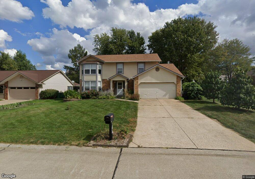
1272 Stephenridge Dr Saint Charles, MO 63304
Estimated Value: $376,809 - $412,000
4
Beds
3
Baths
2,238
Sq Ft
$177/Sq Ft
Est. Value
About This Home
This home is located at 1272 Stephenridge Dr, Saint Charles, MO 63304 and is currently estimated at $395,952, approximately $176 per square foot. 1272 Stephenridge Dr is a home located in St. Charles County with nearby schools including Central Elementary School, Bryan Middle School, and Francis Howell Union High School.
Ownership History
Date
Name
Owned For
Owner Type
Purchase Details
Closed on
Oct 7, 2002
Sold by
Leake Lewis D and Leake Deborah A
Bought by
Wilson Arthur C and Wilson Jennifer K
Current Estimated Value
Home Financials for this Owner
Home Financials are based on the most recent Mortgage that was taken out on this home.
Original Mortgage
$131,600
Outstanding Balance
$54,890
Interest Rate
6.09%
Estimated Equity
$341,062
Create a Home Valuation Report for This Property
The Home Valuation Report is an in-depth analysis detailing your home's value as well as a comparison with similar homes in the area
Home Values in the Area
Average Home Value in this Area
Purchase History
| Date | Buyer | Sale Price | Title Company |
|---|---|---|---|
| Wilson Arthur C | $164,500 | -- |
Source: Public Records
Mortgage History
| Date | Status | Borrower | Loan Amount |
|---|---|---|---|
| Open | Wilson Arthur C | $131,600 | |
| Closed | Wilson Arthur C | $16,450 |
Source: Public Records
Tax History
| Year | Tax Paid | Tax Assessment Tax Assessment Total Assessment is a certain percentage of the fair market value that is determined by local assessors to be the total taxable value of land and additions on the property. | Land | Improvement |
|---|---|---|---|---|
| 2025 | $3,404 | $64,382 | -- | -- |
| 2023 | $3,402 | $56,936 | $0 | $0 |
| 2022 | $2,826 | $43,876 | $0 | $0 |
| 2021 | $2,829 | $43,876 | $0 | $0 |
| 2020 | $2,852 | $42,827 | $0 | $0 |
| 2019 | $2,839 | $42,827 | $0 | $0 |
| 2018 | $2,625 | $37,824 | $0 | $0 |
| 2017 | $2,603 | $37,824 | $0 | $0 |
| 2016 | $2,508 | $35,095 | $0 | $0 |
| 2015 | $2,475 | $35,095 | $0 | $0 |
| 2014 | $2,464 | $33,894 | $0 | $0 |
Source: Public Records
Map
Nearby Homes
- 1276 Stephenridge Dr
- 1248 Shirley Ridge Dr Unit 7C
- 4691 Kellykris Dr
- 323 San Marco Way
- 21 Knollwood Ct
- 3624 Capri Way
- 3812 Capri Way
- 207 Kreder Ln
- 159 Cedar Mill Ct
- Westbrook Plan at Kreder Farms
- Savannah Plan at Kreder Farms
- Rockport Plan at Kreder Farms
- Monaco Plan at Kreder Farms
- Canterbury Plan at Kreder Farms
- Princeton Plan at Kreder Farms
- Sydney Plan at Kreder Farms
- Bradford Plan at Kreder Farms
- Bridgeport Plan at Kreder Farms
- Rochester Plan at Kreder Farms
- Kingston Plan at Kreder Farms
- 1274 Stephenridge Dr
- 4614 Gregory Gerard Dr
- 52 Dugan Ct
- 4697 Gregory Gerard Dr
- 4695 Gregory Gerard Dr
- 1273 Stephenridge Dr
- 1275 Stephenridge Dr
- 4615 Gregory Gerard Dr
- 51 Dugan Ct
- 1277 Stephenridge Dr
- 1278 Stephenridge Dr
- 1266 Stephenridge Dr
- 4613 Gregory Gerard Dr
- 50 Dugan Ct
- 4702 Gregory Gerard Dr
- 1312 Robertridge Dr
- 73 Audrey Ct
- 40 Dugan Ct
- 1279 Stephenridge Dr