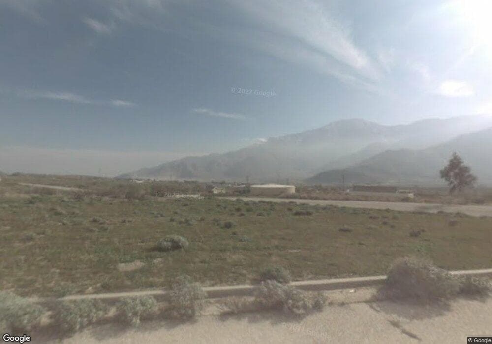
12720 Clay Rd Whitewater, CA 92282
Estimated Value: $410,000
2
Beds
2
Baths
1,649
Sq Ft
$249/Sq Ft
Est. Value
About This Home
This home is located at 12720 Clay Rd, Whitewater, CA 92282 and is currently estimated at $410,000, approximately $248 per square foot. 12720 Clay Rd is a home located in Riverside County with nearby schools including Banning High School.
Ownership History
Date
Name
Owned For
Owner Type
Purchase Details
Closed on
May 19, 2021
Sold by
Johnson Steven and Johnson Carrie
Bought by
Johnson Steven and Johnson Carrie A
Current Estimated Value
Purchase Details
Closed on
Jan 27, 2010
Sold by
Majestic Development Llc
Bought by
Johnson Steven and Johnson Carrie
Purchase Details
Closed on
Mar 14, 2005
Sold by
Barnett Madelaine and Beauchamp Jenalyn
Bought by
Majestic Development Llc
Purchase Details
Closed on
Oct 11, 2004
Sold by
Fenton P Joanne
Bought by
Barnett Madelaine and Beauchamp Jenalyn
Create a Home Valuation Report for This Property
The Home Valuation Report is an in-depth analysis detailing your home's value as well as a comparison with similar homes in the area
Home Values in the Area
Average Home Value in this Area
Purchase History
| Date | Buyer | Sale Price | Title Company |
|---|---|---|---|
| Johnson Steven | -- | None Available | |
| Johnson Steven | $10,500 | None Available | |
| Majestic Development Llc | $22,727 | Stewart Title Guaranty | |
| Barnett Madelaine | $5,000 | Fidelity National Title Co |
Source: Public Records
Tax History Compared to Growth
Tax History
| Year | Tax Paid | Tax Assessment Tax Assessment Total Assessment is a certain percentage of the fair market value that is determined by local assessors to be the total taxable value of land and additions on the property. | Land | Improvement |
|---|---|---|---|---|
| 2025 | $225 | $13,221 | $13,221 | -- |
| 2023 | $226 | $12,708 | $12,708 | $0 |
| 2022 | $225 | $12,459 | $12,459 | $0 |
| 2021 | $222 | $12,215 | $12,215 | $0 |
| 2020 | $217 | $12,090 | $12,090 | $0 |
| 2019 | $214 | $11,853 | $11,853 | $0 |
| 2018 | $211 | $11,621 | $11,621 | $0 |
| 2017 | $207 | $11,394 | $11,394 | $0 |
| 2016 | $197 | $11,171 | $11,171 | $0 |
| 2015 | $194 | $11,004 | $11,004 | $0 |
| 2014 | $193 | $10,790 | $10,790 | $0 |
Source: Public Records
Map
Nearby Homes
- 0 Boulder Dr Unit OC25167444
- 55510 Boulder Dr
- 12560 Clay Rd
- 55200 Hatton Place
- 0 Rockview Dr Unit IV25176063
- 55364 Marble Dr
- 55562 Marble Dr
- 12800 Glen View Ct
- 0 Turmaline Dr Unit SW24190468
- 12793 Cottonwood Rd
- 0 Oakleaf Dr
- 12813 Oakleaf Dr
- 0 Hyacinth Ln Unit JT25047844
- 3 Sapphire 2282 St
- 12868 Topas Dr
- 31 Sapphire St
- 5732 Mint Dr
- 0 Mint Dr
- 55441 Laurel Crest Dr
- 55529 Arroyo Ave
- 1 Clay Rd
- 0 Boulder Dr Unit 219032290
- 0 Boulder Dr Unit 21330598
- 0 Boulder Dr Unit 219091502DA
- 0 Boulder Dr Unit 21330460DA
- 0 Boulder Dr Unit 217026756DA
- 0 Boulder Dr Unit IV22116445
- 0 Boulder Dr Unit IV21109803
- 0 Boulder Dr Unit IV21109780
- 0 Boulder Dr Unit IV21104117
- 0 Boulder Dr Unit 21444477
- 0 Boulder Dr Unit 21474226
- 0 Boulder Dr Unit 214004754
- 0 Boulder Dr Unit 19495250
- 0 Boulder Dr
- 55230 Rockview Dr
- 0 Boulder Unit 9970622
- 0 Boulder Unit 21330598DA
- 55235 Rockview Dr
- 55235 Rockview Dr
