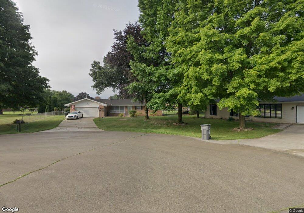
12720 Mark Ct Granger, IN 46530
Estimated Value: $281,000 - $304,508
3
Beds
2
Baths
1,414
Sq Ft
$210/Sq Ft
Est. Value
About This Home
This home is located at 12720 Mark Ct, Granger, IN 46530 and is currently estimated at $296,627, approximately $209 per square foot. 12720 Mark Ct is a home located in St. Joseph County with nearby schools including Mary Frank Harris Elementary School, Discovery Middle School, and Penn High School.
Ownership History
Date
Name
Owned For
Owner Type
Purchase Details
Closed on
Aug 9, 2019
Sold by
Walag Richard M and Walag Michelle M
Bought by
Walag Richard
Current Estimated Value
Home Financials for this Owner
Home Financials are based on the most recent Mortgage that was taken out on this home.
Original Mortgage
$150,000
Outstanding Balance
$131,453
Interest Rate
3.73%
Mortgage Type
New Conventional
Estimated Equity
$165,174
Create a Home Valuation Report for This Property
The Home Valuation Report is an in-depth analysis detailing your home's value as well as a comparison with similar homes in the area
Home Values in the Area
Average Home Value in this Area
Purchase History
| Date | Buyer | Sale Price | Title Company |
|---|---|---|---|
| Walag Richard | $199,500 | Fidelity National Title |
Source: Public Records
Mortgage History
| Date | Status | Borrower | Loan Amount |
|---|---|---|---|
| Open | Walag Richard | $150,000 |
Source: Public Records
Tax History Compared to Growth
Tax History
| Year | Tax Paid | Tax Assessment Tax Assessment Total Assessment is a certain percentage of the fair market value that is determined by local assessors to be the total taxable value of land and additions on the property. | Land | Improvement |
|---|---|---|---|---|
| 2024 | $2,397 | $240,900 | $70,500 | $170,400 |
| 2023 | $2,517 | $267,700 | $70,500 | $197,200 |
| 2022 | $2,517 | $263,100 | $70,500 | $192,600 |
| 2021 | $2,230 | $220,400 | $44,100 | $176,300 |
| 2020 | $2,036 | $205,500 | $39,900 | $165,600 |
| 2019 | $1,947 | $197,300 | $32,900 | $164,400 |
| 2018 | $1,928 | $198,800 | $31,500 | $167,300 |
| 2017 | $1,737 | $176,300 | $28,000 | $148,300 |
| 2016 | $1,461 | $154,200 | $24,800 | $129,400 |
| 2014 | $1,545 | $154,100 | $24,800 | $129,300 |
Source: Public Records
Map
Nearby Homes
- 12793 Brick Rd Unit Lot 4
- Elements 2390 Plan at The Hills at St. Joe Farm - Elements
- Integrity 2080 Plan at The Hills at St. Joe Farm
- Elements 2700 Plan at The Hills at St. Joe Farm - Elements
- Elements 2070 Plan at The Hills at St. Joe Farm - Elements
- Integrity 1880 Plan at The Hills at St. Joe Farm
- Integrity 2280 Plan at The Hills at St. Joe Farm
- Integrity 1605 Plan at The Hills at St. Joe Farm
- Integrity 1610 Plan at The Hills at St. Joe Farm
- 52070 Olympus Pass
- 12983 Brick Rd
- 51891 Covered Wagon Trail
- 52303 Broken Arrow Dr
- 13340 Anderson Rd
- 51772 Currant Rd
- 11963 Peacock Cir
- 52335 Gumwood Dr
- 16390 Greystone Dr
- 16370 Greystone Dr
- 16371 Greystone Dr
- 12744 Mark Ct
- 51823 Cheryl Dr
- 12735 Vicki Ln
- 12689 Vicki Ln
- 51820 Sharon Ct
- 12703 Vicki Ln
- 51860 Sharon Ct
- 51810 Sharon Ct
- 51878 Sharon Ct
- 12733 Mark Ct
- 51789 Sharon Ct
- 12717 Mark Ct
- 51771 Cheryl Dr
- 51820 Cheryl Dr
- 12728 Vicki Ln
- 12736 Vicki Ln
- 51829 Sharon Ct
- 51835 Cheryl Dr
- 51796 Cheryl Dr
- 12684 Vicki Ln