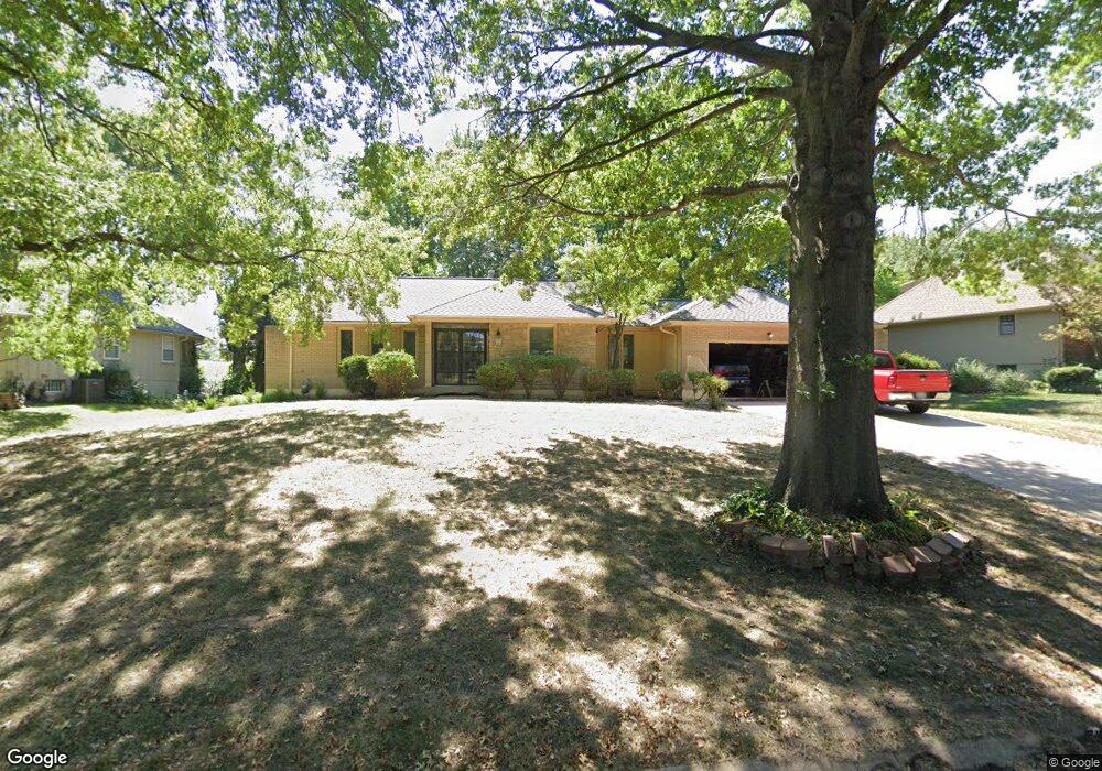
12746 Overbrook Rd Leawood, KS 66209
Estimated Value: $565,000 - $623,000
3
Beds
3
Baths
2,145
Sq Ft
$276/Sq Ft
Est. Value
About This Home
This home is located at 12746 Overbrook Rd, Leawood, KS 66209 and is currently estimated at $592,605, approximately $276 per square foot. 12746 Overbrook Rd is a home located in Johnson County with nearby schools including Leawood Elementary School, Leawood Middle School, and Blue Valley North High School.
Ownership History
Date
Name
Owned For
Owner Type
Purchase Details
Closed on
May 20, 2002
Sold by
Graham Ronald D and Graham Kathleen L
Bought by
Maxfield Larry L
Current Estimated Value
Home Financials for this Owner
Home Financials are based on the most recent Mortgage that was taken out on this home.
Original Mortgage
$144,000
Outstanding Balance
$60,635
Interest Rate
6.89%
Estimated Equity
$531,970
Create a Home Valuation Report for This Property
The Home Valuation Report is an in-depth analysis detailing your home's value as well as a comparison with similar homes in the area
Home Values in the Area
Average Home Value in this Area
Purchase History
| Date | Buyer | Sale Price | Title Company |
|---|---|---|---|
| Maxfield Larry L | -- | Chicago Title Insurance Co |
Source: Public Records
Mortgage History
| Date | Status | Borrower | Loan Amount |
|---|---|---|---|
| Open | Maxfield Larry L | $144,000 |
Source: Public Records
Tax History Compared to Growth
Tax History
| Year | Tax Paid | Tax Assessment Tax Assessment Total Assessment is a certain percentage of the fair market value that is determined by local assessors to be the total taxable value of land and additions on the property. | Land | Improvement |
|---|---|---|---|---|
| 2024 | $6,738 | $60,766 | $15,206 | $45,560 |
| 2023 | $6,569 | $58,362 | $15,206 | $43,156 |
| 2022 | $6,505 | $56,545 | $15,206 | $41,339 |
| 2021 | $5,870 | $48,714 | $13,820 | $34,894 |
| 2020 | $5,333 | $43,401 | $12,011 | $31,390 |
| 2019 | $5,122 | $40,952 | $12,011 | $28,941 |
| 2018 | $4,639 | $36,455 | $10,439 | $26,016 |
| 2017 | $4,195 | $32,453 | $8,697 | $23,756 |
| 2016 | $4,041 | $31,303 | $8,565 | $22,738 |
| 2015 | $3,854 | $29,509 | $8,565 | $20,944 |
| 2013 | -- | $28,578 | $7,855 | $20,723 |
Source: Public Records
Map
Nearby Homes
- 2313 W 127th St
- 12763 Overbrook Rd
- 12768 Overbrook Rd
- 12501 Sagamore Rd
- 2229 Condolea Terrace
- 12815 Pembroke Cir
- 12851 Pembroke Cir
- 12854 Cambridge Terrace
- 12854 Pembroke Cir
- 12716 Oakmont Dr
- 1985 W 123rd Place
- 12725 High Dr
- 2401 W 123rd Terrace
- 12380 Summit St
- 703 Tam-O-shanter Dr
- 12201 Aberdeen St
- 905 W 122nd Terrace
- 1013 W Santa fe Trail
- 2213 W 122nd St
- 12605 Overbrook Rd
- 12748 Overbrook Rd
- 12744 Overbrook Rd
- 12741 Overbrook Rd
- 12750 Overbrook Rd
- 12742 Overbrook Rd
- 12739 Overbrook Rd
- 12749 Overbrook Rd
- 12737 Overbrook Rd
- 12752 Overbrook Rd
- 12740 Overbrook Rd
- 12743 Overbrook Rd
- 12751 Overbrook Rd
- 12735 Overbrook Rd
- 12747 Overbrook Rd
- 12754 Overbrook Rd
- 12709 Eaton Cir
- 12753 Overbrook Rd
- 12745 Overbrook Rd
- 12708 Eaton Cir
- 12733 Overbrook Rd