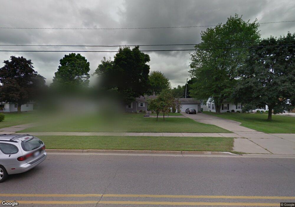
1275 Capital Ave SW Battle Creek, MI 49015
Minges Brook Riverside NeighborhoodEstimated Value: $184,000 - $239,000
3
Beds
1
Bath
2
Sq Ft
$101,804/Sq Ft
Est. Value
About This Home
This home is located at 1275 Capital Ave SW, Battle Creek, MI 49015 and is currently estimated at $203,608, approximately $101,804 per square foot. 1275 Capital Ave SW is a home located in Calhoun County with nearby schools including Lakeview Middle School, Lakeview High School, and Arbor Academy.
Ownership History
Date
Name
Owned For
Owner Type
Purchase Details
Closed on
Dec 19, 2013
Sold by
Hutchinson Todd D and Hutchinson Cecelia Ann
Bought by
Hutchinson Todd D and Hutchinson Cecelia Ann
Current Estimated Value
Home Financials for this Owner
Home Financials are based on the most recent Mortgage that was taken out on this home.
Original Mortgage
$84,500
Outstanding Balance
$43,754
Interest Rate
4.31%
Mortgage Type
New Conventional
Estimated Equity
$159,854
Purchase Details
Closed on
May 31, 2000
Sold by
Hoyt Robert P and Hoyt Elizabeth A
Bought by
Hutchinson Todd D
Create a Home Valuation Report for This Property
The Home Valuation Report is an in-depth analysis detailing your home's value as well as a comparison with similar homes in the area
Home Values in the Area
Average Home Value in this Area
Purchase History
| Date | Buyer | Sale Price | Title Company |
|---|---|---|---|
| Hutchinson Todd D | -- | Transnation | |
| Hutchinson Todd D | $87,900 | -- |
Source: Public Records
Mortgage History
| Date | Status | Borrower | Loan Amount |
|---|---|---|---|
| Open | Hutchinson Todd D | $84,500 |
Source: Public Records
Tax History Compared to Growth
Tax History
| Year | Tax Paid | Tax Assessment Tax Assessment Total Assessment is a certain percentage of the fair market value that is determined by local assessors to be the total taxable value of land and additions on the property. | Land | Improvement |
|---|---|---|---|---|
| 2025 | -- | $78,100 | $0 | $0 |
| 2024 | $1,829 | $73,599 | $0 | $0 |
| 2023 | $2,082 | $65,673 | $0 | $0 |
| 2022 | $1,652 | $59,612 | $0 | $0 |
| 2021 | $2,028 | $55,969 | $0 | $0 |
| 2020 | $2,007 | $54,979 | $0 | $0 |
| 2019 | $1,900 | $50,157 | $0 | $0 |
| 2018 | $1,900 | $49,157 | $3,782 | $45,375 |
| 2017 | $1,802 | $45,189 | $0 | $0 |
| 2016 | $1,789 | $40,732 | $0 | $0 |
| 2015 | $1,664 | $38,405 | $4,094 | $34,311 |
| 2014 | $1,664 | $37,214 | $4,094 | $33,120 |
Source: Public Records
Map
Nearby Homes
- 117 Meadow Dr
- 1116 Lakeside Dr S
- 1200 Lakeside Dr S
- 620 Meadow Dr
- 239 Brewer Dr S
- 0 Jennings Landing
- 618 Jennings Landing
- V/L Riverside Dr
- 32 Golden Ave
- 175 S Ridgeway Dr
- 160 Lincoln Hill Dr
- 66 Wealthy
- 20 Hiawatha Dr
- 125 Williams Dr
- 133 Country Club Terrace
- 819 Riverside Dr
- 348 S Hills Dr
- 214 Morningside Dr
- 677 Morningside Dr
- 226 Morningside Dr
- 1267 Capital Ave SW
- 1283 Capital Ave SW
- 1259 Capital Ave SW
- 321 Westfield Dr
- 1291 Capital Ave SW
- 309 Westfield Dr
- 327 Westfield Dr
- 1251 Capital Ave SW
- 44 Loch Haven Ln
- 333 Westfield Dr
- 1243 Capital Ave SW
- 49 Loch Haven Ln
- 239 Westfield Dr
- 339 Westfield Dr
- 1307 Capital Ave SW
- 302 Westfield Dr
- 314 Westfield Dr
- 320 Westfield Dr
- 57 Loch Haven Ln
- 308 Westfield Dr