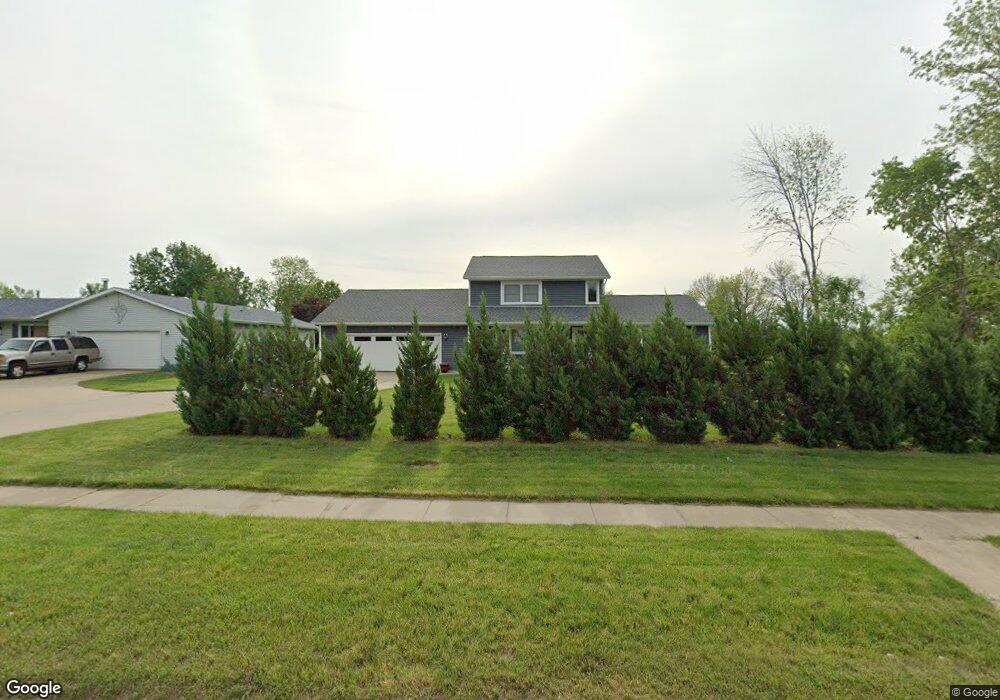
1275 Robins Rd Hiawatha, IA 52233
Estimated Value: $322,000 - $378,000
5
Beds
4
Baths
2,304
Sq Ft
$152/Sq Ft
Est. Value
About This Home
This home is located at 1275 Robins Rd, Hiawatha, IA 52233 and is currently estimated at $350,313, approximately $152 per square foot. 1275 Robins Rd is a home located in Linn County with nearby schools including Nixon Elementary School, Harding Middle School, and John F. Kennedy High School.
Ownership History
Date
Name
Owned For
Owner Type
Purchase Details
Closed on
Aug 15, 2006
Sold by
Prudential Relocation Inc
Bought by
Nesslage Michael V and Nesslage Karlene H
Current Estimated Value
Home Financials for this Owner
Home Financials are based on the most recent Mortgage that was taken out on this home.
Original Mortgage
$197,600
Outstanding Balance
$118,249
Interest Rate
6.7%
Mortgage Type
Purchase Money Mortgage
Estimated Equity
$232,064
Purchase Details
Closed on
Jun 27, 2003
Sold by
Pleima Donald L and Pleima Ruth A
Bought by
Lenz Philip J and Lenz Lana L
Home Financials for this Owner
Home Financials are based on the most recent Mortgage that was taken out on this home.
Original Mortgage
$183,050
Interest Rate
5.62%
Mortgage Type
VA
Create a Home Valuation Report for This Property
The Home Valuation Report is an in-depth analysis detailing your home's value as well as a comparison with similar homes in the area
Home Values in the Area
Average Home Value in this Area
Purchase History
| Date | Buyer | Sale Price | Title Company |
|---|---|---|---|
| Nesslage Michael V | $207,500 | None Available | |
| Lenz Philip J | $179,000 | -- |
Source: Public Records
Mortgage History
| Date | Status | Borrower | Loan Amount |
|---|---|---|---|
| Open | Nesslage Michael V | $197,600 | |
| Previous Owner | Lenz Philip J | $183,050 |
Source: Public Records
Tax History Compared to Growth
Tax History
| Year | Tax Paid | Tax Assessment Tax Assessment Total Assessment is a certain percentage of the fair market value that is determined by local assessors to be the total taxable value of land and additions on the property. | Land | Improvement |
|---|---|---|---|---|
| 2025 | $5,194 | $423,000 | $56,500 | $366,500 |
| 2024 | $5,142 | $332,200 | $29,600 | $302,600 |
| 2023 | $5,142 | $326,400 | $29,600 | $296,800 |
| 2022 | $5,078 | $262,500 | $29,600 | $232,900 |
| 2021 | $5,108 | $262,500 | $29,600 | $232,900 |
| 2020 | $5,108 | $246,900 | $29,600 | $217,300 |
| 2019 | $4,604 | $224,400 | $27,300 | $197,100 |
| 2018 | $4,518 | $224,400 | $27,300 | $197,100 |
| 2017 | $4,460 | $212,300 | $27,300 | $185,000 |
| 2016 | $4,532 | $212,300 | $27,300 | $185,000 |
| 2015 | $4,544 | $212,300 | $27,300 | $185,000 |
| 2014 | $4,358 | $212,300 | $27,300 | $185,000 |
| 2013 | $4,238 | $212,300 | $27,300 | $185,000 |
Source: Public Records
Map
Nearby Homes
- 780 Ryan Ave
- 114 Northwood Dr
- 1708 Brookdale Ln NE
- 6505 Brookview Ln NE
- 1617 Brookdale Ln NE
- 2315 Hawkeye Dr
- 2905 Hawkeye Dr
- 2900 Hawkeye Dr
- 2910 Hawkeye Dr
- 1011 Kacena Rd
- 6509 Mosswood Ln NE
- 2417 Fox Trail Dr NE
- 250 Cimarron Dr Unit 311
- 1813 Northbrook Dr NE
- 7016 Parkdale Ln NE
- 1515 Fox Trail Dr NE
- 1623 Petrus Dr NE
- 250 Cimarron Dr NE Unit 309
- 3 N Center Point Rd
- 1 N Center Point Rd