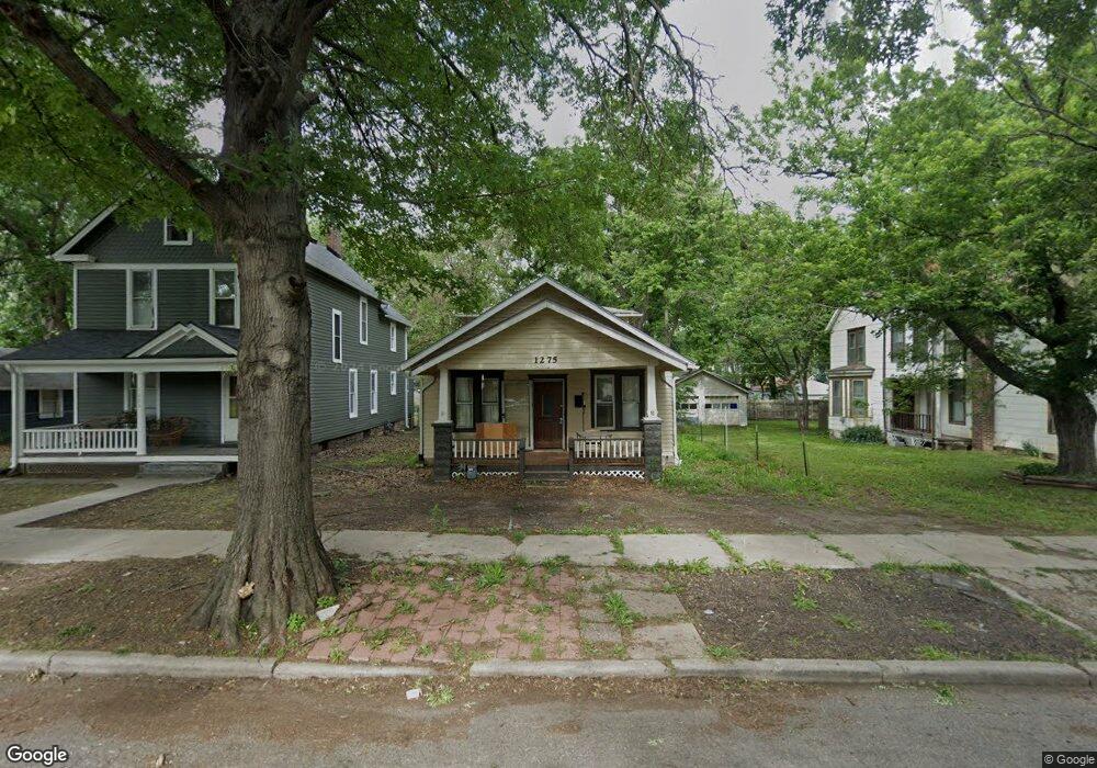
1275 SW Garfield Ave Topeka, KS 66604
College Hill NeighborhoodEstimated Value: $79,696 - $153,000
4
Beds
2
Baths
1,512
Sq Ft
$78/Sq Ft
Est. Value
About This Home
This home is located at 1275 SW Garfield Ave, Topeka, KS 66604 and is currently estimated at $117,924, approximately $77 per square foot. 1275 SW Garfield Ave is a home located in Shawnee County with nearby schools including Randolph Elementary School, Robinson Middle School, and Topeka High School.
Ownership History
Date
Name
Owned For
Owner Type
Purchase Details
Closed on
Oct 21, 2024
Sold by
Moore Nathan and Moore Corrie
Bought by
Moore Corrie
Current Estimated Value
Purchase Details
Closed on
Jan 12, 2022
Sold by
Moore and Nathan
Bought by
Moore Corrie and Moore Nathan
Home Financials for this Owner
Home Financials are based on the most recent Mortgage that was taken out on this home.
Original Mortgage
$27,750
Interest Rate
3.05%
Mortgage Type
New Conventional
Purchase Details
Closed on
Nov 26, 2019
Sold by
Stopher Kimberly Ann and Brion Kimberly Ann
Bought by
Moore Corrie
Create a Home Valuation Report for This Property
The Home Valuation Report is an in-depth analysis detailing your home's value as well as a comparison with similar homes in the area
Home Values in the Area
Average Home Value in this Area
Purchase History
| Date | Buyer | Sale Price | Title Company |
|---|---|---|---|
| Moore Corrie | -- | None Listed On Document | |
| Moore Corrie | -- | Lawyers Title Of Topeka | |
| Moore Corrie | -- | Alpha Title Llc |
Source: Public Records
Mortgage History
| Date | Status | Borrower | Loan Amount |
|---|---|---|---|
| Previous Owner | Moore Corrie | $27,750 |
Source: Public Records
Tax History Compared to Growth
Tax History
| Year | Tax Paid | Tax Assessment Tax Assessment Total Assessment is a certain percentage of the fair market value that is determined by local assessors to be the total taxable value of land and additions on the property. | Land | Improvement |
|---|---|---|---|---|
| 2025 | $533 | $4,422 | -- | -- |
| 2023 | $533 | $3,898 | $0 | $0 |
| 2022 | $490 | $3,643 | $0 | $0 |
| 2021 | $484 | $3,312 | $0 | $0 |
| 2020 | $1,562 | $2,840 | $0 | $0 |
| 2019 | $529 | $3,613 | $0 | $0 |
| 2018 | $513 | $3,507 | $0 | $0 |
| 2017 | $514 | $3,507 | $0 | $0 |
| 2014 | $286 | $2,546 | $0 | $0 |
Source: Public Records
Map
Nearby Homes
- 1224 SW Garfield Ave
- 1801 SW Huntoon St
- 1327 SW College Ave
- 1531 SW 15th St
- 1717 SW 15th St
- 1225 SW Throop St
- 1527 SW Mulvane St
- 1180 SW Woodward Ave
- 0 SW Buchanan St
- 1156 SW Woodward Ave
- 1609 SW Buchanan St
- 1626 SW Lincoln St
- 1215 SW Byron St
- 1432 SW MacVicar Ave
- 1501-1599 SW 17th St
- 1222 SW Wayne Ave
- 1630 SW Buchanan St
- 1164 SW MacVicar Ave
- 1181 SW MacVicar Ave
- 1503 SW MacVicar Ave
- 1283 SW Garfield Ave
- 1273 SW Garfield Ave
- 1269 SW Garfield Ave
- 1287 SW Garfield Ave
- 1265 SW Garfield Ave
- 1274 SW Mulvane St
- 1272 SW Mulvane St
- 1278 SW Mulvane St
- 1291 SW Garfield Ave
- 1280 SW Mulvane St
- 1264 SW Mulvane St
- 1282 SW Mulvane St
- 1276 SW Garfield Ave
- 1263 SW Garfield Ave
- 1274 SW Garfield Ave
- 1280 SW Garfield Ave
- 1260 SW Mulvane St
- 1286 SW Mulvane St
- 1284 SW Garfield Ave
- 1272 SW Garfield Ave