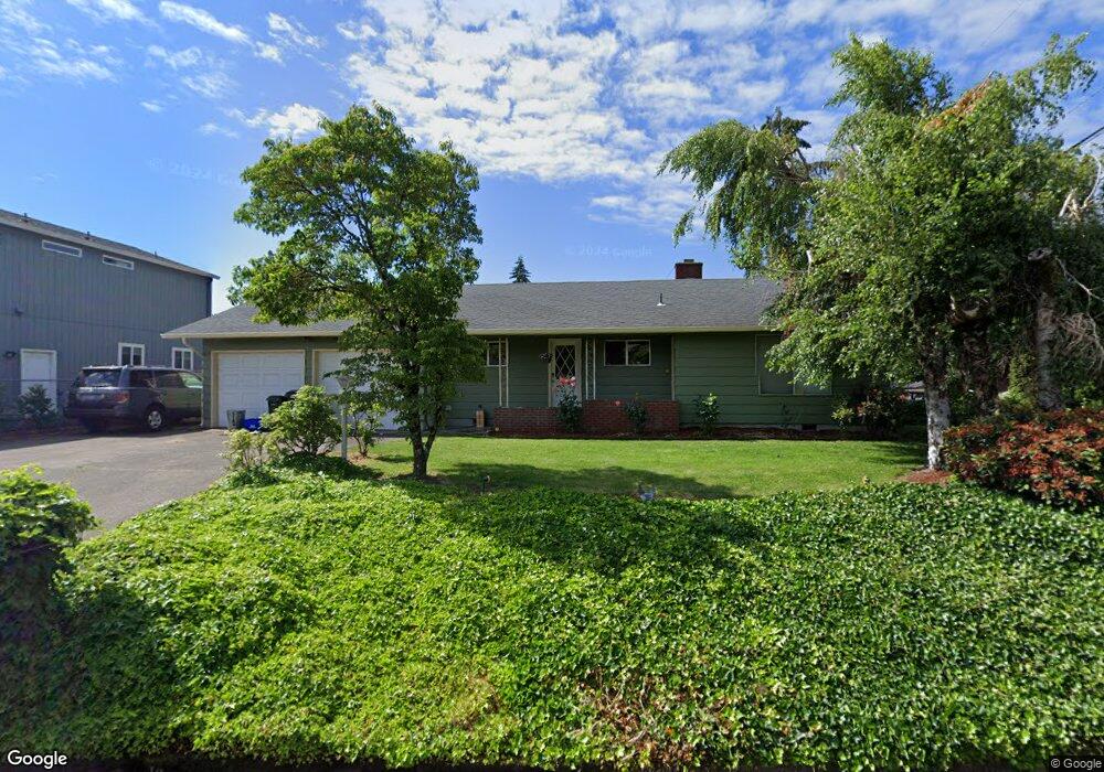
1275 W Quinalt St Springfield, OR 97477
West Springfield NeighborhoodEstimated Value: $400,000 - $478,000
3
Beds
3
Baths
1,492
Sq Ft
$287/Sq Ft
Est. Value
About This Home
This home is located at 1275 W Quinalt St, Springfield, OR 97477 and is currently estimated at $428,900, approximately $287 per square foot. 1275 W Quinalt St is a home located in Lane County with nearby schools including Centennial Elementary School, Hamlin Middle School, and Springfield High School.
Ownership History
Date
Name
Owned For
Owner Type
Purchase Details
Closed on
Sep 22, 2005
Sold by
Steele Barbara K
Bought by
Pina Juan Pedro and Pina Maria R
Current Estimated Value
Home Financials for this Owner
Home Financials are based on the most recent Mortgage that was taken out on this home.
Original Mortgage
$36,400
Interest Rate
5.33%
Mortgage Type
Stand Alone Second
Create a Home Valuation Report for This Property
The Home Valuation Report is an in-depth analysis detailing your home's value as well as a comparison with similar homes in the area
Home Values in the Area
Average Home Value in this Area
Purchase History
| Date | Buyer | Sale Price | Title Company |
|---|---|---|---|
| Pina Juan Pedro | $182,000 | Fidelity National Title Insu |
Source: Public Records
Mortgage History
| Date | Status | Borrower | Loan Amount |
|---|---|---|---|
| Closed | Pina Juan Pedro | $36,400 | |
| Open | Pina Juan Pedro | $145,600 |
Source: Public Records
Tax History Compared to Growth
Tax History
| Year | Tax Paid | Tax Assessment Tax Assessment Total Assessment is a certain percentage of the fair market value that is determined by local assessors to be the total taxable value of land and additions on the property. | Land | Improvement |
|---|---|---|---|---|
| 2025 | $3,519 | $240,207 | -- | -- |
| 2024 | $3,423 | $233,211 | -- | -- |
| 2023 | $3,423 | $226,419 | $0 | $0 |
| 2022 | $3,254 | $219,825 | $0 | $0 |
| 2021 | $3,184 | $213,423 | $0 | $0 |
| 2020 | $3,092 | $207,207 | $0 | $0 |
| 2019 | $2,983 | $201,172 | $0 | $0 |
| 2018 | $2,870 | $189,624 | $0 | $0 |
| 2017 | $2,784 | $189,624 | $0 | $0 |
| 2016 | $2,721 | $184,101 | $0 | $0 |
| 2015 | $2,656 | $178,739 | $0 | $0 |
| 2014 | $2,543 | $173,533 | $0 | $0 |
Source: Public Records
Map
Nearby Homes
- 1310 W Quinalt St
- 1120 W Fairview Dr Unit 3
- 872 W N St
- 804 W N St
- 1130 Anderson Ln
- 1770 Brandy Way
- 1632 Dotie Dr
- 955 Oak Meadows Place
- 1723 Dotie Dr
- 1267 Kenray Loop
- 511 Panda Loop
- 484 Scotts Glen Dr
- 436 W M St
- 428 W Centennial Blvd
- 364 Scotts Glen Dr
- 930 Prescott Ln
- 3460 Oxbow Way
- 633 Rowan Ave
- 3515 Regent Ave
- 952 Summit Blvd
- 1253 W Quinalt St
- 1256 W Fairview Dr
- 1285 W Quinalt St
- 1243 W Quinalt St
- 1725 Tamarack St
- 1240 W Fairview Dr
- 1233 W Quinalt St
- 1233 Quinalt St
- 1280 W Quinalt St
- 1298 W Fairview Dr
- 1296 W Fairview Dr
- 1252 W Quinalt St
- 1298 W Quinalt St
- 1260 W Quinalt St
- 1224 W Fairview Dr
- 1223 W Quinalt St
- 0 W Quinalt St Unit 9076319
- 1325 W Quinalt St
- 1242 W Quinalt St
- 1120 W Fairview Dr Unit 1