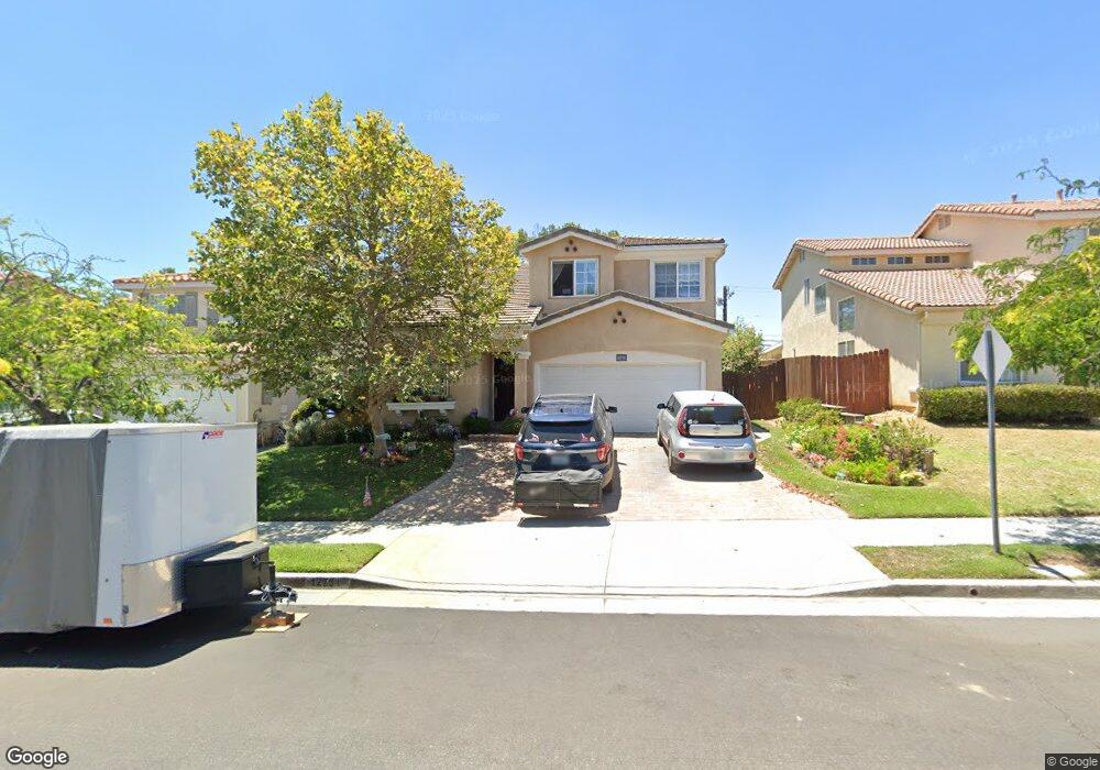
12751 Cameron Ave Sylmar, CA 91342
Estimated Value: $902,192 - $995,000
4
Beds
3
Baths
1,911
Sq Ft
$492/Sq Ft
Est. Value
About This Home
This home is located at 12751 Cameron Ave, Sylmar, CA 91342 and is currently estimated at $940,298, approximately $492 per square foot. 12751 Cameron Ave is a home located in Los Angeles County with nearby schools including Harding Street Elementary School, San Fernando Middle School, and San Fernando Senior High School.
Ownership History
Date
Name
Owned For
Owner Type
Purchase Details
Closed on
Feb 28, 2003
Sold by
Gladstone Premier Homes Llc
Bought by
Colorado John
Current Estimated Value
Home Financials for this Owner
Home Financials are based on the most recent Mortgage that was taken out on this home.
Original Mortgage
$265,200
Outstanding Balance
$113,759
Interest Rate
5.85%
Estimated Equity
$826,539
Create a Home Valuation Report for This Property
The Home Valuation Report is an in-depth analysis detailing your home's value as well as a comparison with similar homes in the area
Home Values in the Area
Average Home Value in this Area
Purchase History
| Date | Buyer | Sale Price | Title Company |
|---|---|---|---|
| Colorado John | $331,500 | Stewart Title |
Source: Public Records
Mortgage History
| Date | Status | Borrower | Loan Amount |
|---|---|---|---|
| Open | Colorado John | $265,200 | |
| Closed | Colorado John | $44,800 |
Source: Public Records
Tax History
| Year | Tax Paid | Tax Assessment Tax Assessment Total Assessment is a certain percentage of the fair market value that is determined by local assessors to be the total taxable value of land and additions on the property. | Land | Improvement |
|---|---|---|---|---|
| 2025 | $6,007 | $486,355 | $228,098 | $258,257 |
| 2024 | $6,007 | $476,820 | $223,626 | $253,194 |
| 2023 | $5,890 | $467,472 | $219,242 | $248,230 |
| 2022 | $5,614 | $458,307 | $214,944 | $243,363 |
| 2021 | $5,535 | $449,322 | $210,730 | $238,592 |
| 2019 | $5,367 | $435,997 | $204,481 | $231,516 |
| 2018 | $5,294 | $427,449 | $200,472 | $226,977 |
| 2016 | $5,042 | $410,853 | $192,689 | $218,164 |
| 2015 | $4,969 | $404,682 | $189,795 | $214,887 |
| 2014 | $4,988 | $396,756 | $186,078 | $210,678 |
Source: Public Records
Map
Nearby Homes
- 12801 Gladstone Ave
- 12902 Chippewa St
- 13238 Klein Ct
- 12745 N Watt Ln Unit B
- 12800 N Watt Ln Unit D
- 12807 N Watt Ln Unit D
- 12820 N Watt Ln Unit C
- 13384 Foothill Blvd
- 12870 Four Palms Ln
- 1425 8th St
- 12888 Four Palms Ln
- 1617 Knox St
- 1075 N Maclay Ave Unit 14
- 13540 Hubbard St Unit 10
- 1965 8th St
- 13345 Calcutta St
- 13475 Hubbard St Unit 31
- 1128 7th St
- 13042 Mesa Verde Way
- 13750 Hubbard St Unit 6
- 12755 Cameron Ave
- 12747 Cameron Ave
- 12759 Cameron Ave
- 12743 Cameron Ave
- 12763 Cameron Ave
- 12739 Cameron Ave
- 13050 Hagar St
- 12767 Cameron Ave
- 12764 Cameron Ave
- 12742 Cameron Ave
- 12727 Gladstone Ave
- 12741 Gladstone Ave
- 12733 Cameron Ave
- 13044 Hagar St
- 12771 Cameron Ave
- 12715 Gladstone Ave
- 12768 Cameron Ave
- 12738 Cameron Ave
- 13045 Hagar St
- 12749 Gladstone Ave
