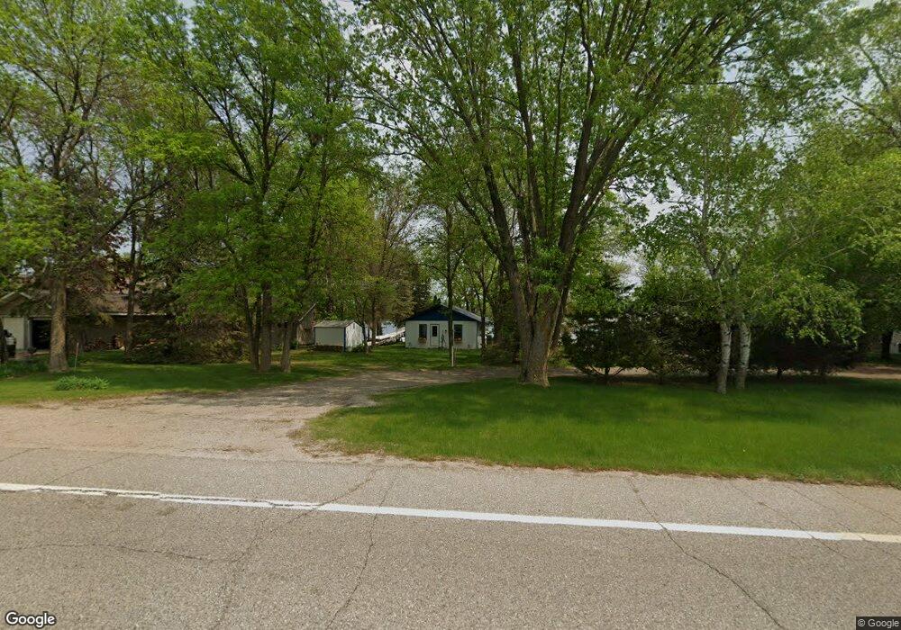
12763 County Road 9 NE Spicer, MN 56288
Estimated Value: $318,000 - $385,000
2
Beds
1
Bath
690
Sq Ft
$502/Sq Ft
Est. Value
About This Home
This home is located at 12763 County Road 9 NE, Spicer, MN 56288 and is currently estimated at $346,447, approximately $502 per square foot. 12763 County Road 9 NE is a home located in Kandiyohi County with nearby schools including Prairie Woods Elementary School, New London-Spicer Middle School, and New London-Spicer Senior High School.
Ownership History
Date
Name
Owned For
Owner Type
Purchase Details
Closed on
Jun 16, 2017
Sold by
Lussenden Roger and Lussenden Susan
Bought by
Coquyt Michael C and Coquyt Brenda M
Current Estimated Value
Home Financials for this Owner
Home Financials are based on the most recent Mortgage that was taken out on this home.
Original Mortgage
$184,000
Outstanding Balance
$153,050
Interest Rate
4.02%
Mortgage Type
New Conventional
Estimated Equity
$193,397
Create a Home Valuation Report for This Property
The Home Valuation Report is an in-depth analysis detailing your home's value as well as a comparison with similar homes in the area
Home Values in the Area
Average Home Value in this Area
Purchase History
| Date | Buyer | Sale Price | Title Company |
|---|---|---|---|
| Coquyt Michael C | $230,000 | Quality Title |
Source: Public Records
Mortgage History
| Date | Status | Borrower | Loan Amount |
|---|---|---|---|
| Open | Coquyt Michael C | $184,000 |
Source: Public Records
Tax History Compared to Growth
Tax History
| Year | Tax Paid | Tax Assessment Tax Assessment Total Assessment is a certain percentage of the fair market value that is determined by local assessors to be the total taxable value of land and additions on the property. | Land | Improvement |
|---|---|---|---|---|
| 2025 | $2,142 | $220,200 | $149,600 | $70,600 |
| 2024 | $1,988 | $211,800 | $149,600 | $62,200 |
| 2023 | $1,950 | $199,200 | $142,500 | $56,700 |
| 2022 | $1,896 | $198,400 | $142,500 | $55,900 |
| 2021 | $1,866 | $164,300 | $116,400 | $47,900 |
| 2020 | $1,796 | $156,500 | $114,000 | $42,500 |
| 2019 | $1,784 | $152,000 | $109,300 | $42,700 |
| 2018 | $1,588 | $149,600 | $109,300 | $40,300 |
| 2017 | $2,382 | $136,900 | $109,300 | $27,600 |
| 2016 | $2,372 | $1,363 | $0 | $0 |
| 2015 | -- | $0 | $0 | $0 |
| 2014 | -- | $0 | $0 | $0 |
Source: Public Records
Map
Nearby Homes
- 4316 133rd Ave NE
- 4808 132nd Ave NE Unit 25
- 5078 132nd Ave NE
- 5288 132nd Ave NE Unit C7
- 5288 (R22) 53rd St NE
- 5288 (R24) 53rd St NE
- 5272 (R26) 53rd St NE
- 5288 (R19) 53rd St NE
- 13205 (R17) 53rd St NE
- 5288 (R23) 53rd St NE
- 4539 141st Ave NE
- 10957 Highway 71 NE
- 6844 140th Ave NE
- 621 Loretta Cir
- 403 Miller St
- 6567 150th Ave NE
- - Agnes St & 6th Ave Bypass
- 263 Lake Ave N
- 311 131st Ave NE
- 14224 Skyline Dr
- 12739 County Road 9 NE
- 12801 42nd St NE
- 12707 County Road 9 NE
- 12821 42nd St NE
- 12681 County Road 9 NE
- 12655 County Road 9 NE
- 12611 County Road 9 NE
- 12919 42nd St NE
- 12916 42nd St NE
- 12549 County Road 9 NE
- 12931 42nd St NE
- 12953 42nd St NE
- 12953 12953 Ne 42 Street--
- 12953 NE 42 St
- 12535 County Road 9 NE
- 12960 42nd St NE
- 12979 42nd St NE
- 13010 42nd St NE
- 12479 County Road 9 NE
- 13011 42nd St NE