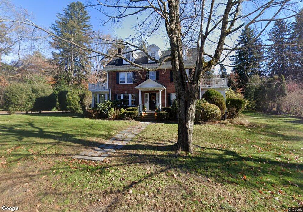
1278 Canton Ave Milton, MA 02186
Brush Hill NeighborhoodEstimated Value: $1,481,000 - $1,704,000
5
Beds
4
Baths
2,313
Sq Ft
$678/Sq Ft
Est. Value
About This Home
This home is located at 1278 Canton Ave, Milton, MA 02186 and is currently estimated at $1,569,347, approximately $678 per square foot. 1278 Canton Ave is a home located in Norfolk County with nearby schools including Milton High School, Delphi Academy, and Thacher Montessori School.
Ownership History
Date
Name
Owned For
Owner Type
Purchase Details
Closed on
Aug 21, 1998
Sold by
Gillis Eileen F
Bought by
Feeney Joan N
Current Estimated Value
Home Financials for this Owner
Home Financials are based on the most recent Mortgage that was taken out on this home.
Original Mortgage
$330,000
Interest Rate
6.86%
Mortgage Type
Purchase Money Mortgage
Create a Home Valuation Report for This Property
The Home Valuation Report is an in-depth analysis detailing your home's value as well as a comparison with similar homes in the area
Home Values in the Area
Average Home Value in this Area
Purchase History
| Date | Buyer | Sale Price | Title Company |
|---|---|---|---|
| Feeney Joan N | $445,000 | -- |
Source: Public Records
Mortgage History
| Date | Status | Borrower | Loan Amount |
|---|---|---|---|
| Open | Feeney Joan N | $318,000 | |
| Closed | Feeney Joan N | $330,000 | |
| Previous Owner | Feeney Joan N | $76,000 | |
| Previous Owner | Feeney Joan N | $40,000 |
Source: Public Records
Tax History
| Year | Tax Paid | Tax Assessment Tax Assessment Total Assessment is a certain percentage of the fair market value that is determined by local assessors to be the total taxable value of land and additions on the property. | Land | Improvement |
|---|---|---|---|---|
| 2025 | $15,205 | $1,371,100 | $625,100 | $746,000 |
| 2024 | $14,651 | $1,341,700 | $595,400 | $746,300 |
| 2023 | $14,261 | $1,251,000 | $567,000 | $684,000 |
| 2022 | $13,705 | $1,099,000 | $567,000 | $532,000 |
| 2021 | $13,381 | $1,019,100 | $512,400 | $506,700 |
| 2020 | $13,241 | $1,009,200 | $512,300 | $496,900 |
| 2019 | $12,914 | $979,800 | $497,400 | $482,400 |
| 2018 | $11,305 | $818,600 | $345,000 | $473,600 |
| 2017 | $10,577 | $780,000 | $328,500 | $451,500 |
| 2016 | $10,399 | $770,300 | $328,500 | $441,800 |
| 2015 | $9,861 | $707,400 | $275,300 | $432,100 |
Source: Public Records
Map
Nearby Homes
- 1386 Canton Ave
- 200 Robbins St
- 7 Preacher Rd
- 350 Blue Hill Ave
- 5 Kinsale Ln
- 17 Quisset Brook Rd
- 6 Kinsale Ln
- 4 Farmer Rd
- 58 Adanac Rd
- 10 Van Brunt St
- 49 Summit St
- 31 Badger Rd
- 485 Blue Hills Pkwy Unit 10
- 485 Blue Hills Pkwy Unit 12
- 485 Blue Hills Pkwy Unit 33
- 485 Blue Hills Pkwy Unit 13
- 485 Blue Hills Pkwy Unit 2
- 485 Blue Hills Pkwy Unit 49
- 485 Blue Hills Pkwy Unit 6
- 241 Neponset Valley Pkwy Unit 241
- 1288 Canton Ave
- 1250 Canton Ave
- 1296 Canton Ave
- 1269 Canton Ave
- 33 Corey Ln
- 303 Atherton St
- 245 Atherton St
- 55 Corey Ln
- 25 Woodland Rd
- 1238 Canton Ave
- 1253 Canton Ave
- 1253 Canton Ave Unit 1253
- 1300 Canton Ave
- 239 Atherton St
- 1325 Canton Ave
- 1303 Canton Ave
- 45 Woodland Rd
- 231 Atherton St
- 1237 Canton Ave
- 321 Atherton St
Your Personal Tour Guide
Ask me questions while you tour the home.