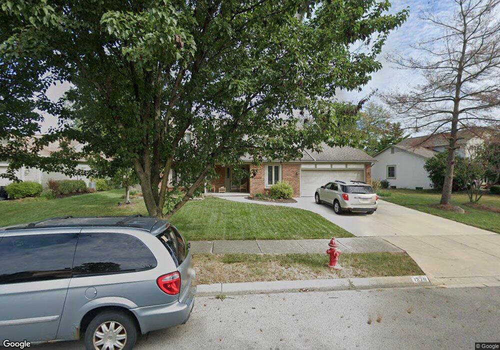
1278 Scituate Ct Westerville, OH 43081
Estimated Value: $448,000 - $509,000
4
Beds
3
Baths
2,330
Sq Ft
$201/Sq Ft
Est. Value
About This Home
This home is located at 1278 Scituate Ct, Westerville, OH 43081 and is currently estimated at $469,030, approximately $201 per square foot. 1278 Scituate Ct is a home located in Franklin County with nearby schools including Mcvay Elementary School, Walnut Springs Middle School, and Westerville-North High School.
Ownership History
Date
Name
Owned For
Owner Type
Purchase Details
Closed on
Feb 27, 2005
Sold by
Woods Mary Eileen and Woods Barry E
Bought by
Dick James A and Dick Judith A
Current Estimated Value
Purchase Details
Closed on
May 8, 2002
Sold by
Otey Earl T and Otey Barbara C
Bought by
Woods Mary Eileen and Woods Barry E
Home Financials for this Owner
Home Financials are based on the most recent Mortgage that was taken out on this home.
Original Mortgage
$184,000
Interest Rate
7.07%
Mortgage Type
Purchase Money Mortgage
Purchase Details
Closed on
Oct 14, 1986
Bought by
Otey Earl T and Otey Barbara C
Purchase Details
Closed on
Jul 1, 1984
Purchase Details
Closed on
May 1, 1979
Create a Home Valuation Report for This Property
The Home Valuation Report is an in-depth analysis detailing your home's value as well as a comparison with similar homes in the area
Home Values in the Area
Average Home Value in this Area
Purchase History
| Date | Buyer | Sale Price | Title Company |
|---|---|---|---|
| Dick James A | -- | -- | |
| Woods Mary Eileen | $185,000 | Title First Agency Inc | |
| Otey Earl T | $136,000 | -- | |
| -- | $119,000 | -- | |
| -- | $95,900 | -- |
Source: Public Records
Mortgage History
| Date | Status | Borrower | Loan Amount |
|---|---|---|---|
| Previous Owner | Woods Mary Eileen | $184,000 |
Source: Public Records
Tax History Compared to Growth
Tax History
| Year | Tax Paid | Tax Assessment Tax Assessment Total Assessment is a certain percentage of the fair market value that is determined by local assessors to be the total taxable value of land and additions on the property. | Land | Improvement |
|---|---|---|---|---|
| 2024 | $7,551 | $129,780 | $33,250 | $96,530 |
| 2023 | $7,395 | $129,780 | $33,250 | $96,530 |
| 2022 | $6,976 | $93,490 | $23,380 | $70,110 |
| 2021 | $7,035 | $93,490 | $23,380 | $70,110 |
| 2020 | $7,015 | $93,490 | $23,380 | $70,110 |
| 2019 | $6,155 | $77,280 | $19,460 | $57,820 |
| 2018 | $3,020 | $77,280 | $19,460 | $57,820 |
| 2017 | $6,060 | $77,280 | $19,460 | $57,820 |
| 2016 | $5,555 | $64,480 | $21,740 | $42,740 |
| 2015 | $2,693 | $64,480 | $21,740 | $42,740 |
| 2014 | $5,389 | $64,480 | $21,740 | $42,740 |
| 2013 | $2,562 | $61,390 | $20,685 | $40,705 |
Source: Public Records
Map
Nearby Homes
- 1209 Chatham Ridge Rd
- 1146 Forest Rise Dr
- 1368 Nutmeg Ct
- 750 Autumn Branch Rd
- 737 Autumn Branch Rd
- 613 Valley Wood Ct
- 1003 Autumn Meadows Dr
- 994 Autumn Lake Ct
- 969 Farrington Dr
- 1201 Wallean Dr
- 640 Brook Run Dr
- 800 S Spring Rd
- 90 Spring Creek Dr
- 5769 Burntwood Way
- 806 Watten Ln
- 4540 Central College Rd
- 6452 Rockhold Dr
- 371 Delaware Dr
- 810 Applewood Ln
- 461 Delaware Ct
- 1284 Scituate Ct
- 1270 Scituate Ct
- 1267 Smoke Burr Dr
- 1273 Smoke Burr Dr
- 1262 Scituate Ct
- 1275 Scituate Ct
- 1294 Scituate Ct
- 1265 Scituate Ct
- 1294 NE Scituate
- 1279 Smoke Burr Dr
- 1285 Scituate Ct
- 1261 Smoke Burr Dr
- 640 Ipswich St
- 1195 Clapham Ct
- 1300 Scituate Ct
- 1289 Smoke Burr Dr
- 1293 Scituate Ct
- 1199 Clapham Ct
- 658 Ipswich St
- 1255 Smoke Burr Dr