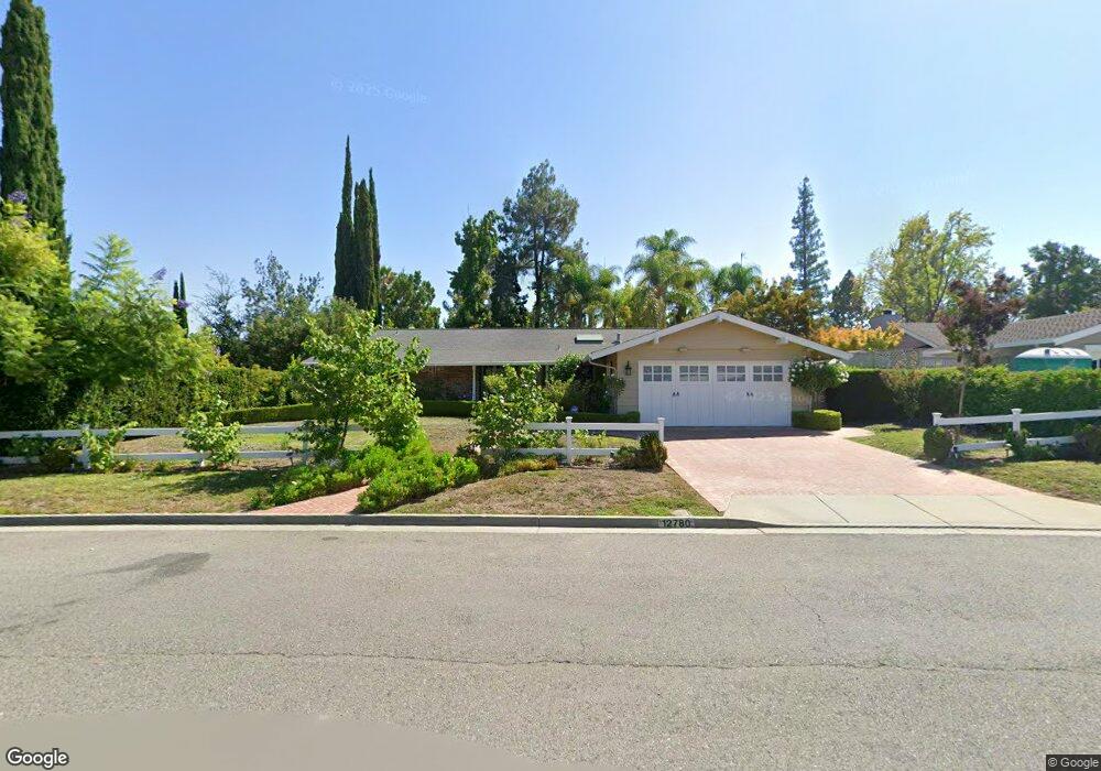
12780 Miller Ave Saratoga, CA 95070
West San Jose NeighborhoodEstimated Value: $3,752,000 - $3,895,000
4
Beds
2
Baths
1,943
Sq Ft
$1,977/Sq Ft
Est. Value
About This Home
This home is located at 12780 Miller Ave, Saratoga, CA 95070 and is currently estimated at $3,840,419, approximately $1,976 per square foot. 12780 Miller Ave is a home located in Santa Clara County with nearby schools including Argonaut Elementary School, Foothill Elementary School, and Saratoga Elementary School.
Ownership History
Date
Name
Owned For
Owner Type
Purchase Details
Closed on
Dec 22, 2004
Sold by
Lewis Williams T and William T Lewis Revocable Trus
Bought by
Kao Paul and Kao Rachel
Current Estimated Value
Purchase Details
Closed on
Sep 23, 2004
Sold by
Lewis William T
Bought by
Lewis William T and The William T Lewis Revocable
Purchase Details
Closed on
Aug 13, 1999
Sold by
Ross Bernard A And Murield Trustee
Bought by
Lewis William T
Home Financials for this Owner
Home Financials are based on the most recent Mortgage that was taken out on this home.
Original Mortgage
$525,000
Interest Rate
7%
Create a Home Valuation Report for This Property
The Home Valuation Report is an in-depth analysis detailing your home's value as well as a comparison with similar homes in the area
Home Values in the Area
Average Home Value in this Area
Purchase History
| Date | Buyer | Sale Price | Title Company |
|---|---|---|---|
| Kao Paul | -- | North American Title Company | |
| Lewis William T | -- | -- | |
| Lewis William T | $825,000 | Stewart Title |
Source: Public Records
Mortgage History
| Date | Status | Borrower | Loan Amount |
|---|---|---|---|
| Previous Owner | Lewis William T | $525,000 |
Source: Public Records
Tax History Compared to Growth
Tax History
| Year | Tax Paid | Tax Assessment Tax Assessment Total Assessment is a certain percentage of the fair market value that is determined by local assessors to be the total taxable value of land and additions on the property. | Land | Improvement |
|---|---|---|---|---|
| 2025 | $23,559 | $1,986,314 | $1,533,300 | $453,014 |
| 2024 | $23,559 | $1,947,368 | $1,503,236 | $444,132 |
| 2023 | $23,310 | $1,909,185 | $1,473,761 | $435,424 |
| 2022 | $22,844 | $1,871,751 | $1,444,864 | $426,887 |
| 2021 | $22,466 | $1,835,051 | $1,416,534 | $418,517 |
| 2020 | $21,997 | $1,816,236 | $1,402,010 | $414,226 |
| 2019 | $21,631 | $1,780,624 | $1,374,520 | $406,104 |
| 2018 | $21,250 | $1,745,711 | $1,347,569 | $398,142 |
| 2017 | $21,173 | $1,711,483 | $1,321,147 | $390,336 |
| 2016 | $20,554 | $1,677,926 | $1,295,243 | $382,683 |
| 2015 | $20,140 | $1,652,723 | $1,275,788 | $376,935 |
| 2014 | $19,711 | $1,620,350 | $1,250,798 | $369,552 |
Source: Public Records
Map
Nearby Homes
- 13010 Glen Brae Dr
- 19437 Via Real Dr
- 19423 Vineyard Ln
- 19113 Vineyard Ln
- 19662 Via Grande Dr
- 11010 Maple Place Unit 25-06 Plan 4
- 10750 Elm Cir Unit 88-17 Plan 2
- 10730 Elm Cir Unit 86-17 Plan 2
- 12790 Glen Arbor Ct
- Plan 2 at The Elms
- Plan 3 at The Elms
- Plan 4 at The Elms
- 11645 Redwood Place Unit 56-12 Plan 4
- 11315 Cottonwood Place Unit 39-09 Plan 3
- 11210 Cottonwood Place Unit 35-08 Plan 4
- 11115 Maple Place Unit 30-07
- 11220 Cottonwood Place Unit 36-08 Plan 2
- 11125 Maple Place Unit 31-07 Plan 2
- 11240 Cottonwood Place Unit 38-08 Plan 3
- 11145 Maple Place Unit 33-07 Plan 2
- 12792 Miller Ave
- 19394 Brockton Ln
- 12787 Bach Ct
- 19382 Brockton Ln
- 12799 Bach Ct
- 12781 Miller Ave
- 12775 Bach Ct
- 12799 Miller Ave
- 19401 Shubert Dr
- 19446 Brockton Ln
- 12756 Miller Ave
- 12796 Bach Ct
- 19387 Shubert Dr
- 19385 Brockton Ln
- 12772 Bach Ct
- 12784 Bach Ct
- 19363 Brockton Ln
- 19423 Brockton Ln
- 19461 De Havilland Dr
- 19365 Shubert Dr