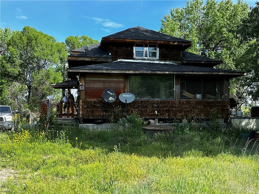
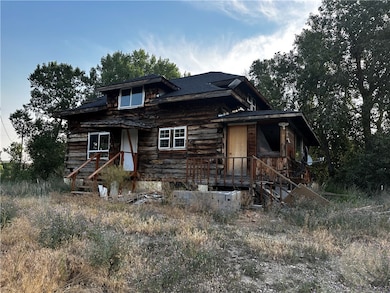
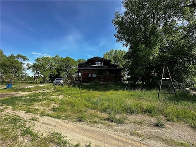
12788 Us Highway 12 Ryegate, MT 59074
Estimated payment $2,160/month
Highlights
- Barn
- Deck
- Wooded Lot
- River Front
- Secluded Lot
- Views
About This Home
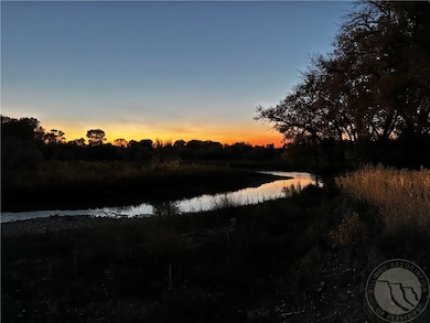
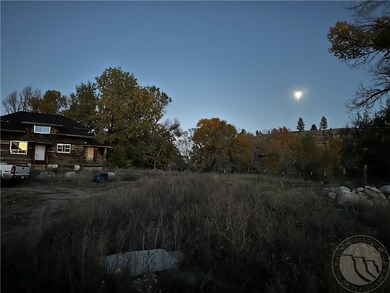
Here's your opportunity to live the country life on 16.2 acres ~1 mile west of Ryegate. A 1908 log home moved apx. 1999 onto a insulated concrete foundation right next to the Musselshell River. Backdropped by sandstone rims to the south - carved out over the millenia by the Musselshell River would make a wonderful getaway from the hectic pace of city life. Ryegate, MT is a quiet little community that is situated ~60 miles northwest of Billings. Cafe, Groceries and it's own Fire Station, K-12 grades. This home was purchase with the intent of a getaway or airbnb but plans have changed. The owners have put in a great deal of money and work to get this property updated and there's more to do... are you the right person to take on this project??? If so, let's schedule a showing of this property full of so much potential and a place to find solitude and a place to make great memories!!!
Listing Agent
Meridian Real Estate LLC Brokerage Phone: 406-855-1081 License #RRE-RBS-LIC-13124 Listed on: 11/14/2025
Home Details
Home Type
- Single Family
Est. Annual Taxes
- $2,276
Year Built
- Built in 1908
Lot Details
- 16.2 Acre Lot
- River Front
- Fenced
- Secluded Lot
- Sloped Lot
- Wooded Lot
- Landscaped with Trees
Home Design
- Bungalow
- Shingle Roof
- Asphalt Roof
- Log Siding
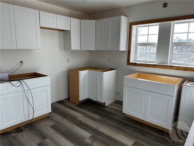
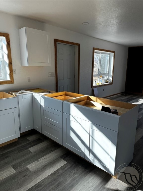
Interior Spaces
- 2,376 Sq Ft Home
- 2-Story Property
- Property Views
Bedrooms and Bathrooms
- 1 Bedroom
- 2 Full Bathrooms
Laundry
- Laundry Room
- Washer
Basement
- Walk-Out Basement
- Basement Fills Entire Space Under The House
Outdoor Features
- Deck
- Patio
Schools
- Ryegate Elementary And Middle School
- Ryegate High School
Farming
- Barn
Utilities
- No Cooling
- Forced Air Heating System
- Well
- Septic Tank
Community Details
- Stream
Listing and Financial Details
- Assessor Parcel Number 2493000000
Map
Home Values in the Area
Average Home Value in this Area
Tax History
| Year | Tax Paid | Tax Assessment Tax Assessment Total Assessment is a certain percentage of the fair market value that is determined by local assessors to be the total taxable value of land and additions on the property. | Land | Improvement |
|---|---|---|---|---|
| 2025 | $769 | $226,200 | $0 | $0 |
| 2024 | $1,070 | $168,600 | $0 | $0 |
| 2023 | $986 | $168,600 | $0 | $0 |
| 2022 | $790 | $131,600 | $0 | $0 |
| 2021 | $776 | $131,600 | $0 | $0 |
| 2020 | $728 | $125,500 | $0 | $0 |
| 2019 | $748 | $125,500 | $0 | $0 |
| 2018 | $622 | $100,100 | $24,630 | $77,170 |
| 2017 | $597 | $101,800 | $24,630 | $77,170 |
| 2016 | $490 | $84,070 | $19,940 | $64,130 |
| 2015 | $469 | $81,310 | $19,940 | $61,370 |
| 2014 | $203 | $19,390 | $0 | $0 |
Property History
| Date | Event | Price | List to Sale | Price per Sq Ft |
|---|---|---|---|---|
| 11/22/2024 11/22/24 | For Sale | $375,000 | -- | $158 / Sq Ft |
Purchase History
| Date | Type | Sale Price | Title Company |
|---|---|---|---|
| Grant Deed | -- | -- |
Source: Billings Multiple Listing Service
MLS Number: 349935
APN: 53-1513-01-3-01-02-0002
Disclaimer: Certain information contained herein is derived from information provided by parties other than Homes.com. All information provided is deemed reliable, but is not guaranteed to be accurate and should be independently verified.
![]() IDX information is provided exclusively for personal, non-commercial use, and may not be used for any purpose other than to identify prospective properties consumers may be interested in purchasing. Information is deemed reliable but not guaranteed.
IDX information is provided exclusively for personal, non-commercial use, and may not be used for any purpose other than to identify prospective properties consumers may be interested in purchasing. Information is deemed reliable but not guaranteed.
- 308 1st St N
- Jessie Rd
- DMB-61&62 Lookout Point
- NHN Canyon Dr
- DMB-18 Antelope Rd
- Tract 25 Antelope Rd
- tbd Basin Acres Rd
- 350 Antelope Rd
- 322 Antelope Rd
- Tbd Canal Rd
- NHN Canal Rd
- 144 Acres Canal Rd
- 345 Hedgesville Rd
- 0
- TBD Hedgesville Rd
- 147 Meins Rd
- 530 Belmont Rd
- 113 First Ave W
- 325 Main St
- 209 First St E
