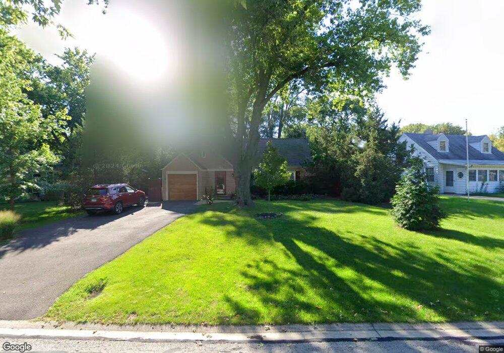
1279 Brandywine Cir Batavia, IL 60510
Southwest Batavia NeighborhoodEstimated Value: $280,000 - $312,000
4
Beds
--
Bath
1,335
Sq Ft
$222/Sq Ft
Est. Value
About This Home
This home is located at 1279 Brandywine Cir, Batavia, IL 60510 and is currently estimated at $296,219, approximately $221 per square foot. 1279 Brandywine Cir is a home located in Kane County with nearby schools including Sam Rotolo Middle School, Batavia Sr High School, and Immanuel Lutheran School.
Ownership History
Date
Name
Owned For
Owner Type
Purchase Details
Closed on
Oct 12, 2004
Sold by
Lafond William M and Lafond Melissa K
Bought by
Dewolf Delmar J and Dewolf Mary Jane
Current Estimated Value
Home Financials for this Owner
Home Financials are based on the most recent Mortgage that was taken out on this home.
Original Mortgage
$150,500
Outstanding Balance
$75,333
Interest Rate
5.93%
Mortgage Type
Purchase Money Mortgage
Estimated Equity
$220,886
Purchase Details
Closed on
Dec 28, 1998
Sold by
Smith Justin F and Smith Laura D R
Bought by
Lafond William M and Lafond Melissa K
Home Financials for this Owner
Home Financials are based on the most recent Mortgage that was taken out on this home.
Original Mortgage
$90,475
Interest Rate
6.76%
Create a Home Valuation Report for This Property
The Home Valuation Report is an in-depth analysis detailing your home's value as well as a comparison with similar homes in the area
Home Values in the Area
Average Home Value in this Area
Purchase History
| Date | Buyer | Sale Price | Title Company |
|---|---|---|---|
| Dewolf Delmar J | $190,500 | Fox Title Company | |
| Lafond William M | $129,500 | -- |
Source: Public Records
Mortgage History
| Date | Status | Borrower | Loan Amount |
|---|---|---|---|
| Open | Dewolf Delmar J | $150,500 | |
| Previous Owner | Lafond William M | $90,475 |
Source: Public Records
Tax History Compared to Growth
Tax History
| Year | Tax Paid | Tax Assessment Tax Assessment Total Assessment is a certain percentage of the fair market value that is determined by local assessors to be the total taxable value of land and additions on the property. | Land | Improvement |
|---|---|---|---|---|
| 2024 | $4,653 | $74,855 | $13,603 | $61,252 |
| 2023 | $4,457 | $67,939 | $12,346 | $55,593 |
| 2022 | $4,584 | $63,494 | $11,538 | $51,956 |
| 2021 | $4,363 | $60,218 | $10,943 | $49,275 |
| 2020 | $4,242 | $59,061 | $10,733 | $48,328 |
| 2019 | $4,146 | $56,970 | $10,353 | $46,617 |
| 2018 | $3,952 | $54,800 | $9,959 | $44,841 |
| 2017 | $3,831 | $52,993 | $9,631 | $43,362 |
| 2016 | $3,727 | $51,449 | $9,350 | $42,099 |
| 2015 | -- | $50,277 | $9,137 | $41,140 |
| 2014 | -- | $48,694 | $8,849 | $39,845 |
| 2013 | -- | $49,649 | $10,581 | $39,068 |
Source: Public Records
Map
Nearby Homes
- 1280 Brandywine Cir
- 1232 S Batavia Ave
- 818 Bernadette Ln
- 1316 Brandywine Cir Unit 4
- 1010 S Jefferson St
- 717 S Batavia Ave
- 344 Danforth Dr
- 369 Danforth Dr
- 384 Danforth Dr
- 396 Danforth Dr
- 303 Danforth Dr
- 245 Stone Manor Cir
- 524 Walnut St
- 1676 Carlstedt Dr
- 404 S Batavia Ave
- 1375 Green Pheasant Ln
- 860 S River St
- 445 Chillem Dr
- 514 Main St
- 304 Manchester Ave
- 1281 Brandywine Cir
- 1274 Brandywine Cir
- 647 Mount Vernon Place
- 1272 Brandywine Cir
- 1283 Brandywine Cir
- 649 Mount Vernon Place
- 581 Monticello Rd
- 1270 Brandywine Cir
- 1285 Brandywine Cir
- 645 Mount Vernon Place Unit 1
- 1277 Brandywine Cir
- 1273 Brandywine Cir
- 1256 Brandywine Cir
- 1287 Brandywine Cir
- 561 Monticello Rd Unit 1
- 643 Mount Vernon Place
- 701 Mount Vernon Place
- 1284 Brandywine Cir
- 1284 Brandywine Cir
- 1248 Brandywine Cir Unit 1