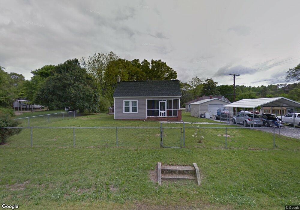
1279 Elmwood Ave Lancaster, SC 29720
Estimated Value: $83,000 - $183,000
--
Bed
1
Bath
1,230
Sq Ft
$102/Sq Ft
Est. Value
About This Home
This home is located at 1279 Elmwood Ave, Lancaster, SC 29720 and is currently estimated at $125,596, approximately $102 per square foot. 1279 Elmwood Ave is a home located in Lancaster County with nearby schools including Brooklyn Springs Elementary School, South Middle School, and Lancaster High School.
Ownership History
Date
Name
Owned For
Owner Type
Purchase Details
Closed on
Jun 25, 2010
Sold by
Newcomb Brenda and Newcomb William O
Bought by
Roof James L
Current Estimated Value
Home Financials for this Owner
Home Financials are based on the most recent Mortgage that was taken out on this home.
Original Mortgage
$66,900
Outstanding Balance
$44,876
Interest Rate
4.91%
Mortgage Type
VA
Estimated Equity
$80,720
Purchase Details
Closed on
Dec 1, 2005
Sold by
Gamble Flonnie and Taylor Ralph
Bought by
Newcomb Brenda and Newcomb William O
Create a Home Valuation Report for This Property
The Home Valuation Report is an in-depth analysis detailing your home's value as well as a comparison with similar homes in the area
Home Values in the Area
Average Home Value in this Area
Purchase History
| Date | Buyer | Sale Price | Title Company |
|---|---|---|---|
| Roof James L | $65,500 | -- | |
| Newcomb Brenda | $35,000 | -- |
Source: Public Records
Mortgage History
| Date | Status | Borrower | Loan Amount |
|---|---|---|---|
| Open | Roof James L | $66,900 |
Source: Public Records
Tax History Compared to Growth
Tax History
| Year | Tax Paid | Tax Assessment Tax Assessment Total Assessment is a certain percentage of the fair market value that is determined by local assessors to be the total taxable value of land and additions on the property. | Land | Improvement |
|---|---|---|---|---|
| 2024 | $313 | $2,040 | $344 | $1,696 |
| 2023 | $312 | $2,040 | $344 | $1,696 |
| 2022 | $311 | $2,040 | $344 | $1,696 |
| 2021 | $304 | $2,040 | $344 | $1,696 |
| 2020 | $282 | $1,844 | $344 | $1,500 |
| 2019 | $622 | $1,844 | $344 | $1,500 |
| 2018 | $599 | $1,844 | $344 | $1,500 |
| 2017 | $276 | $0 | $0 | $0 |
| 2016 | $269 | $0 | $0 | $0 |
| 2015 | $210 | $0 | $0 | $0 |
| 2014 | $210 | $0 | $0 | $0 |
| 2013 | $210 | $0 | $0 | $0 |
Source: Public Records
Map
Nearby Homes
- 1334 Williams Estate Dr
- TBD Williams Estate Dr
- 1429 Williams Estate Dr
- 1257 Springdale Rd
- 1453 Old Landsford Rd
- TBD Old Landsford Rd
- 1451 Kings Cir
- 5.45 acres Memorial Park Rd
- 3.04 acres Memorial Park Rd
- 1319 Jefferson St
- 126 S Jackson Rd
- 1747 Summit Ave Unit C
- 1613 Small St
- 707 W Barr St
- 439 South Ave
- 1010 13th St Unit 11
- 1841 Grace Ave
- 1501 Victoria St Unit 11
- 1503 Victoria St
- 1500 Victoria St Unit 4
- 1338 Yancey St
- 1357 Williams Estate Dr
- 1345 Williams Estate Dr
- 1322 Yancey St
- 1348 Yancey St
- 1286 Elmwood Ave
- 1356 Williams Estate Dr
- 1335 Williams Estate Dr
- 1356 Yancey St
- 1347 Yancey St
- 1310 Yancey St
- 1377 Williams Estate Dr
- 1260 Elmwood Ave
- 1368 Williams Estate Dr
- 676 W Brooklyn Ave
- 1323 Williams Estate Dr
- 1357 Yancey St
- 1302 Yancey St
- 1309 Yancey St
- 1328 Williams Estate Dr