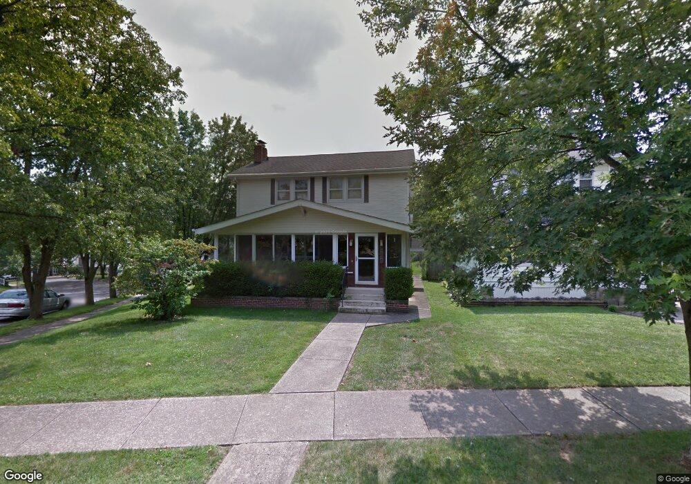
1279 Mulford Rd Columbus, OH 43212
Estimated Value: $451,000 - $579,005
3
Beds
2
Baths
1,504
Sq Ft
$359/Sq Ft
Est. Value
About This Home
This home is located at 1279 Mulford Rd, Columbus, OH 43212 and is currently estimated at $539,751, approximately $358 per square foot. 1279 Mulford Rd is a home located in Franklin County with nearby schools including Robert Louis Stevenson Elementary School, Larson Middle School, and Grandview Heights High School.
Ownership History
Date
Name
Owned For
Owner Type
Purchase Details
Closed on
Dec 20, 2000
Sold by
Wardlow Wanda E
Bought by
Bigge Robert H
Current Estimated Value
Home Financials for this Owner
Home Financials are based on the most recent Mortgage that was taken out on this home.
Original Mortgage
$150,000
Outstanding Balance
$55,674
Interest Rate
7.8%
Estimated Equity
$484,077
Purchase Details
Closed on
Sep 8, 1983
Bought by
Wardlow Wanda E
Create a Home Valuation Report for This Property
The Home Valuation Report is an in-depth analysis detailing your home's value as well as a comparison with similar homes in the area
Home Values in the Area
Average Home Value in this Area
Purchase History
| Date | Buyer | Sale Price | Title Company |
|---|---|---|---|
| Bigge Robert H | -- | -- | |
| Wardlow Wanda E | -- | -- |
Source: Public Records
Mortgage History
| Date | Status | Borrower | Loan Amount |
|---|---|---|---|
| Open | Bigge Robert H | $150,000 |
Source: Public Records
Tax History Compared to Growth
Tax History
| Year | Tax Paid | Tax Assessment Tax Assessment Total Assessment is a certain percentage of the fair market value that is determined by local assessors to be the total taxable value of land and additions on the property. | Land | Improvement |
|---|---|---|---|---|
| 2024 | $10,356 | $177,560 | $102,060 | $75,500 |
| 2023 | $9,072 | $177,555 | $102,060 | $75,495 |
| 2022 | $8,379 | $139,650 | $54,040 | $85,610 |
| 2021 | $7,844 | $139,650 | $54,040 | $85,610 |
| 2020 | $7,812 | $139,650 | $54,040 | $85,610 |
| 2019 | $7,544 | $119,350 | $54,040 | $65,310 |
| 2018 | $6,889 | $119,350 | $54,040 | $65,310 |
| 2017 | $7,034 | $119,350 | $54,040 | $65,310 |
| 2016 | $6,267 | $91,040 | $43,790 | $47,250 |
| 2015 | $6,267 | $91,040 | $43,790 | $47,250 |
| 2014 | $6,287 | $91,040 | $43,790 | $47,250 |
| 2013 | $2,762 | $82,740 | $39,795 | $42,945 |
Source: Public Records
Map
Nearby Homes
- 945 Quay Ave Unit 945E
- 945 Quay Ave Unit G
- 932 Mcclain Rd
- 1081 W 3rd Ave
- 1225 Eastview Ave
- 943 Timberman Rd
- 1240 Oxley Rd
- 1242 Oxley Rd
- 1083 W 3rd Ave
- 1095 W 3rd Ave
- 1093 W 3rd Ave
- 1280 Broadview Ave
- 1068 Edgehill Rd
- 1124 Edgehill Rd
- 1378 Morning Ave
- 922 Northwest Blvd
- 1343 Thornwood Place
- 1475 W 3rd Ave Unit 204
- 910-912 Northwest Blvd
- 1317 Broadview Ave
- 1283 Mulford Rd
- 1273 Mulford Rd
- 1273 Mulford Rd Unit r
- 1285 Mulford Rd
- 1291 Mulford Rd
- 1267 Mulford Rd
- 1297 Mulford Rd
- 1286 Bluff Ave
- 1268 Mulford Rd
- 1282 Bluff Ave
- 1264 Mulford Rd
- 1294 Bluff Ave
- 1278 Bluff Ave
- 995 Woodhill Dr
- 1282 Mulford Rd
- 1305 Mulford Rd
- 1272 Mulford Rd
- 1305 Mulford Rd
- 1256 Mulford Rd
- 1286 Mulford Rd