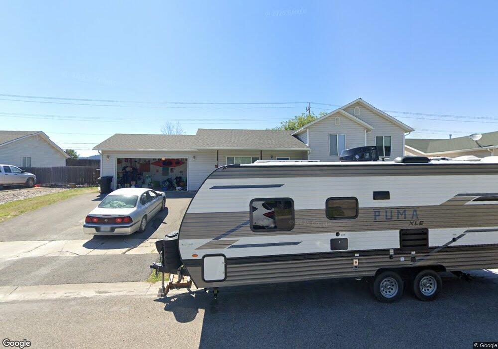
128 Beargass Ln Kalispell, MT 59901
Estimated Value: $346,000 - $541,000
4
Beds
3
Baths
1,310
Sq Ft
$363/Sq Ft
Est. Value
About This Home
This home is located at 128 Beargass Ln, Kalispell, MT 59901 and is currently estimated at $475,766, approximately $363 per square foot. 128 Beargass Ln is a home located in Flathead County with nearby schools including Elrod School, Kalispell Middle School, and Flathead High School.
Ownership History
Date
Name
Owned For
Owner Type
Purchase Details
Closed on
Sep 7, 2021
Sold by
Grady Anthony and Grady Ashley
Bought by
Grady Anthony M and Grady Ashley A
Current Estimated Value
Home Financials for this Owner
Home Financials are based on the most recent Mortgage that was taken out on this home.
Original Mortgage
$316,000
Outstanding Balance
$288,465
Interest Rate
3.02%
Mortgage Type
New Conventional
Estimated Equity
$187,301
Purchase Details
Closed on
Jun 16, 2021
Sold by
Meredith Robert M
Bought by
Grady Anthony and Grady Ashley
Home Financials for this Owner
Home Financials are based on the most recent Mortgage that was taken out on this home.
Original Mortgage
$320,000
Interest Rate
2.9%
Mortgage Type
New Conventional
Purchase Details
Closed on
Aug 13, 2020
Sold by
Perry Brent and Perry Jolene
Bought by
Meredith Robert M
Home Financials for this Owner
Home Financials are based on the most recent Mortgage that was taken out on this home.
Original Mortgage
$315,980
Interest Rate
3%
Mortgage Type
VA
Purchase Details
Closed on
Jul 21, 2017
Sold by
Noland Scott
Bought by
Perry Brent and Perry Jolene
Home Financials for this Owner
Home Financials are based on the most recent Mortgage that was taken out on this home.
Original Mortgage
$239,898
Interest Rate
3.89%
Mortgage Type
New Conventional
Purchase Details
Closed on
Feb 17, 2006
Sold by
Masuda Benjamin Asa and Story Tiffany Elizabeth
Bought by
Noland Scott
Home Financials for this Owner
Home Financials are based on the most recent Mortgage that was taken out on this home.
Original Mortgage
$160,000
Interest Rate
6.5%
Mortgage Type
Adjustable Rate Mortgage/ARM
Purchase Details
Closed on
Jan 31, 2005
Sold by
Bennetts Brett D and Bennetts Alice E
Bought by
Masuda Benjamin Asa and Story Tiffany Elizabeth
Home Financials for this Owner
Home Financials are based on the most recent Mortgage that was taken out on this home.
Original Mortgage
$160,000
Interest Rate
6.5%
Mortgage Type
Adjustable Rate Mortgage/ARM
Create a Home Valuation Report for This Property
The Home Valuation Report is an in-depth analysis detailing your home's value as well as a comparison with similar homes in the area
Home Values in the Area
Average Home Value in this Area
Purchase History
| Date | Buyer | Sale Price | Title Company |
|---|---|---|---|
| Grady Anthony M | -- | Insured Titles | |
| Grady Anthony | -- | Fidelity National Title | |
| Meredith Robert M | -- | First Title Of Montana | |
| Perry Brent | -- | Insured Titles | |
| Noland Scott | -- | Stewart Title Of Flathead Co | |
| Masuda Benjamin Asa | -- | None Available |
Source: Public Records
Mortgage History
| Date | Status | Borrower | Loan Amount |
|---|---|---|---|
| Open | Grady Anthony M | $316,000 | |
| Closed | Grady Anthony | $320,000 | |
| Previous Owner | Meredith Robert M | $315,980 | |
| Previous Owner | Perry Brent | $239,898 | |
| Previous Owner | Noland Scott | $160,000 | |
| Previous Owner | Masuda Benjamin Asa | $160,000 |
Source: Public Records
Tax History Compared to Growth
Tax History
| Year | Tax Paid | Tax Assessment Tax Assessment Total Assessment is a certain percentage of the fair market value that is determined by local assessors to be the total taxable value of land and additions on the property. | Land | Improvement |
|---|---|---|---|---|
| 2025 | $2,919 | $543,000 | $0 | $0 |
| 2024 | $3,095 | $397,400 | $0 | $0 |
| 2023 | $3,858 | $397,400 | $0 | $0 |
| 2022 | $3,737 | $287,300 | $0 | $0 |
| 2021 | $3,092 | $287,300 | $0 | $0 |
| 2020 | $3,474 | $247,900 | $0 | $0 |
| 2019 | $3,484 | $247,900 | $0 | $0 |
| 2018 | $3,236 | $215,300 | $0 | $0 |
| 2017 | $2,257 | $215,300 | $0 | $0 |
| 2016 | $2,929 | $208,600 | $0 | $0 |
| 2015 | $2,932 | $208,600 | $0 | $0 |
| 2014 | $2,856 | $120,840 | $0 | $0 |
Source: Public Records
Map
Nearby Homes
- 11 Muskrat Dr
- 115 Russell Dr
- 2147 S Woodland Dr
- 14 Wind River Dr
- 59 Honeysuckle Ln
- 1571 Haven Dr
- 71 Wind River Dr
- 50 Twin Acres Dr Unit 7
- 50 Twin Acres Dr Unit 11
- 2455 Us Highway 93 S
- 1340 Willow Glen Dr Unit 19
- 1340 Willow Glen Dr Unit 26
- 1340 Willow Glen Dr Unit 23
- NHN U S 93 S
- 3943 Lower Valley Rd
- 2883 & 2879 Lower Valley Rd
- 1221 7th Ave E
- 826 11th St E
- 51 Selders Ln
- 1024 Woodland Ave
- 128 Beargrass Ln
- 132 Beargrass Ln
- 124 Beargrass Ln
- 127 Beargrass Ln
- 624 Kelly Rd
- 636 Willow Glen Dr
- 123 Beargrass Ln
- 131 Beargrass Ln
- 120 Beargrass Ln
- 620 Kelly Rd
- 119 Beargrass Ln
- 136 Beargrass Ln
- 135 Beargrass Ln
- 18 Honeysuckle Ln
- 14 Honeysuckle Ln
- 588 Kelly Rd
- 22 Honeysuckle Ln
- 10 Honeysuckle Ln
- 26 Honeysuckle Ln
- 141 Beargrass Ln