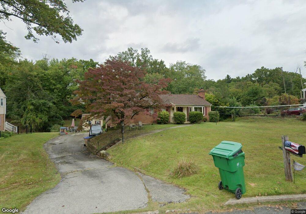
128 Brookside Rd Newtown Square, PA 19073
Estimated Value: $542,000 - $652,000
3
Beds
3
Baths
1,530
Sq Ft
$385/Sq Ft
Est. Value
About This Home
This home is located at 128 Brookside Rd, Newtown Square, PA 19073 and is currently estimated at $588,923, approximately $384 per square foot. 128 Brookside Rd is a home located in Delaware County with nearby schools including Culbertson Elementary School, Paxon Hollow Middle School, and Marple Newtown Senior High School.
Ownership History
Date
Name
Owned For
Owner Type
Purchase Details
Closed on
May 3, 2012
Sold by
Snyder Kenneth and Dimemmo Christina
Bought by
Snyder Kenneth
Current Estimated Value
Purchase Details
Closed on
Jun 26, 2003
Sold by
Brennan Joseph L and Brennan Amy L
Bought by
Snyder Kenneth and Dimemmo Christina
Home Financials for this Owner
Home Financials are based on the most recent Mortgage that was taken out on this home.
Original Mortgage
$199,000
Outstanding Balance
$86,324
Interest Rate
5.53%
Mortgage Type
Purchase Money Mortgage
Estimated Equity
$502,599
Purchase Details
Closed on
Jul 31, 2001
Sold by
Williams David H and Williams Marcia J
Bought by
Brennan Joseph L and Brennan Amy L
Home Financials for this Owner
Home Financials are based on the most recent Mortgage that was taken out on this home.
Original Mortgage
$160,000
Interest Rate
7.14%
Create a Home Valuation Report for This Property
The Home Valuation Report is an in-depth analysis detailing your home's value as well as a comparison with similar homes in the area
Home Values in the Area
Average Home Value in this Area
Purchase History
| Date | Buyer | Sale Price | Title Company |
|---|---|---|---|
| Snyder Kenneth | -- | None Available | |
| Snyder Kenneth | $290,000 | Commonwealth Land Title Insu | |
| Brennan Joseph L | $245,000 | Commonwealth Land Title Ins |
Source: Public Records
Mortgage History
| Date | Status | Borrower | Loan Amount |
|---|---|---|---|
| Open | Snyder Kenneth | $199,000 | |
| Previous Owner | Brennan Joseph L | $160,000 |
Source: Public Records
Tax History Compared to Growth
Tax History
| Year | Tax Paid | Tax Assessment Tax Assessment Total Assessment is a certain percentage of the fair market value that is determined by local assessors to be the total taxable value of land and additions on the property. | Land | Improvement |
|---|---|---|---|---|
| 2025 | $6,256 | $375,900 | $130,580 | $245,320 |
| 2024 | $6,256 | $375,900 | $130,580 | $245,320 |
| 2023 | $6,058 | $375,900 | $130,580 | $245,320 |
| 2022 | $5,926 | $375,900 | $130,580 | $245,320 |
| 2021 | $9,059 | $375,900 | $130,580 | $245,320 |
| 2020 | $4,733 | $172,540 | $70,540 | $102,000 |
| 2019 | $4,658 | $172,540 | $70,540 | $102,000 |
| 2018 | $4,607 | $172,540 | $0 | $0 |
| 2017 | $4,592 | $172,540 | $0 | $0 |
| 2016 | $966 | $172,540 | $0 | $0 |
| 2015 | $966 | $172,540 | $0 | $0 |
| 2014 | $966 | $172,540 | $0 | $0 |
Source: Public Records
Map
Nearby Homes
- 133 Brookside Rd
- 126 Bryn Mawr Ave
- 10 Bryn Mawr Ave
- 135 Bryn Mawr Ave
- 212 Aronimink Dr
- 3500 Goshen Rd
- 31 Barren Rd
- 217 Jeffrey Ln
- 14 Valley View Ln
- 202 Barren Rd
- 204 3rd Ave
- 204 Wedgewood Cir
- 115 Newby Dr
- 27 Mary Jane Ln
- 10 Fox Chase Cir
- 334 Foxtail Ln Unit 22D
- 310 Jeffrey Ln
- 326 Squire Dr Unit 21C
- 304 Squire Dr
- 204 Media Line Rd
- 126 Brookside Rd
- 130 Brookside Rd
- 124 Brookside Rd
- 143 Ashley Rd
- 132 Brookside Rd
- 127 Brookside Rd
- 145 Ashley Rd
- 141 Ashley Rd
- 125 Brookside Rd
- 122 Brookside Rd
- 129 Brookside Rd
- 139 Ashley Rd
- 147 Ashley Rd
- 134 Brookside Rd
- 131 Brookside Rd
- 107 Furlong Ave
- 120 Brookside Rd
- 137 Ashley Rd
- 136 Brookside Rd
- 135 Brookside Rd