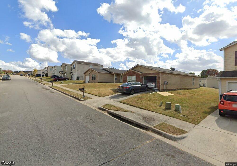
128 Dormont Dr NE Huntsville, AL 35810
Moores Mill NeighborhoodEstimated Value: $201,000 - $246,000
--
Bed
--
Bath
1,515
Sq Ft
$142/Sq Ft
Est. Value
About This Home
This home is located at 128 Dormont Dr NE, Huntsville, AL 35810 and is currently estimated at $215,122, approximately $141 per square foot. 128 Dormont Dr NE is a home with nearby schools including Martin Luther King Jr. Elementary School, Chapman Middle School, and Lee High School.
Ownership History
Date
Name
Owned For
Owner Type
Purchase Details
Closed on
Nov 7, 2022
Sold by
Madison County
Bought by
Ross Howard
Current Estimated Value
Purchase Details
Closed on
Aug 13, 2010
Sold by
Hunter Communities Inc
Bought by
Walker Constance A
Home Financials for this Owner
Home Financials are based on the most recent Mortgage that was taken out on this home.
Original Mortgage
$2,745
Interest Rate
4.61%
Mortgage Type
Stand Alone Second
Purchase Details
Closed on
Apr 9, 2010
Sold by
Concord Development Co Inc
Bought by
Hunter Communities Inc
Create a Home Valuation Report for This Property
The Home Valuation Report is an in-depth analysis detailing your home's value as well as a comparison with similar homes in the area
Home Values in the Area
Average Home Value in this Area
Purchase History
| Date | Buyer | Sale Price | Title Company |
|---|---|---|---|
| Ross Howard | $2,000 | -- | |
| Walker Constance A | -- | -- | |
| Hunter Communities Inc | -- | -- |
Source: Public Records
Mortgage History
| Date | Status | Borrower | Loan Amount |
|---|---|---|---|
| Previous Owner | Walker Constance A | $2,745 |
Source: Public Records
Tax History Compared to Growth
Tax History
| Year | Tax Paid | Tax Assessment Tax Assessment Total Assessment is a certain percentage of the fair market value that is determined by local assessors to be the total taxable value of land and additions on the property. | Land | Improvement |
|---|---|---|---|---|
| 2024 | $976 | $16,320 | $3,500 | $12,820 |
| 2023 | $899 | $13,100 | $3,500 | $9,600 |
| 2022 | $547 | $10,260 | $3,000 | $7,260 |
| 2021 | $440 | $8,420 | $2,000 | $6,420 |
| 2020 | $440 | $8,410 | $2,000 | $6,410 |
| 2019 | $407 | $7,830 | $2,000 | $5,830 |
| 2018 | $287 | $5,780 | $0 | $0 |
| 2017 | $256 | $5,240 | $0 | $0 |
| 2016 | $256 | $5,240 | $0 | $0 |
| 2015 | $256 | $5,240 | $0 | $0 |
| 2014 | $276 | $5,580 | $0 | $0 |
Source: Public Records
Map
Nearby Homes
- 127 Whitestone Dr NE
- 102 Whitestone Dr NE
- 223 Dormont Dr NE
- 235 Dormont Dr NE
- 220 Valleyside Dr NE
- 340 Ruby Elm Ave NE
- 341 Ruby Elm Ave NE
- Lakeside-4 sides Brick Plan at Highland Hills
- Freeport-4 sides Brick Plan at Highland Hills
- Cali-4 sides Brick Plan at Highland Hills
- Kerry-4 sides Brick Plan at Highland Hills
- 6028 Normal Heights Cir NW
- 336 Ruby Elm Ave NE
- 334 Ruby Elm Ave NE
- 2102 Southline Dr NW
- 339 Ruby Elm Ave NE
- 338 Ruby Elm Ave NE
- 335 Ruby Elm Ave NE
- 2236 NW Swaim Cir NW
- 11019 Mount Charron Rd NW
- 126 Dormont Dr NE
- 130 Dormont Dr NE
- 132 Dormont Dr NE
- 124 Dormont Dr NE
- 134 Dormont Dr NE
- 122 Dormont Dr NE
- 141 Whitestone Dr NE
- 145 Whitestone Dr NE
- 145 Dormont Dr NE
- 149 Dormont Dr NE
- 141 Dormont Dr NE
- 147 Dormont Dr NE
- 143 Dormont Dr NE
- 143 Whitestone Dr NE
- 139 Whitestone Dr NE
- 120 Dormont Dr NE
- 135 Whitestone Dr NE
- 151 Dormont Dr NE
- 139 Dormont Dr NE
- 147 Whitestone Dr NE