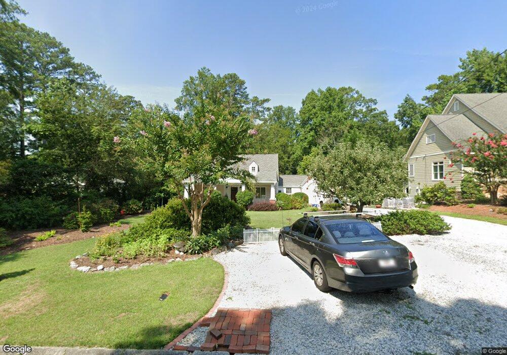
128 Durham St SW Marietta, GA 30064
Estimated Value: $516,418 - $729,000
4
Beds
4
Baths
2,101
Sq Ft
$308/Sq Ft
Est. Value
About This Home
This home is located at 128 Durham St SW, Marietta, GA 30064 and is currently estimated at $646,355, approximately $307 per square foot. 128 Durham St SW is a home located in Cobb County with nearby schools including A.L. Burruss Elementary School, Marietta Sixth Grade Academy, and Marietta Middle School.
Ownership History
Date
Name
Owned For
Owner Type
Purchase Details
Closed on
Jul 11, 2019
Sold by
Shaw Darren James
Bought by
Shaw Lorene Mei Lan
Current Estimated Value
Purchase Details
Closed on
Dec 4, 2001
Sold by
Hook Lorene M
Bought by
Shaw Lorene M
Home Financials for this Owner
Home Financials are based on the most recent Mortgage that was taken out on this home.
Original Mortgage
$206,400
Interest Rate
6.42%
Mortgage Type
New Conventional
Purchase Details
Closed on
Sep 29, 1995
Sold by
Settlemyer A Frank Robin P
Bought by
Shaw Darren J and Hook Lorene M
Create a Home Valuation Report for This Property
The Home Valuation Report is an in-depth analysis detailing your home's value as well as a comparison with similar homes in the area
Home Values in the Area
Average Home Value in this Area
Purchase History
| Date | Buyer | Sale Price | Title Company |
|---|---|---|---|
| Shaw Lorene Mei Lan | -- | -- | |
| Shaw Lorene M | -- | -- | |
| Shaw Darren J | $132,000 | -- |
Source: Public Records
Mortgage History
| Date | Status | Borrower | Loan Amount |
|---|---|---|---|
| Previous Owner | Shaw Lorene M | $206,400 |
Source: Public Records
Tax History Compared to Growth
Tax History
| Year | Tax Paid | Tax Assessment Tax Assessment Total Assessment is a certain percentage of the fair market value that is determined by local assessors to be the total taxable value of land and additions on the property. | Land | Improvement |
|---|---|---|---|---|
| 2024 | $371 | $212,400 | $60,000 | $152,400 |
| 2023 | $219 | $184,868 | $52,000 | $132,868 |
| 2022 | $371 | $164,152 | $52,000 | $112,152 |
| 2021 | $390 | $149,288 | $52,000 | $97,288 |
| 2020 | $389 | $140,352 | $52,000 | $88,352 |
| 2019 | $390 | $146,072 | $48,000 | $98,072 |
| 2018 | $388 | $126,976 | $44,000 | $82,976 |
| 2017 | $313 | $126,976 | $44,000 | $82,976 |
| 2016 | $317 | $106,724 | $44,000 | $62,724 |
| 2015 | $351 | $102,724 | $40,000 | $62,724 |
| 2014 | $366 | $105,332 | $0 | $0 |
Source: Public Records
Map
Nearby Homes
- 131 Brookwood Dr SW
- 32 Durham St SW
- 21 Whitlock Dr SW
- 563 Hillandale Cir SW
- 80 Lindley Ave NW Unit 1
- 305 Brookwood Dr SW
- 132 Northcutt St SW
- 325 Polk St NW
- 415 S Woodland Dr SW
- 25 Whitlock Square SW
- 600 Applewood Ln NW
- 96 McDonald St SW
- 236 Ridge Ave NW
- 255 Maple Ave NW
- 798 Sentinel Ridge SW
- 221 Wright St SW
- 195 Wright St SW
- 59 Trammell St SW
- 865 Cavalry Dr SW
- 138 Durham St SW
- 120 Durham St SW
- 123 Durham St SW
- 96 Durham St SW
- 150 Durham St SW
- 143 Durham St SW
- 109 Durham St SW
- 88 Durham St SW
- 160 Durham St SW
- 95 Durham St SW
- 144 Durham St SW
- 84 Durham St SW
- 165 Durham St SW
- 385 Maxwell Ave SW
- 145 Brookwood Dr SW
- 85 Durham St SW
- 366 N Woodland Dr SW
- 159 Brookwood Dr SW
- 373 Maxwell Ave SW
- 73 Durham St SW