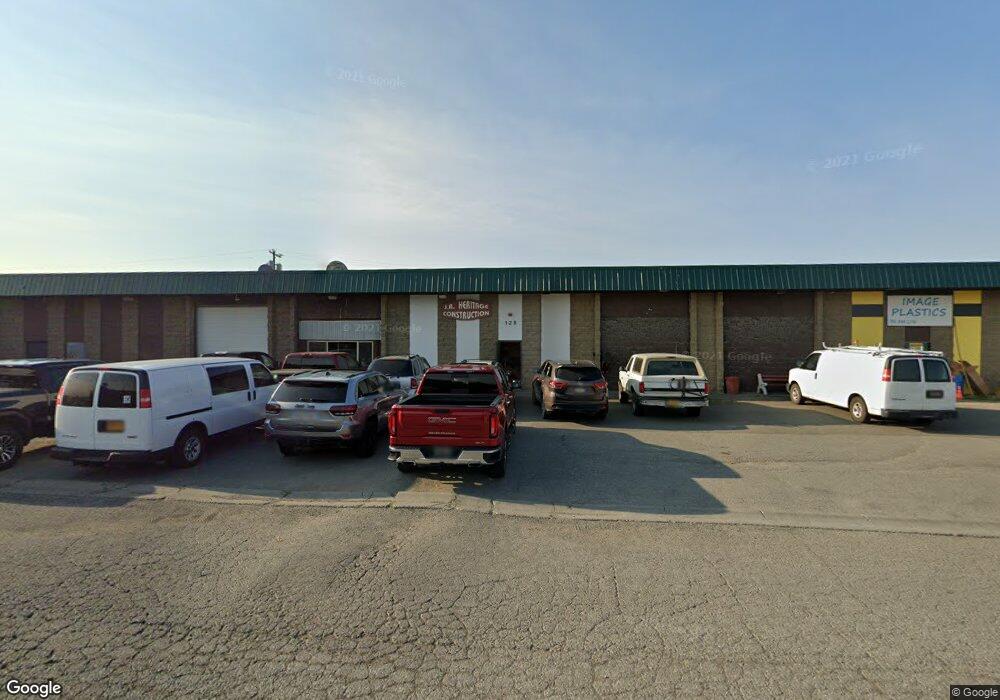
128 E 51st Ave Anchorage, AK 99503
Midtown NeighborhoodEstimated Value: $2,137,540
Studio
--
Bath
17,702
Sq Ft
$121/Sq Ft
Est. Value
About This Home
This home is located at 128 E 51st Ave, Anchorage, AK 99503 and is currently priced at $2,137,540, approximately $120 per square foot. 128 E 51st Ave is a home located in Anchorage Municipality with nearby schools including Rogers Park Elementary School, Romig Middle School, and West High School.
Ownership History
Date
Name
Owned For
Owner Type
Purchase Details
Closed on
Jan 2, 2024
Sold by
Schmidt Viktor and Schmidt Nicole
Bought by
Schmidt Property Holdings Llc
Current Estimated Value
Home Financials for this Owner
Home Financials are based on the most recent Mortgage that was taken out on this home.
Original Mortgage
$1,799,990
Outstanding Balance
$1,769,767
Interest Rate
7.44%
Mortgage Type
Seller Take Back
Purchase Details
Closed on
Dec 15, 2023
Sold by
Trust Agreement Of Craig King and King Craig
Bought by
Schmidt Viktor and Schmidt Nicole
Home Financials for this Owner
Home Financials are based on the most recent Mortgage that was taken out on this home.
Original Mortgage
$1,799,990
Outstanding Balance
$1,769,767
Interest Rate
7.44%
Mortgage Type
Seller Take Back
Create a Home Valuation Report for This Property
The Home Valuation Report is an in-depth analysis detailing your home's value as well as a comparison with similar homes in the area
Home Values in the Area
Average Home Value in this Area
Purchase History
| Date | Buyer | Sale Price | Title Company |
|---|---|---|---|
| Schmidt Property Holdings Llc | -- | Stewart Title | |
| Schmidt Viktor | -- | None Listed On Document |
Source: Public Records
Mortgage History
| Date | Status | Borrower | Loan Amount |
|---|---|---|---|
| Open | Schmidt Viktor | $1,799,990 |
Source: Public Records
Tax History
| Year | Tax Paid | Tax Assessment Tax Assessment Total Assessment is a certain percentage of the fair market value that is determined by local assessors to be the total taxable value of land and additions on the property. | Land | Improvement |
|---|---|---|---|---|
| 2025 | $20,806 | $1,526,100 | $331,600 | $1,194,500 |
| 2024 | $20,806 | $1,288,700 | $331,600 | $957,100 |
| 2023 | $20,961 | $1,230,800 | $319,000 | $911,800 |
| 2022 | $20,085 | $1,192,700 | $319,300 | $873,400 |
| 2021 | $21,911 | $1,215,900 | $313,100 | $902,800 |
| 2020 | $20,565 | $1,209,700 | $306,900 | $902,800 |
| 2019 | $19,768 | $1,208,300 | $300,700 | $907,600 |
| 2018 | $23,196 | $1,414,400 | $300,700 | $1,113,700 |
| 2017 | $21,777 | $1,390,600 | $300,700 | $1,089,900 |
| 2016 | $19,469 | $1,414,300 | $300,700 | $1,113,600 |
| 2015 | $19,469 | $1,373,800 | $300,700 | $1,073,100 |
| 2014 | $19,469 | $1,332,900 | $300,700 | $1,032,200 |
Source: Public Records
Map
Nearby Homes
- 4810 C St
- 000 Business Park Blvd
- 420 E 46th Place
- N/A Silverado Tract 2a
- 817 Shakespeare Cir
- 4101 Credit Union Dr
- 905 Lancaster Dr
- 300 W Tudor Rd
- 311 Lynnwood Dr Unit 4
- 4906 Cambridge Way
- 6243 Eula St
- 1200 Southampton Dr
- 4207 Cope St
- 4101 N North Star St
- 4106 N Star St
- 4113 Cope St
- 1506 Cache Dr
- 4004 Cope St
- 3400 Indiana St
- 1643 Mountainman Loop Unit 32
- 101 E International Airport Rd Unit 101
- 101 E International Airport Rd
- 219 E International Airport Rd
- 219 E International Airport Rd Unit 200
- 101 International Arprt E
- 101 International Arpt Rd
- 101 E Intl Airport Rd
- 209 E 51st Ave
- 209 E 51st Ave
- 219 E Intl Airport Rd
- 219 E International Arprt
- 219 E International Rd
- 219 E 51st Ave
- 118 E International Airport Rd
- 100 W International
- 5011 A St
- 239 E Intl Airport Rd
- 5100 Cordova St Unit 206
- 5100 Cordova St Unit 201
- 5100 Cordova St Unit 202
Your Personal Tour Guide
Ask me questions while you tour the home.