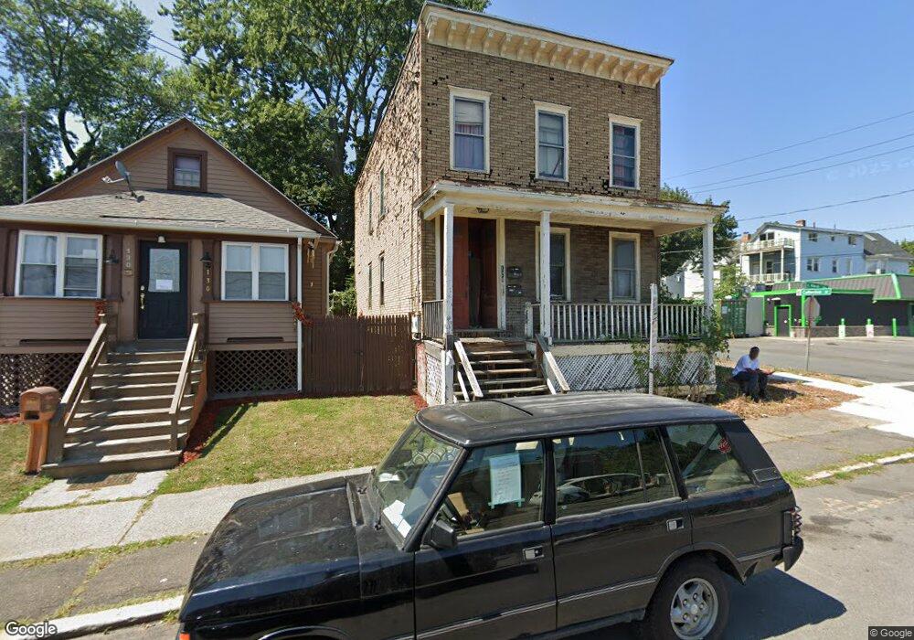
128 Hawk St S Albany, NY 12202
South End NeighborhoodEstimated Value: $137,000 - $258,000
3
Beds
2
Baths
2,082
Sq Ft
$94/Sq Ft
Est. Value
About This Home
This home is located at 128 Hawk St S, Albany, NY 12202 and is currently estimated at $194,796, approximately $93 per square foot. 128 Hawk St S is a home located in Albany County with nearby schools including Giffen Memorial Elementary School, Stephen And Harriet Myers Middle School, and Albany High School.
Ownership History
Date
Name
Owned For
Owner Type
Purchase Details
Closed on
Mar 18, 2003
Sold by
Tobin Elizabeth
Bought by
Mcmullin Grady
Current Estimated Value
Purchase Details
Closed on
Nov 14, 2002
Sold by
Capital Affordable Housin G Funding Corp
Bought by
Tobin Elizabeth
Purchase Details
Closed on
Feb 13, 2002
Purchase Details
Closed on
Mar 12, 1998
Sold by
Spickorman Tim
Bought by
Raine'S Joe L
Purchase Details
Closed on
Dec 16, 1996
Sold by
Cohoes Savings Bank
Bought by
Spickerman Tim
Purchase Details
Closed on
Nov 18, 1996
Create a Home Valuation Report for This Property
The Home Valuation Report is an in-depth analysis detailing your home's value as well as a comparison with similar homes in the area
Home Values in the Area
Average Home Value in this Area
Purchase History
| Date | Buyer | Sale Price | Title Company |
|---|---|---|---|
| Mcmullin Grady | $78,000 | Timothy Elliot | |
| Tobin Elizabeth | $25,000 | Michael Lynch | |
| -- | $22,000 | -- | |
| Raine'S Joe L | $52,000 | -- | |
| Spickerman Tim | $7,000 | -- | |
| -- | $82,000 | -- |
Source: Public Records
Tax History Compared to Growth
Tax History
| Year | Tax Paid | Tax Assessment Tax Assessment Total Assessment is a certain percentage of the fair market value that is determined by local assessors to be the total taxable value of land and additions on the property. | Land | Improvement |
|---|---|---|---|---|
| 2024 | $4,137 | $120,000 | $24,000 | $96,000 |
| 2023 | $2,198 | $46,000 | $9,200 | $36,800 |
| 2022 | $2,261 | $46,000 | $9,200 | $36,800 |
| 2021 | $2,257 | $46,000 | $9,200 | $36,800 |
| 2020 | $1,964 | $46,000 | $9,200 | $36,800 |
| 2019 | $1,811 | $46,000 | $9,200 | $36,800 |
| 2018 | $2,369 | $46,000 | $9,200 | $36,800 |
| 2017 | $2,263 | $46,000 | $9,200 | $36,800 |
| 2016 | $2,240 | $46,000 | $9,200 | $36,800 |
| 2015 | $2,599 | $47,300 | $9,500 | $37,800 |
| 2014 | -- | $47,300 | $9,500 | $37,800 |
Source: Public Records
Map
Nearby Homes
- 46 Osborne St
- 252 Morton Ave
- 15 Oneida Terrace
- 3 Osborne St
- 4 Osborne St
- 3 Elizabeth St Unit 2
- 278 Morton Ave
- 37 Sloan St
- 64 Alexander St
- 124 2nd Ave
- 163 Eagle St
- 8 Avondale Terrace
- 292 Catherine St
- 178A Delaware Ave
- 137 4th Ave
- 36 Slingerland St
- 1A Providence Place
- 16 Regent St
- 227 2nd Ave
- 64 Clinton St
- 130 Hawk St S
- 45 Catherine St
- 134 Hawk St S
- 168 Catherine St
- 136 Hawk St S
- 166 Morton Ave
- 170 Morton Ave
- 138 Hawk St S
- 105 Osborne St
- 144 Catherine St
- 140 Hawk St S
- 158 Morton Ave
- 178 Morton Ave
- 155 Hawk St S
- 154 Morton Ave
- 146 Catherine St
- 182 Morton Ave Unit 3
- 182 Morton Ave
- 20 Hawk St S
- 180 Morton Ave