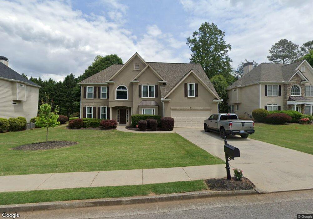
128 Mayes Farm Rd NW Unit 2 Marietta, GA 30064
West Cobb NeighborhoodEstimated Value: $559,321 - $626,000
5
Beds
3
Baths
3,375
Sq Ft
$176/Sq Ft
Est. Value
About This Home
This home is located at 128 Mayes Farm Rd NW Unit 2, Marietta, GA 30064 and is currently estimated at $592,580, approximately $175 per square foot. 128 Mayes Farm Rd NW Unit 2 is a home located in Cobb County with nearby schools including Due West Elementary School, Lost Mountain Middle School, and Harrison High School.
Ownership History
Date
Name
Owned For
Owner Type
Purchase Details
Closed on
Jul 14, 2005
Sold by
Burgess Harrison and Burgess Shelia
Bought by
Sturges Michael and Sturges Lori
Current Estimated Value
Home Financials for this Owner
Home Financials are based on the most recent Mortgage that was taken out on this home.
Original Mortgage
$204,800
Outstanding Balance
$106,078
Interest Rate
5.54%
Mortgage Type
New Conventional
Estimated Equity
$486,502
Purchase Details
Closed on
Aug 14, 2001
Sold by
Morrison Homes Inc
Bought by
Burgess Harrison and Burgess Shelia L
Home Financials for this Owner
Home Financials are based on the most recent Mortgage that was taken out on this home.
Original Mortgage
$237,500
Interest Rate
7.18%
Mortgage Type
New Conventional
Create a Home Valuation Report for This Property
The Home Valuation Report is an in-depth analysis detailing your home's value as well as a comparison with similar homes in the area
Home Values in the Area
Average Home Value in this Area
Purchase History
| Date | Buyer | Sale Price | Title Company |
|---|---|---|---|
| Sturges Michael | $261,000 | -- | |
| Burgess Harrison | $250,000 | -- |
Source: Public Records
Mortgage History
| Date | Status | Borrower | Loan Amount |
|---|---|---|---|
| Open | Sturges Michael | $204,800 | |
| Previous Owner | Burgess Harrison | $237,500 |
Source: Public Records
Tax History Compared to Growth
Tax History
| Year | Tax Paid | Tax Assessment Tax Assessment Total Assessment is a certain percentage of the fair market value that is determined by local assessors to be the total taxable value of land and additions on the property. | Land | Improvement |
|---|---|---|---|---|
| 2024 | $5,114 | $212,116 | $48,000 | $164,116 |
| 2023 | $3,640 | $169,196 | $20,000 | $149,196 |
| 2022 | $4,336 | $174,756 | $20,000 | $154,756 |
| 2021 | $3,706 | $145,988 | $20,000 | $125,988 |
| 2020 | $3,706 | $145,988 | $20,000 | $125,988 |
| 2019 | $3,289 | $126,912 | $20,000 | $106,912 |
| 2018 | $3,289 | $126,912 | $20,000 | $106,912 |
| 2017 | $2,867 | $113,556 | $20,000 | $93,556 |
| 2016 | $2,870 | $113,556 | $20,000 | $93,556 |
| 2015 | $2,382 | $89,688 | $20,000 | $69,688 |
| 2014 | $2,402 | $89,688 | $0 | $0 |
Source: Public Records
Map
Nearby Homes
- 4609 McTyre Way NW
- 355 Glynnwilde Dr NW
- 511 Earlvine Way NW
- 4188 Fawn Ivy Ln
- 4259 Hansford Loop SW
- 380 Parkside Meadow Dr SW
- 345 Vineyard Dr NW
- 3910 Lisas Dr NW
- 240 Whisperwood Ln NW
- 3797 Churchill Dr SW
- 191 Whisperwood Ln NW
- 4796 Dallas Hwy
- 140 Whisperwood Ln NW
- 407 Ward Farm Dr
- 3470 Whisperwood Ct NW
- 100 Whisperwood Ln NW
- 130 Mayes Farm Rd NW Unit 2
- 126 Mayes Farm Rd NW
- 4397 Mayes Farm Ct NW Unit 2
- 124 Mayes Farm Rd NW Unit None
- 124 Mayes Farm Rd NW
- 124 Mayes Farm Rd NW
- 127 Mayes Farm Rd NW
- 125 Mayes Farm Rd NW
- 114 Midway Rd NW
- 133 Mayes Farm Rd NW
- 110 Midway Rd NW
- 0 Midway Rd 0
- 123 Mayes Farm Rd NW
- 123 Mayes Farm Rd NW
- 122 Mayes Farm Rd NW
- 106 Midway Rd NW
- 4395 Mayes Farm Ct NW
- 121 Mayes Farm Rd NW
- 104 Midway Rd NW
- 119 Mayes Farm Rd NW