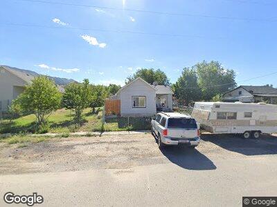
128 N Connor Ave Stockton, UT 84071
Estimated Value: $174,000 - $278,000
1
Bed
1
Bath
760
Sq Ft
$301/Sq Ft
Est. Value
About This Home
This home is located at 128 N Connor Ave, Stockton, UT 84071 and is currently estimated at $228,758, approximately $300 per square foot. 128 N Connor Ave is a home located in Tooele County with nearby schools including Settlement Canyon Elementary School and Dugway.
Ownership History
Date
Name
Owned For
Owner Type
Purchase Details
Closed on
Sep 17, 2018
Sold by
Thomas Gregory W and Thomas Sarah
Bought by
Vance Dillon and Phillips Billi Kay
Current Estimated Value
Purchase Details
Closed on
Aug 30, 2013
Sold by
Thomas Gregory W
Bought by
Thomas Gregory W and Thomas Sarah
Purchase Details
Closed on
Aug 28, 2013
Sold by
Fletcher Amy Sue
Bought by
Thomas Gregory W
Purchase Details
Closed on
Dec 20, 2007
Sold by
Hawkins Troy E
Bought by
Fletcher Amy Sue
Home Financials for this Owner
Home Financials are based on the most recent Mortgage that was taken out on this home.
Original Mortgage
$78,665
Interest Rate
6.2%
Mortgage Type
FHA
Create a Home Valuation Report for This Property
The Home Valuation Report is an in-depth analysis detailing your home's value as well as a comparison with similar homes in the area
Home Values in the Area
Average Home Value in this Area
Purchase History
| Date | Buyer | Sale Price | Title Company |
|---|---|---|---|
| Vance Dillon | -- | Security Title Insurance Age | |
| Thomas Gregory W | -- | Us Title Insurance Agency | |
| Thomas Gregory W | -- | Us Title Insurance Agency | |
| Fletcher Amy Sue | -- | Metro National Title |
Source: Public Records
Mortgage History
| Date | Status | Borrower | Loan Amount |
|---|---|---|---|
| Previous Owner | Fletcher Amy Sue | $78,665 |
Source: Public Records
Tax History Compared to Growth
Tax History
| Year | Tax Paid | Tax Assessment Tax Assessment Total Assessment is a certain percentage of the fair market value that is determined by local assessors to be the total taxable value of land and additions on the property. | Land | Improvement |
|---|---|---|---|---|
| 2024 | $1,637 | $120,614 | $47,988 | $72,626 |
| 2023 | $1,637 | $115,127 | $47,988 | $67,139 |
| 2022 | $1,246 | $100,667 | $42,983 | $57,684 |
| 2021 | $1,253 | $84,334 | $42,983 | $41,351 |
| 2020 | $778 | $87,570 | $2,200 | $85,370 |
| 2019 | $614 | $73,342 | $2,200 | $71,142 |
| 2018 | $555 | $61,485 | $2,200 | $59,285 |
| 2017 | $407 | $51,604 | $2,200 | $49,404 |
| 2016 | $426 | $28,382 | $1,210 | $27,172 |
| 2015 | $426 | $28,808 | $0 | $0 |
| 2014 | -- | $28,808 | $0 | $0 |
Source: Public Records
Map
Nearby Homes
- 93 N Sherman St
- 60 S Johnson St
- 25 W Pearson
- 282 S Sheridan St
- 305 S Sheridan St
- 609 E 900 S
- 0 E Bald Mountain Rd
- 0 Utah 36
- 1843 W Big Sky Dr
- 2258 W Deer Run Dr Unit 174
- 2521 W Ridgeline Rd
- 3017 W Ridgeline Rd
- 3214 W Ridgeline Rd
- 1054 S 1050 W
- 1081 S 900 W
- 799 3 O'Clock Dr
- 1018 S 810 W
- 1082 Southland Dr
- 765 1 O'Clock Dr
- 615 W 1080 S
- 128 N Connor Ave
- 10 E Smith Ave
- 116 N Connor Ave
- 20 E Smith Ave
- 115 N Sheridan St
- 97 N Sheridan Ave
- 129 N Connor Ave
- 94 N Connor Ave
- 113 N Connor Ave
- 125 N Sheridan St Unit 1&2
- 25 E Clark St
- 91 N Connor Ave
- 124 N Sheridan Ave
- 112 N Sheridan Ave
- 37 E Clark St
- 182 N Connor Ave
- 83 N Connor Ave
- 174 N Sheridan St
- 188 N Sheridan St
- 98 N Sherman St