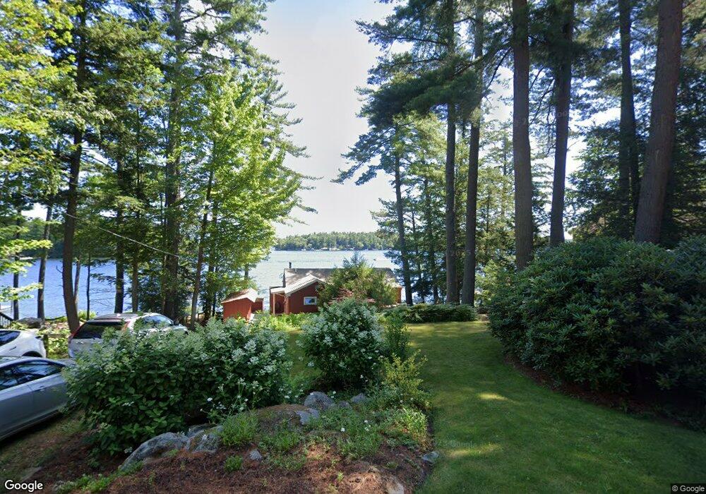
128 Powers Rd Meredith, NH 03253
Estimated Value: $1,677,754 - $2,241,000
2
Beds
1
Bath
1,040
Sq Ft
$1,868/Sq Ft
Est. Value
About This Home
This home is located at 128 Powers Rd, Meredith, NH 03253 and is currently estimated at $1,942,918, approximately $1,868 per square foot. 128 Powers Rd is a home with nearby schools including Inter-Lakes Elementary School, Sandwich Central School, and Inter-Lakes Middle High School.
Ownership History
Date
Name
Owned For
Owner Type
Purchase Details
Closed on
Jan 3, 2017
Sold by
Dahl David A
Bought by
Dahl Rt
Current Estimated Value
Purchase Details
Closed on
Dec 21, 1998
Sold by
E & D Rt
Bought by
Dahl Russell
Home Financials for this Owner
Home Financials are based on the most recent Mortgage that was taken out on this home.
Original Mortgage
$100,000
Interest Rate
6.85%
Mortgage Type
Purchase Money Mortgage
Create a Home Valuation Report for This Property
The Home Valuation Report is an in-depth analysis detailing your home's value as well as a comparison with similar homes in the area
Home Values in the Area
Average Home Value in this Area
Purchase History
| Date | Buyer | Sale Price | Title Company |
|---|---|---|---|
| Dahl Rt | -- | -- | |
| Dahl Russell | $125,000 | -- |
Source: Public Records
Mortgage History
| Date | Status | Borrower | Loan Amount |
|---|---|---|---|
| Previous Owner | Dahl Russell | $100,000 |
Source: Public Records
Tax History
| Year | Tax Paid | Tax Assessment Tax Assessment Total Assessment is a certain percentage of the fair market value that is determined by local assessors to be the total taxable value of land and additions on the property. | Land | Improvement |
|---|---|---|---|---|
| 2024 | $16,355 | $1,594,100 | $1,505,200 | $88,900 |
| 2023 | $15,766 | $1,594,100 | $1,505,200 | $88,900 |
| 2022 | $11,147 | $797,900 | $722,700 | $75,200 |
| 2021 | $10,716 | $797,900 | $722,700 | $75,200 |
| 2020 | $11,187 | $797,900 | $722,700 | $75,200 |
| 2019 | $10,406 | $654,900 | $583,700 | $71,200 |
| 2018 | $10,230 | $654,900 | $583,700 | $71,200 |
| 2016 | $9,472 | $607,600 | $524,700 | $82,900 |
| 2015 | $9,236 | $607,600 | $524,700 | $82,900 |
| 2014 | $9,011 | $607,600 | $524,700 | $82,900 |
| 2013 | $8,756 | $607,600 | $524,700 | $82,900 |
Source: Public Records
Map
Nearby Homes
- 18 Lovejoy Ln
- 11 Quimby Rd
- Lot 21 Cummings Cove Rd
- 43 Happy Homes Rd
- 39 Lake Country Rd
- 22 Tiger Trail
- 30 Leopards Leap
- 4 Cummings Cove Rd
- 56 Patrician Shores Cir
- 61 Wallace Point Rd
- 53 Oak Knoll Rd
- 8 Oak Knoll Rd
- 11 Birch Ledge Rd
- 320 Redding Ln
- 21 Barnard Ridge Rd
- 75 Neal Shore Rd
- 29 S Watch Rd
- 18 Bay Ridge Dr
- 105 Nh Route 25
- 214 Krainewood Dr
- 130 Powers Rd
- 126 Powers Rd
- 126 Powers Rd
- 126 & 125 Powers
- 127 Powers Rd
- 122 Powers Rd
- 132 Powers Rd
- 120 Powers Rd
- 133 Powers Rd
- 120 Powers Rd
- 134 Powers Rd
- 138 Powers Rd
- 111 Powers Rd
- 116 Powers Rd
- 140 Powers Rd
- 0 Powers Rd Unit 4122969
- 0 Powers Rd Unit 4057841
- 0 Powers Rd Unit 4045428
- 0 Powers Rd
- 109 Powers Rd
Your Personal Tour Guide
Ask me questions while you tour the home.