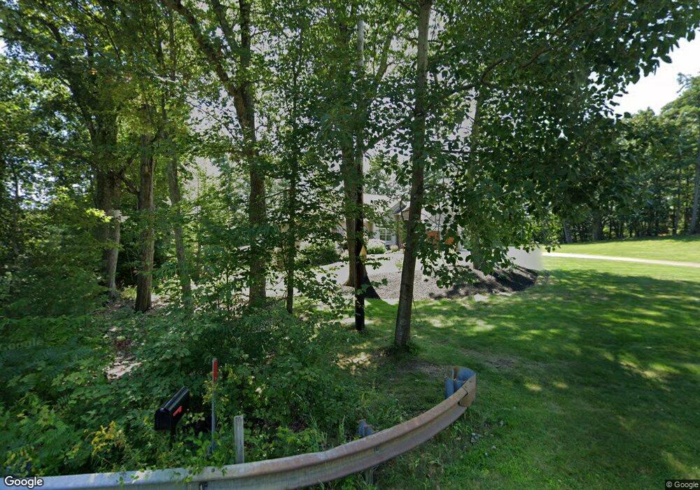
128 S Ashburnham Rd Westminster, MA 01473
Estimated Value: $638,000 - $865,000
3
Beds
3
Baths
2,208
Sq Ft
$357/Sq Ft
Est. Value
About This Home
This home is located at 128 S Ashburnham Rd, Westminster, MA 01473 and is currently estimated at $788,011, approximately $356 per square foot. 128 S Ashburnham Rd is a home with nearby schools including Oakmont Regional High School.
Ownership History
Date
Name
Owned For
Owner Type
Purchase Details
Closed on
Jan 31, 2014
Sold by
Patrick J Cronin Ret
Bought by
Cronin Patrick J
Current Estimated Value
Purchase Details
Closed on
Feb 7, 2013
Sold by
Cronin Rt
Bought by
Patrick J Cronin Ret
Purchase Details
Closed on
Nov 4, 2009
Sold by
Crocker Pond Prop Inc
Bought by
Cronin Rt and Cronin Patrick J
Home Financials for this Owner
Home Financials are based on the most recent Mortgage that was taken out on this home.
Original Mortgage
$96,000
Interest Rate
5.06%
Mortgage Type
Purchase Money Mortgage
Create a Home Valuation Report for This Property
The Home Valuation Report is an in-depth analysis detailing your home's value as well as a comparison with similar homes in the area
Home Values in the Area
Average Home Value in this Area
Purchase History
| Date | Buyer | Sale Price | Title Company |
|---|---|---|---|
| Cronin Patrick J | -- | -- | |
| Patrick J Cronin Ret | -- | -- | |
| Cronin Rt | $175,000 | -- |
Source: Public Records
Mortgage History
| Date | Status | Borrower | Loan Amount |
|---|---|---|---|
| Previous Owner | Patrick J Cronin Ret | $330,000 | |
| Previous Owner | Patrick J Cronin Ret | $335,000 | |
| Previous Owner | Patrick J Cronin Ret | $100,000 | |
| Previous Owner | Cronin Rt | $96,000 |
Source: Public Records
Tax History Compared to Growth
Tax History
| Year | Tax Paid | Tax Assessment Tax Assessment Total Assessment is a certain percentage of the fair market value that is determined by local assessors to be the total taxable value of land and additions on the property. | Land | Improvement |
|---|---|---|---|---|
| 2025 | $9,301 | $756,200 | $295,700 | $460,500 |
| 2024 | $8,864 | $723,000 | $289,100 | $433,900 |
| 2023 | $9,433 | $722,300 | $306,700 | $415,600 |
| 2022 | $10,621 | $672,200 | $319,800 | $352,400 |
| 2021 | $10,455 | $623,800 | $280,400 | $343,400 |
| 2020 | $10,135 | $577,500 | $254,100 | $323,400 |
| 2019 | $9,700 | $531,500 | $208,100 | $323,400 |
| 2018 | $9,325 | $502,700 | $183,900 | $318,800 |
| 2017 | $8,826 | $485,200 | $163,000 | $322,200 |
| 2016 | $8,659 | $461,100 | $135,600 | $325,500 |
| 2015 | $8,446 | $445,700 | $135,600 | $310,100 |
| 2014 | $8,459 | $445,700 | $135,600 | $310,100 |
Source: Public Records
Map
Nearby Homes
- 26 Bathrick Rd
- 11 Syd Smith Rd
- 0 Syd Smith Rd (Rear)
- 0 Syd Smith Rd (Parcel 71 4 1)
- 0 Syd Smith Rd Unit 73395578
- 47 Newcomb Rd
- 73 N Common Rd
- 16 Old Mill Cir
- 22 Heritage Ln
- 0-1 Bean Porridge Hill Rd
- 25 Newcomb Rd
- 51 State Rd E
- 1317 Westminster St
- 139 Parson Cir
- 208 Bean Porridge Hill Rd
- 87 Roosevelt St
- 15 Cascade St
- 45 Bacon St
- 2 Old Town Farm Rd
- 204 Roosevelt St
- 127 S Ashburnham Rd
- 123 S Ashburnham Rd
- 131 S Ashburnham Rd
- 115 S Ashburnham Rd
- 1 Bean Porridge Hill Rd
- 111 S Ashburnham Rd
- 4 Bean Porridge Hill Rd
- 6 Bean Porridge Hill Rd
- 8 Bean Porridge Hill Rd
- 107 S Ashburnham Rd
- 3 Bean Porridge Hill Rd
- 135 S Ashburnham Rd
- 135 S Ashburnham Rd Unit 1
- 135 S Ashburnham Rd
- 10 Bean Porridge Hill Rd Unit L
- 2 Bean Porridge Hill Rd
- 2 Bean Porridge Hill Rd
- 5 Bean Porridge Hill Rd
- 5 Bean Porridge Hill Rd
- 5 Bean Porridge Hill Rd