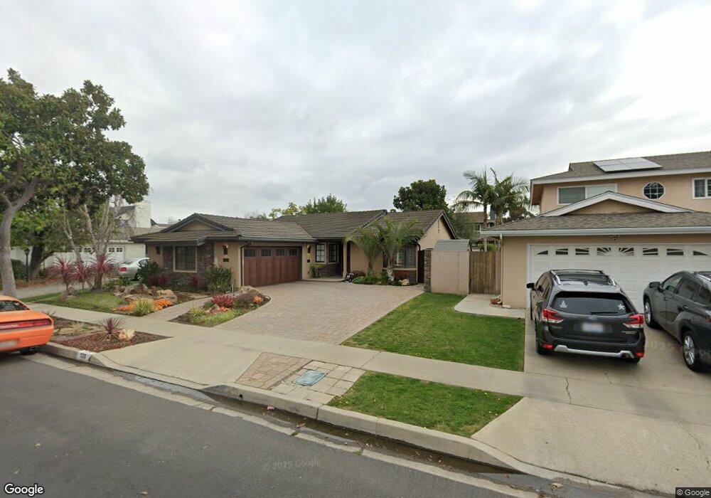
128 Stanford Ln Seal Beach, CA 90740
Estimated Value: $1,325,525 - $1,539,000
4
Beds
2
Baths
1,851
Sq Ft
$766/Sq Ft
Est. Value
About This Home
This home is located at 128 Stanford Ln, Seal Beach, CA 90740 and is currently estimated at $1,418,631, approximately $766 per square foot. 128 Stanford Ln is a home located in Orange County with nearby schools including Francis Hopkinson Elementary School, Jack L. Weaver Elementary School, and Oak Middle School.
Ownership History
Date
Name
Owned For
Owner Type
Purchase Details
Closed on
May 2, 2024
Sold by
Lowe Susan M
Bought by
Lowe Living Trust and Lowe
Current Estimated Value
Purchase Details
Closed on
Apr 12, 2018
Sold by
Lowe Narvil J and Lowe Susan M
Bought by
Lowe Susan M
Home Financials for this Owner
Home Financials are based on the most recent Mortgage that was taken out on this home.
Original Mortgage
$445,000
Interest Rate
4.46%
Mortgage Type
New Conventional
Purchase Details
Closed on
May 19, 2015
Sold by
Lowe Narvil J and Lowe Susan M
Bought by
Lowe Family Trust
Purchase Details
Closed on
May 14, 2010
Sold by
Gomez William Anthony and Gomez Candice Marie
Bought by
Lowe Narvil J and Lowe Susan M
Home Financials for this Owner
Home Financials are based on the most recent Mortgage that was taken out on this home.
Original Mortgage
$500,000
Interest Rate
5.03%
Mortgage Type
New Conventional
Purchase Details
Closed on
Sep 11, 2003
Sold by
Olsen Ronald A and Olsen Susan E
Bought by
Gomez William Anthony and Gomez Candice Marie
Home Financials for this Owner
Home Financials are based on the most recent Mortgage that was taken out on this home.
Original Mortgage
$322,699
Interest Rate
4%
Mortgage Type
Purchase Money Mortgage
Purchase Details
Closed on
Sep 4, 2001
Sold by
Olsen Ronald A
Bought by
Olsen Ronald A and Olsen Susan E
Home Financials for this Owner
Home Financials are based on the most recent Mortgage that was taken out on this home.
Original Mortgage
$285,000
Interest Rate
7.05%
Purchase Details
Closed on
Aug 31, 2001
Sold by
Olsen Susan
Bought by
Olsen Ronald A
Home Financials for this Owner
Home Financials are based on the most recent Mortgage that was taken out on this home.
Original Mortgage
$285,000
Interest Rate
7.05%
Purchase Details
Closed on
Jul 23, 2001
Sold by
Ketcham Christopher F and Ketcham Wendy Parker
Bought by
Olsen Ronald A
Home Financials for this Owner
Home Financials are based on the most recent Mortgage that was taken out on this home.
Original Mortgage
$285,000
Interest Rate
7.05%
Purchase Details
Closed on
May 4, 1995
Sold by
Ketcham Christopher F and Ketcham Wendy Parker
Bought by
Ketcham Christopher F and Ketcham Wendy Parker
Home Financials for this Owner
Home Financials are based on the most recent Mortgage that was taken out on this home.
Original Mortgage
$243,500
Interest Rate
6.25%
Create a Home Valuation Report for This Property
The Home Valuation Report is an in-depth analysis detailing your home's value as well as a comparison with similar homes in the area
Home Values in the Area
Average Home Value in this Area
Purchase History
| Date | Buyer | Sale Price | Title Company |
|---|---|---|---|
| Lowe Living Trust | -- | None Listed On Document | |
| Lowe Susan M | -- | North American Title | |
| Lowe Family Trust | -- | None Available | |
| Lowe Narvil J | $625,000 | Stewart Title Guaranty Co | |
| Gomez William Anthony | $550,000 | -- | |
| Olsen Ronald A | -- | Commonwealth Land Title | |
| Olsen Ronald A | -- | Commonwealth Land Title | |
| Olsen Ronald A | $400,000 | Commonwealth Land Title | |
| Ketcham Christopher F | -- | Chicago Title Company |
Source: Public Records
Mortgage History
| Date | Status | Borrower | Loan Amount |
|---|---|---|---|
| Previous Owner | Lowe Susan M | $445,000 | |
| Previous Owner | Lowe Narvil J | $500,000 | |
| Previous Owner | Gomez William Anthony | $322,699 | |
| Previous Owner | Olsen Ronald A | $285,000 | |
| Previous Owner | Ketcham Christopher F | $243,500 |
Source: Public Records
Tax History Compared to Growth
Tax History
| Year | Tax Paid | Tax Assessment Tax Assessment Total Assessment is a certain percentage of the fair market value that is determined by local assessors to be the total taxable value of land and additions on the property. | Land | Improvement |
|---|---|---|---|---|
| 2025 | $9,520 | $828,321 | $687,286 | $141,035 |
| 2024 | $9,520 | $812,080 | $673,810 | $138,270 |
| 2023 | $9,303 | $796,157 | $660,598 | $135,559 |
| 2022 | $9,267 | $780,547 | $647,646 | $132,901 |
| 2021 | $9,066 | $765,243 | $634,947 | $130,296 |
| 2020 | $9,096 | $757,397 | $628,437 | $128,960 |
| 2019 | $8,765 | $742,547 | $616,115 | $126,432 |
| 2018 | $8,444 | $727,988 | $604,035 | $123,953 |
| 2017 | $8,267 | $713,714 | $592,191 | $121,523 |
| 2016 | $8,109 | $699,720 | $580,579 | $119,141 |
| 2015 | $7,702 | $659,972 | $547,179 | $112,793 |
| 2014 | -- | $659,972 | $547,179 | $112,793 |
Source: Public Records
Map
Nearby Homes
- 13061 Oak Hills Dr Unit 221D
- 13021 Oak Hills Dr Unit 219H
- 1075 Brookline Rd
- 13081 Oak Hills Dr
- 6911 E 10th St
- 1100 Brookline Rd
- 12725 Martha Ann Dr
- 13160 Nassau Dr Unit 211L
- 13410 Oak Hills Dr Unit 224D
- 1121 Northwood Rd Unit 237A M9
- 13201 El Dorado Dr Unit 207-I
- 1150 Northwood Rd Unit 166E M7
- 865 Kallin Ave
- 12452 Martha Ann Dr
- 2692 Copa de Oro Dr
- 13261 Southport Ln
- 13171 St Andrews Dr Unit 154-J
- 13110 Seaview Ln Unit 245B
- 2762 Engel Dr
- 13380 El Dorado Dr