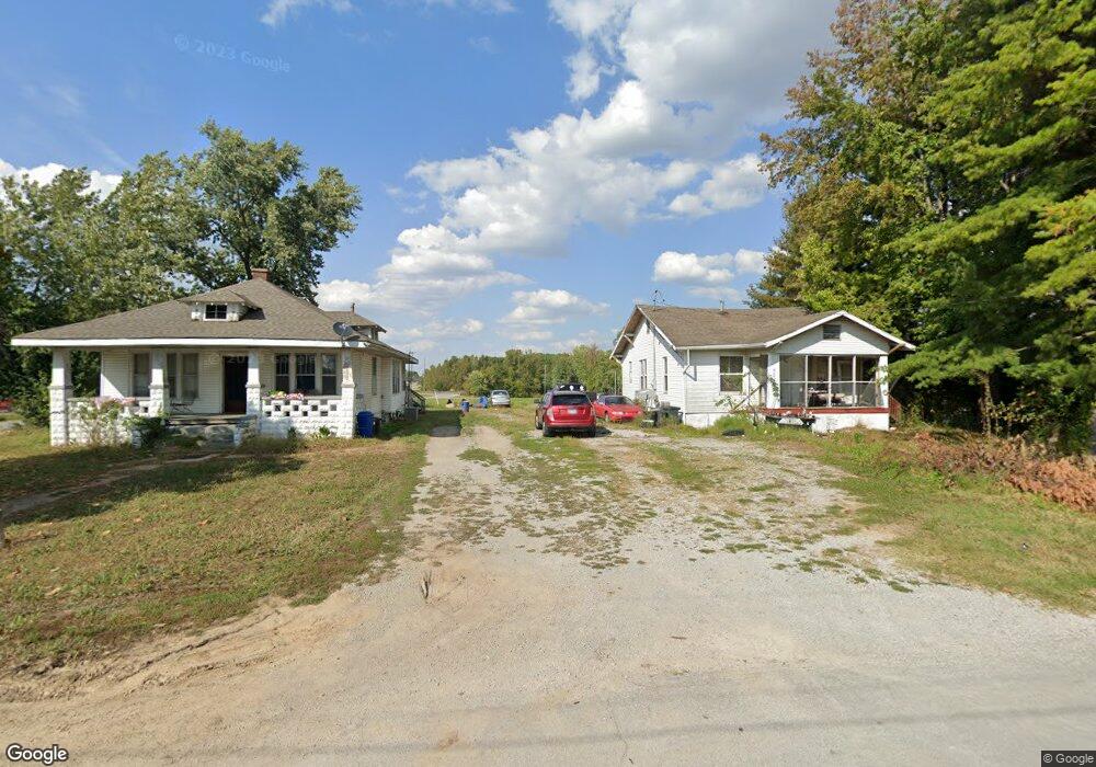
128 W Mobile Ranch Dr Murphysboro, IL 62966
Estimated Value: $80,524 - $141,000
3
Beds
--
Bath
1,350
Sq Ft
$81/Sq Ft
Est. Value
About This Home
This home is located at 128 W Mobile Ranch Dr, Murphysboro, IL 62966 and is currently estimated at $108,881, approximately $80 per square foot. 128 W Mobile Ranch Dr is a home with nearby schools including Murphysboro High School, St. Andrew Catholic School, and Montessori School of S. Illinois.
Ownership History
Date
Name
Owned For
Owner Type
Purchase Details
Closed on
Mar 28, 2024
Sold by
Layne Kristine Kay
Bought by
Layne Michael Lance
Current Estimated Value
Purchase Details
Closed on
Oct 10, 2009
Sold by
Schimpf Dale Ray and Schimpf Sheryl L
Bought by
Layne Michael L and Layne Kristine K
Home Financials for this Owner
Home Financials are based on the most recent Mortgage that was taken out on this home.
Original Mortgage
$67,000
Interest Rate
5.1%
Mortgage Type
Purchase Money Mortgage
Create a Home Valuation Report for This Property
The Home Valuation Report is an in-depth analysis detailing your home's value as well as a comparison with similar homes in the area
Home Values in the Area
Average Home Value in this Area
Purchase History
| Date | Buyer | Sale Price | Title Company |
|---|---|---|---|
| Layne Michael Lance | -- | None Listed On Document | |
| Layne Michael L | $97,500 | None Available |
Source: Public Records
Mortgage History
| Date | Status | Borrower | Loan Amount |
|---|---|---|---|
| Previous Owner | Layne Michael L | $67,000 |
Source: Public Records
Tax History Compared to Growth
Tax History
| Year | Tax Paid | Tax Assessment Tax Assessment Total Assessment is a certain percentage of the fair market value that is determined by local assessors to be the total taxable value of land and additions on the property. | Land | Improvement |
|---|---|---|---|---|
| 2024 | $1,742 | $16,982 | $3,839 | $13,143 |
| 2023 | $1,642 | $15,067 | $3,406 | $11,661 |
| 2022 | $1,563 | $13,810 | $3,122 | $10,688 |
| 2021 | $1,514 | $12,956 | $2,929 | $10,027 |
| 2020 | $1,523 | $12,801 | $2,894 | $9,907 |
| 2019 | $1,410 | $12,579 | $2,844 | $9,735 |
| 2018 | $1,403 | $13,332 | $2,844 | $10,488 |
| 2017 | $1,398 | $13,332 | $2,844 | $10,488 |
| 2016 | $1,364 | $13,332 | $2,844 | $10,488 |
| 2015 | -- | $13,332 | $2,844 | $10,488 |
| 2014 | -- | $12,720 | $2,844 | $9,876 |
| 2012 | -- | $12,720 | $2,844 | $9,876 |
Source: Public Records
Map
Nearby Homes
- 509 Lucier St
- 103 N 7th St
- 603 N 8th St
- 604 N 9th St
- 101 S 6th St
- 000 Chestnut St
- 923 N 9th St
- 1302 Walnut St Unit 1302 & 1306
- 1318 Olive St
- 1402 Manning St Unit 6
- 1408 Manning St
- 528 N 15th St
- 1420 Poplar St
- 1502 Gartside St
- 207 Bob A Rosa Ave
- 1516 Elm St
- 1520 Gartside St
- 267 Brian Ave
- 000 Birkner Ln
- 1206 N 14th St
- 104 W Mobile Ranch Dr
- 0 Business Highway 127
- 0000 Illinois 127
- 511 N 2nd St
- 6 Mobile Ranch 94 Rd Unit 94
- 507 N 2nd St
- 6 Mobile Ranch Rd
- 416 N 4 1/2 St
- 402 Lucier St
- 323 Lucier St
- 315 Lucier St
- 331 Lucier St
- 414 N 4 1/2 St
- 337 Lucier St
- 410 N 4 1/2 St
- 404 Lucier St
- 417 N 4 1/2 St
- 314 Murphy St
- 108 Murphy St