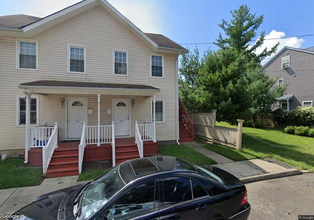
128 William St Unit 130 Hightstown, NJ 08520
Estimated Value: $574,618 - $685,000
--
Bed
--
Bath
2,100
Sq Ft
$291/Sq Ft
Est. Value
About This Home
This home is located at 128 William St Unit 130, Hightstown, NJ 08520 and is currently estimated at $611,155, approximately $291 per square foot. 128 William St Unit 130 is a home located in Mercer County with nearby schools including Melvin H. Kreps Middle School, Hightstown High School, and SciCore Academy.
Ownership History
Date
Name
Owned For
Owner Type
Purchase Details
Closed on
Feb 15, 2008
Sold by
April Spalto John and April Spalto
Bought by
Shah Dharmesh N and Shah Alpa D
Current Estimated Value
Home Financials for this Owner
Home Financials are based on the most recent Mortgage that was taken out on this home.
Original Mortgage
$341,600
Outstanding Balance
$212,523
Interest Rate
5.8%
Mortgage Type
New Conventional
Estimated Equity
$398,632
Purchase Details
Closed on
Nov 30, 2004
Sold by
Maltby Assoc
Bought by
Spaltro John and Spaltro April
Home Financials for this Owner
Home Financials are based on the most recent Mortgage that was taken out on this home.
Original Mortgage
$318,750
Interest Rate
5.75%
Purchase Details
Closed on
Nov 17, 2003
Sold by
Wells Fargo Bank
Bought by
Malbty Associates
Purchase Details
Closed on
Jul 3, 2003
Sold by
Sears Charles R
Bought by
Wells Fargo Bk Minnesota
Create a Home Valuation Report for This Property
The Home Valuation Report is an in-depth analysis detailing your home's value as well as a comparison with similar homes in the area
Home Values in the Area
Average Home Value in this Area
Purchase History
| Date | Buyer | Sale Price | Title Company |
|---|---|---|---|
| Shah Dharmesh N | $427,000 | -- | |
| Spaltro John | $425,000 | -- | |
| Malbty Associates | $137,200 | -- | |
| Wells Fargo Bk Minnesota | $165,019 | -- |
Source: Public Records
Mortgage History
| Date | Status | Borrower | Loan Amount |
|---|---|---|---|
| Open | Shah Dharmesh N | $341,600 | |
| Previous Owner | Spaltro John | $318,750 | |
| Closed | Wells Fargo Bk Minnesota | $0 |
Source: Public Records
Tax History Compared to Growth
Tax History
| Year | Tax Paid | Tax Assessment Tax Assessment Total Assessment is a certain percentage of the fair market value that is determined by local assessors to be the total taxable value of land and additions on the property. | Land | Improvement |
|---|---|---|---|---|
| 2025 | $14,719 | $300,200 | $75,900 | $224,300 |
| 2024 | $14,569 | $300,200 | $75,900 | $224,300 |
| 2023 | $14,569 | $300,200 | $75,900 | $224,300 |
| 2022 | $14,064 | $300,200 | $75,900 | $224,300 |
| 2021 | $13,557 | $300,200 | $75,900 | $224,300 |
| 2020 | $13,248 | $300,200 | $75,900 | $224,300 |
| 2019 | $12,879 | $300,200 | $75,900 | $224,300 |
| 2018 | $12,503 | $300,200 | $75,900 | $224,300 |
| 2017 | $12,374 | $300,200 | $75,900 | $224,300 |
| 2016 | $12,266 | $300,200 | $75,900 | $224,300 |
| 2015 | $12,188 | $300,200 | $75,900 | $224,300 |
| 2014 | $12,266 | $300,200 | $75,900 | $224,300 |
Source: Public Records
Map
Nearby Homes
- 128 Monmouth St
- 344 Monmouth St
- 23 Barton Dr
- 4 Brakeman Ct
- 158 Mill Run E
- 164 Mill Run E Unit 141
- 5 Mill Run W
- 23 Powell Ct
- 43 Norton Ave
- 126 Mill Run E
- 126 Mill Run E Unit 84
- 124 Mill Run E Unit 85
- 219 Maxwell Ave
- 336 Monmouth St
- 4 Sandstone Rd
- 309 Lincoln Ave
- 104 1st Ave
- 302 S Main St
- 141 Lincoln Ave
- 145 Lincoln Ave
- 122 William St
- 15 Perry L Drew Place
- 15 Perry Dr
- 14 Perry L Drew Place
- 3 Perry L Drew Place
- 118 William St
- 132-134 William St Unit A
- 132-134 William St Unit D
- 132 William St
- 132 William St Unit A
- 132 William St Unit D
- 132 William St Unit B
- 132-134 William St Unit B
- 132-134 William St
- 6 Perry L Drew Place Unit C
- 6 Perry L Drew Place
- 5 Perry L Drew Place Unit C
- 5 Perry L Drew Place
- 4 Perry L Drew Place Unit C
- 4 Perry L Drew Place