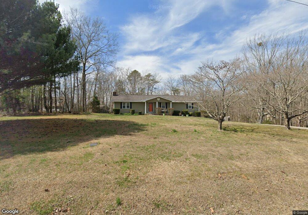
1280 Bicentennial Trail Rock Spring, GA 30739
Rock Spring NeighborhoodEstimated Value: $296,998 - $531,000
--
Bed
2
Baths
1,812
Sq Ft
$212/Sq Ft
Est. Value
About This Home
This home is located at 1280 Bicentennial Trail, Rock Spring, GA 30739 and is currently estimated at $384,500, approximately $212 per square foot. 1280 Bicentennial Trail is a home located in Walker County with nearby schools including Rock Spring Elementary School and Lafayette High School.
Ownership History
Date
Name
Owned For
Owner Type
Purchase Details
Closed on
Sep 25, 1992
Sold by
White William M
Bought by
Turner Raymond and Kami Shawn
Current Estimated Value
Purchase Details
Closed on
Feb 15, 1992
Sold by
Millican Ricky R and Millican Debbie
Bought by
White William M
Purchase Details
Closed on
Jan 1, 1972
Bought by
Millican Ricky R and Millican Debbie
Create a Home Valuation Report for This Property
The Home Valuation Report is an in-depth analysis detailing your home's value as well as a comparison with similar homes in the area
Home Values in the Area
Average Home Value in this Area
Purchase History
| Date | Buyer | Sale Price | Title Company |
|---|---|---|---|
| Turner Raymond | $76,000 | -- | |
| White William M | $75,500 | -- | |
| Millican Ricky R | -- | -- |
Source: Public Records
Tax History Compared to Growth
Tax History
| Year | Tax Paid | Tax Assessment Tax Assessment Total Assessment is a certain percentage of the fair market value that is determined by local assessors to be the total taxable value of land and additions on the property. | Land | Improvement |
|---|---|---|---|---|
| 2024 | $2,035 | $96,124 | $25,380 | $70,744 |
| 2023 | $1,992 | $92,234 | $25,380 | $66,854 |
| 2022 | $1,789 | $71,234 | $13,752 | $57,482 |
| 2021 | $1,663 | $59,618 | $13,752 | $45,866 |
| 2020 | $1,478 | $50,599 | $13,752 | $36,847 |
| 2019 | $1,504 | $50,599 | $13,752 | $36,847 |
| 2018 | $1,339 | $50,599 | $13,752 | $36,847 |
| 2017 | $1,740 | $53,803 | $16,956 | $36,847 |
| 2016 | $1,398 | $53,803 | $16,956 | $36,847 |
| 2015 | $1,405 | $50,968 | $16,000 | $34,968 |
| 2014 | $1,300 | $50,968 | $16,000 | $34,968 |
| 2013 | -- | $50,967 | $16,000 | $34,967 |
Source: Public Records
Map
Nearby Homes
- 701 Bicentennial Trail
- 1370 Old Highway 27
- 1003 Highway N Old 27
- 10180 Us Highway 27
- 15 Willow Cir
- The Pearson Plan at Laurel Ridge
- The Benson II Plan at Laurel Ridge
- The Langford Plan at Laurel Ridge
- The Lawson Plan at Laurel Ridge
- The Piedmont Plan at Laurel Ridge
- The Coleman Plan at Laurel Ridge
- The McGinnis Plan at Laurel Ridge
- The Caldwell Plan at Laurel Ridge
- 23 Willow Cir
- 16 Willow Cir
- 11 Willow Cir
- 954 Goodson Cir
- 5602 Georgia 95
- 00 Georgia 95
- 1902 Long Hollow Rd
- 1310 Bicentennial Trail
- 1253 Bicentennial Trail
- 1372 Bicentennial Trail
- 1170 Bicentennial Tr
- 1170 Bicentennial Trail
- 1289 Bicentennial Trail
- 1229 Bicentennial Trail
- 1226 Bicentennial Trail
- 1299 Bicentennial Trail
- 1315 Bicentennial Trail
- 1159 Bicentennial Trail Unit Tr
- 1159 Bicentennial Trail
- 0 Bicentennial Tr Unit 1388356
- 0 Bicentennial Tr Unit 1368071
- 1385 Bicentennial Trail
- 1116 Bicentennial Trail
- 1116 Bicentennial Trail
- 1443 Bicentennial Trail
- 1093 Bicentennial Tr
- 1497 Bicentennial Trail