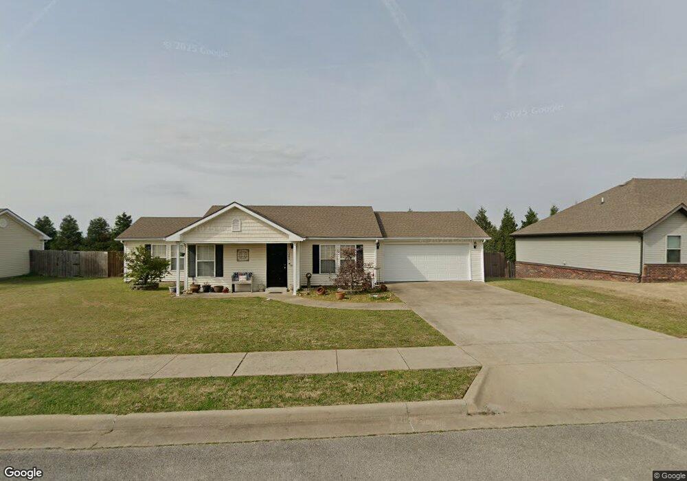
1280 Col Solomon Prairie Grove, AR 72753
Estimated Value: $216,000 - $308,937
3
Beds
2
Baths
1,222
Sq Ft
$208/Sq Ft
Est. Value
About This Home
This home is located at 1280 Col Solomon, Prairie Grove, AR 72753 and is currently estimated at $254,484, approximately $208 per square foot. 1280 Col Solomon is a home located in Washington County with nearby schools including Prairie Grove Elementary School, Prairie Grove Middle School, and Prairie Grove Junior High School.
Ownership History
Date
Name
Owned For
Owner Type
Purchase Details
Closed on
Jun 23, 2017
Sold by
Gavdea Holdings Llc
Bought by
Candlewick Properties Llc
Current Estimated Value
Home Financials for this Owner
Home Financials are based on the most recent Mortgage that was taken out on this home.
Original Mortgage
$80,000
Interest Rate
4.05%
Mortgage Type
Future Advance Clause Open End Mortgage
Purchase Details
Closed on
Feb 29, 2016
Sold by
Andrade Properties Llc
Bought by
Gavdea Holdings Llc
Home Financials for this Owner
Home Financials are based on the most recent Mortgage that was taken out on this home.
Original Mortgage
$63,750
Interest Rate
3.79%
Mortgage Type
Future Advance Clause Open End Mortgage
Create a Home Valuation Report for This Property
The Home Valuation Report is an in-depth analysis detailing your home's value as well as a comparison with similar homes in the area
Home Values in the Area
Average Home Value in this Area
Purchase History
| Date | Buyer | Sale Price | Title Company |
|---|---|---|---|
| Candlewick Properties Llc | $100,000 | Waco Title Co | |
| Gavdea Holdings Llc | $75,000 | None Available |
Source: Public Records
Mortgage History
| Date | Status | Borrower | Loan Amount |
|---|---|---|---|
| Closed | Candlewick Properties Llc | $80,000 | |
| Previous Owner | Gavdea Holdings Llc | $63,750 |
Source: Public Records
Tax History Compared to Growth
Tax History
| Year | Tax Paid | Tax Assessment Tax Assessment Total Assessment is a certain percentage of the fair market value that is determined by local assessors to be the total taxable value of land and additions on the property. | Land | Improvement |
|---|---|---|---|---|
| 2025 | $1,749 | $34,160 | $8,000 | $26,160 |
| 2024 | $1,569 | $34,160 | $8,000 | $26,160 |
| 2023 | $1,494 | $34,160 | $8,000 | $26,160 |
| 2022 | $1,358 | $25,150 | $6,000 | $19,150 |
| 2021 | $1,358 | $25,150 | $6,000 | $19,150 |
| 2020 | $1,353 | $25,150 | $6,000 | $19,150 |
| 2019 | $1,031 | $18,960 | $5,000 | $13,960 |
| 2018 | $1,031 | $18,960 | $5,000 | $13,960 |
| 2017 | $1,022 | $18,960 | $5,000 | $13,960 |
| 2016 | $1,022 | $18,960 | $5,000 | $13,960 |
| 2015 | $1,022 | $18,960 | $5,000 | $13,960 |
| 2014 | $1,090 | $20,230 | $5,000 | $15,230 |
Source: Public Records
Map
Nearby Homes
- 1421 Colonel McNeil Dr
- 1360 Colonel Bass Ln
- 1280 General Parson Dr
- 611 Sundowner Ranch Ave
- 650 Marcella St
- 1461 General Parson Dr
- 631 Marcella St
- 1321 General Marmaduke Dr
- 16543 U S Highway 62
- 1681 Cavalry Ln
- 511 Captain Stockton St
- 816 Spurgeon Ln
- 661 Kendra St
- 101 S Eagle Mountain St
- 150 N Eagle Mountain St
- 951 E Buchanan St
- 730 Marcella St
- 212 Marna Lynn Dr
- 123 S Eagle Mountain St
- 113 S Eagle Mountain St
- 1280 Colonel Salomon Dr
- 1280 Colonel Salomon Dr
- 1320 Colonel Salomon Dr
- 1250 Colonel Salomon Dr
- 1321 Colonel Hawthorne Dr
- 1321 Colonel Hawthorne Dr
- 1281 Colonel Hawthorne Dr
- 1321 Colonel Salomon Dr
- 1281 Colonel Salomon Dr
- 1340 Colonel Salomon Dr
- 1251 Colonel Salomon Dr
- 1251 Colonel Hawthorne Dr
- 1230 Colonel Salomon Dr
- 1341 Colonel Salomon Dr
- 1341 Colonel Hawthorne Dr
- 1341 Colonel Hawthorne Dr
- 0 Colonel Saloman Dr Unit 691927
- 1231 Colonel Hawthorne Dr
- 1280 Colonel Hawthorne Dr
- 1360 Colonel Salomon Dr