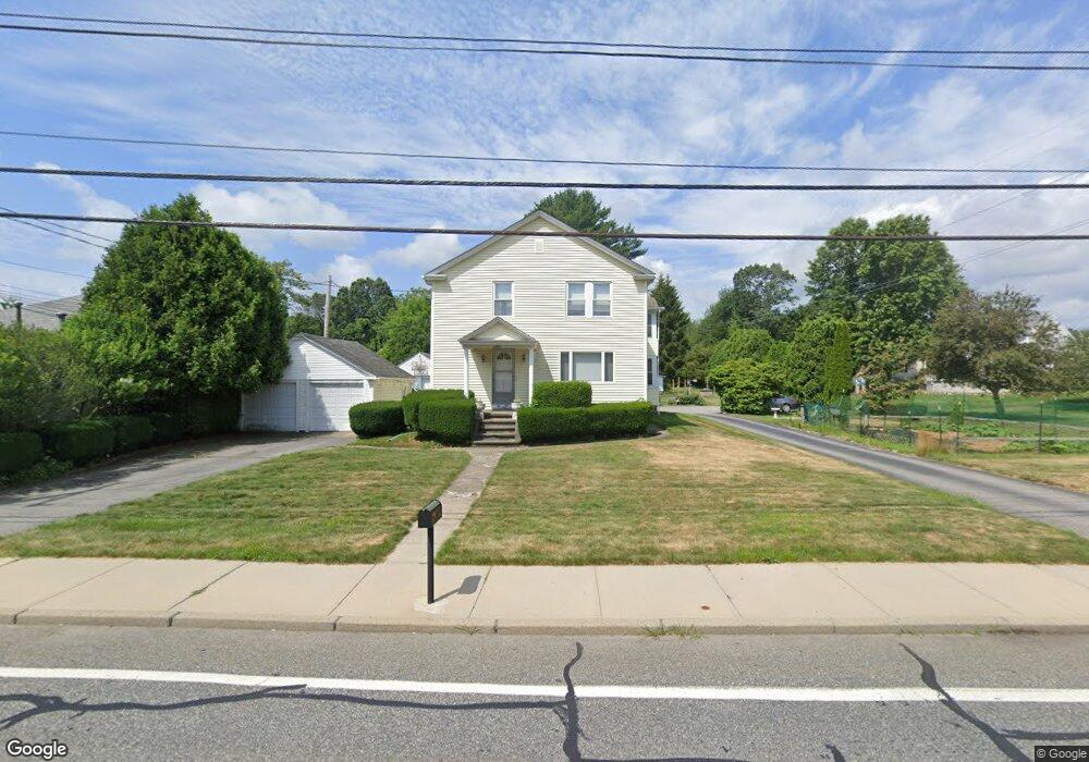
1280 High St Cumberland, RI 02864
Monastery Heights NeighborhoodEstimated Value: $449,000 - $725,000
--
Bed
--
Bath
--
Sq Ft
0.93
Acres
About This Home
This home is located at 1280 High St, Cumberland, RI 02864 and is currently estimated at $645,801. 1280 High St is a home located in Providence County with nearby schools including Garvin Memorial School, Joseph L. McCourt Middle School, and Cumberland High School.
Ownership History
Date
Name
Owned For
Owner Type
Purchase Details
Closed on
Sep 9, 1987
Bought by
Heffner Dannie G and Heffner Sandra A
Current Estimated Value
Create a Home Valuation Report for This Property
The Home Valuation Report is an in-depth analysis detailing your home's value as well as a comparison with similar homes in the area
Home Values in the Area
Average Home Value in this Area
Purchase History
| Date | Buyer | Sale Price | Title Company |
|---|---|---|---|
| Heffner Dannie G | -- | -- |
Source: Public Records
Mortgage History
| Date | Status | Borrower | Loan Amount |
|---|---|---|---|
| Open | Heffner Dannie G | $10,000 |
Source: Public Records
Tax History Compared to Growth
Tax History
| Year | Tax Paid | Tax Assessment Tax Assessment Total Assessment is a certain percentage of the fair market value that is determined by local assessors to be the total taxable value of land and additions on the property. | Land | Improvement |
|---|---|---|---|---|
| 2025 | $7,021 | $572,200 | $146,800 | $425,400 |
| 2024 | $6,838 | $572,200 | $146,800 | $425,400 |
| 2023 | $6,649 | $572,200 | $146,800 | $425,400 |
| 2022 | $5,244 | $349,800 | $104,400 | $245,400 |
| 2021 | $5,156 | $349,800 | $104,400 | $245,400 |
| 2020 | $5,009 | $349,800 | $104,400 | $245,400 |
| 2019 | $4,751 | $299,200 | $74,700 | $224,500 |
| 2018 | $4,614 | $299,200 | $74,700 | $224,500 |
| 2017 | $4,551 | $299,200 | $74,700 | $224,500 |
| 2016 | $4,407 | $258,000 | $80,700 | $177,300 |
| 2015 | $4,398 | $257,500 | $80,700 | $176,800 |
| 2014 | $8,366 | $257,500 | $80,700 | $176,800 |
| 2013 | $4,431 | $280,800 | $84,400 | $196,400 |
Source: Public Records
Map
Nearby Homes
- 38 Chestnut St
- 163 Woodside Ave
- 11 Woodside Ave
- 70 Mohawk St
- 33 Valley St
- 98 Iroquois Rd
- 1551 Diamond Hill Rd
- 0 Narragansett Rd
- 17 Mowry Ave
- 44 Marshall Ave
- 18 Susan Dr
- 73 Grandview Dr
- 153 Morris St
- 8 Dorr St
- 66 Pequot Ave
- 500 Mendon Rd Unit 216
- 500 Mendon Rd Unit 302
- 457 Bryant St
- 34 Goddard St
- 94 Hines Rd
- 1270 High St
- 1260 High St
- 179 Lonsdale Farm Rd
- 181 Lonsdale Farm Rd
- 177 Lonsdale Farm Rd
- 258 Diamond Hill Rd
- 1287 High St
- Parcel 2 Diamond Hill Rd
- 1248 High St
- 10 Chestnut St
- 4 Chestnut St
- 15 Chestnut St
- 1156 Diamond Hill Rd
- 1251 High St
- 1305 High St
- 175 Lonsdale Farm Rd
- 1249 High St
- 1307 High St
- 12 Chestnut St
- 1310 Diamond Hill Rd