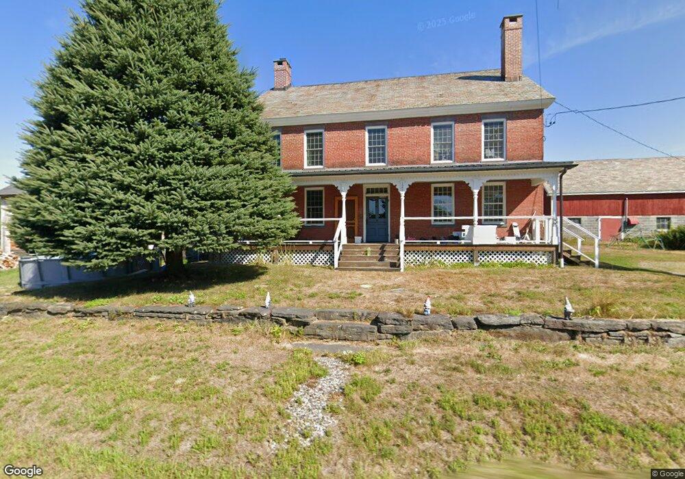
1280 Spruce Corner Rd Ashfield, MA 01330
Ashfield NeighborhoodEstimated Value: $445,000 - $720,000
6
Beds
2
Baths
3,570
Sq Ft
$152/Sq Ft
Est. Value
About This Home
This home is located at 1280 Spruce Corner Rd, Ashfield, MA 01330 and is currently estimated at $543,621, approximately $152 per square foot. 1280 Spruce Corner Rd is a home located in Franklin County with nearby schools including Mohawk Trail Regional High School.
Ownership History
Date
Name
Owned For
Owner Type
Purchase Details
Closed on
Mar 11, 2019
Sold by
Wildermuth Peter D and Wildermuth Jennifer L
Bought by
Wildermuth Ft
Current Estimated Value
Purchase Details
Closed on
Jun 30, 2010
Sold by
Streeter Howard A
Bought by
Wildermuth Peter D and Wildermuth Jennifer Lee
Home Financials for this Owner
Home Financials are based on the most recent Mortgage that was taken out on this home.
Original Mortgage
$100,000
Interest Rate
4.63%
Mortgage Type
Commercial
Create a Home Valuation Report for This Property
The Home Valuation Report is an in-depth analysis detailing your home's value as well as a comparison with similar homes in the area
Home Values in the Area
Average Home Value in this Area
Purchase History
| Date | Buyer | Sale Price | Title Company |
|---|---|---|---|
| Wildermuth Ft | -- | -- | |
| Wildermuth Peter D | $270,000 | -- |
Source: Public Records
Mortgage History
| Date | Status | Borrower | Loan Amount |
|---|---|---|---|
| Open | Wildermuth Ft | $185,000 | |
| Previous Owner | Wildermuth Peter D | $78,216 | |
| Previous Owner | Streeter Howard A | $35,754 | |
| Previous Owner | Streeter Howard A | $100,000 | |
| Previous Owner | Wildermuth Peter D | $260,988 | |
| Previous Owner | Streeter Emilianna | $10,335 | |
| Previous Owner | Streeter Howard A | $60,000 | |
| Previous Owner | Streeter Howard A | $60,000 |
Source: Public Records
Tax History Compared to Growth
Tax History
| Year | Tax Paid | Tax Assessment Tax Assessment Total Assessment is a certain percentage of the fair market value that is determined by local assessors to be the total taxable value of land and additions on the property. | Land | Improvement |
|---|---|---|---|---|
| 2025 | $5,170 | $384,078 | $88,678 | $295,400 |
| 2024 | $5,583 | $382,150 | $88,550 | $293,600 |
| 2023 | $5,442 | $309,034 | $71,034 | $238,000 |
| 2022 | $5,116 | $294,347 | $67,447 | $226,900 |
| 2021 | $0 | $286,837 | $67,337 | $219,500 |
| 2020 | $4,779 | $286,837 | $67,337 | $219,500 |
| 2019 | $4,723 | $275,214 | $63,014 | $212,200 |
| 2018 | $2,282 | $271,560 | $63,060 | $208,500 |
| 2017 | $2,192 | $270,660 | $62,160 | $208,500 |
| 2016 | $3,423 | $208,228 | $61,928 | $146,300 |
| 2015 | $3,325 | $208,228 | $61,928 | $146,300 |
| 2014 | $3,796 | $234,928 | $58,428 | $176,500 |
Source: Public Records
Map
Nearby Homes
- 0 John Ford Rd Unit 73403156
- 0 John Ford Rd Unit 73403157
- 374 Watson Spruce Corner Rd
- 0 Spruce Corner Rd Unit 73244975
- 39 Bow St
- 106 Shaw Rd
- 688 Bear Swamp Rd
- 220 Hawley Rd
- 81 Shaw Rd
- 0 Old Stage Rd Unit 73326639
- 85 Nash Rd
- 0 Shaw Rd
- 1069 West Rd
- 121 Stage Rd
- 344 Main St
- 79 Berkshire Trail W
- 224 Berkshire Trail
- 609 Berkshire Trail
- 10 Maple St
- 56 Bryant Rd
- 1280 Spruce Corner Rd
- 0 Plainfield Rd
- 1237 Spruce Corner Rd
- 1281 Spruce Corner Rd
- 1207 Spruce Corner Rd
- 1330 Spruce Corner Rd
- 1, 2A &2B Spruce Corner Rd
- 68 Plainfield Rd
- 0 Watson Spruce Corner Rd
- 1179 Spruce Corner Rd
- 25 Watson Spruce Corner Rd
- 118 Plainfield Rd
- 1379 Spruce Corner Rd
- 17 Watson Spruce Corner Rd
- 77 Watson Spruce Corner Rd
- 1432 Spruce Corner Rd
- 164 Plainfield Rd
- 201A Plainfield Rd
- 201B Plainfield Rd
- 198 Plainfield Rd