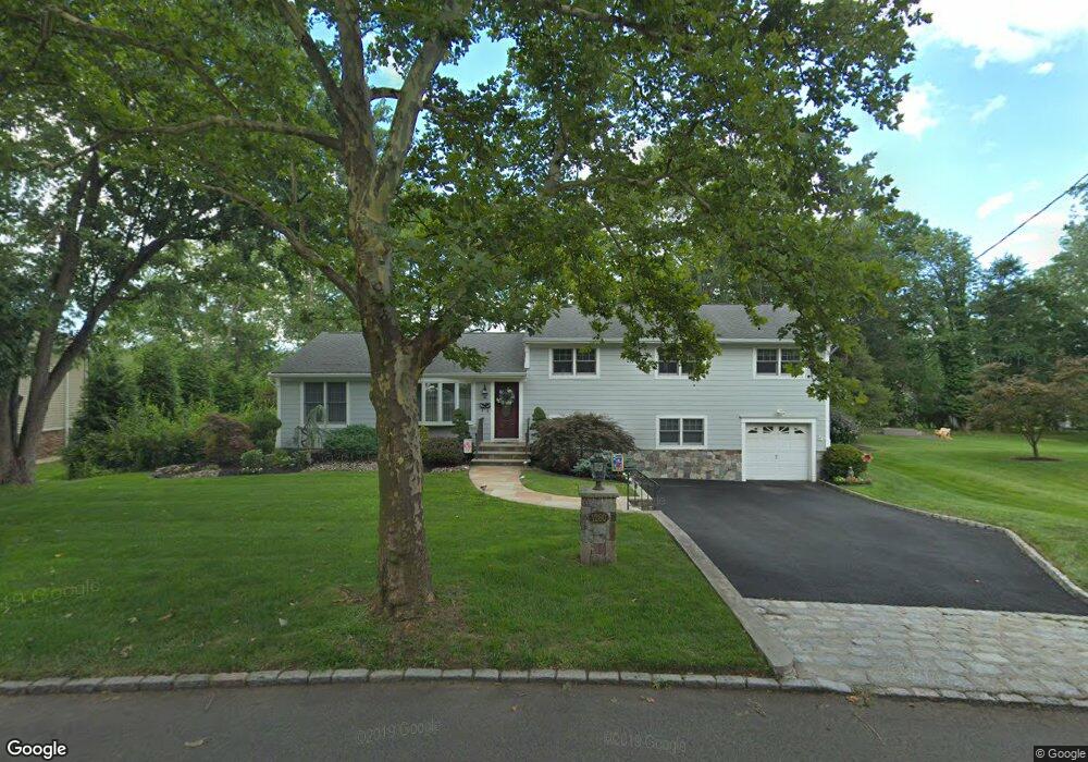
1280 White Oak Rd Scotch Plains, NJ 07076
Estimated Value: $694,287 - $1,189,000
--
Bed
--
Bath
2,366
Sq Ft
$403/Sq Ft
Est. Value
About This Home
This home is located at 1280 White Oak Rd, Scotch Plains, NJ 07076 and is currently estimated at $954,072, approximately $403 per square foot. 1280 White Oak Rd is a home located in Union County with nearby schools including William J. McGinn Elementary School, Terrill Middle School, and Scotch Plains-Fanwood High School.
Ownership History
Date
Name
Owned For
Owner Type
Purchase Details
Closed on
Sep 18, 1992
Bought by
Egan John B and Egan Helen
Current Estimated Value
Create a Home Valuation Report for This Property
The Home Valuation Report is an in-depth analysis detailing your home's value as well as a comparison with similar homes in the area
Home Values in the Area
Average Home Value in this Area
Purchase History
| Date | Buyer | Sale Price | Title Company |
|---|---|---|---|
| Egan John B | $241,000 | -- |
Source: Public Records
Tax History Compared to Growth
Tax History
| Year | Tax Paid | Tax Assessment Tax Assessment Total Assessment is a certain percentage of the fair market value that is determined by local assessors to be the total taxable value of land and additions on the property. | Land | Improvement |
|---|---|---|---|---|
| 2025 | $14,439 | $122,700 | $40,400 | $82,300 |
| 2024 | $14,014 | $122,700 | $40,400 | $82,300 |
| 2023 | $14,014 | $122,700 | $40,400 | $82,300 |
| 2022 | $13,847 | $122,700 | $40,400 | $82,300 |
| 2021 | $13,823 | $122,700 | $40,400 | $82,300 |
| 2020 | $13,757 | $122,700 | $40,400 | $82,300 |
| 2019 | $13,655 | $122,700 | $40,400 | $82,300 |
| 2018 | $13,426 | $122,700 | $40,400 | $82,300 |
| 2017 | $13,128 | $122,700 | $40,400 | $82,300 |
| 2016 | $12,875 | $122,700 | $40,400 | $82,300 |
| 2015 | $12,664 | $122,700 | $40,400 | $82,300 |
| 2014 | $12,247 | $122,700 | $40,400 | $82,300 |
Source: Public Records
Map
Nearby Homes
- 1933 W Broad St
- 1933 Mary Ellen Ln
- 2 Brookside Ct
- 2116 Newark Ave
- 2154 W Broad St
- 119 Lamberts Mill Rd
- 187 King St
- 1466 Lamberts Mill Rd
- 2212 Shady Ln
- 314 Highgate Ave
- 5 Robin Rd
- 120 S Martine Ave
- 57 Rambling Dr
- 345 La Grande Ave
- 2219 North Ave Unit 6
- 2314 Longfellow Ave
- 2 Dutch Ln
- 40 1st St
- 21 Old South Ave
- 524 Edgar Rd
- 1282 White Oak Rd
- 1278 White Oak Rd
- 2021 W Broad St
- 2027 W Broad St
- 2015 W Broad St
- 2009 W Broad St
- 1277 White Oak Rd
- 1276 White Oak Rd
- 1290 White Oak Rd
- 1286 White Oak Rd
- 2033 W Broad St
- 1283 White Oak Rd
- 2005 W Broad St
- 2000 Mary Beth Ct
- 1274 White Oak Rd
- 2039 W Broad St
- 1275 White Oak Rd
- 1990 Mary Beth Ct
- 1995 W Broad St
- 2016 W Broad St