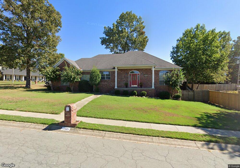
12801 Cherry Laurel Dr Little Rock, AR 72211
Western Little Rock NeighborhoodEstimated Value: $287,000 - $316,000
--
Bed
2
Baths
2,040
Sq Ft
$148/Sq Ft
Est. Value
About This Home
This home is located at 12801 Cherry Laurel Dr, Little Rock, AR 72211 and is currently estimated at $302,737, approximately $148 per square foot. 12801 Cherry Laurel Dr is a home located in Pulaski County with nearby schools including Baker Interdistrict Elementary School, Joe T. Robinson Middle School, and Joe T. Robinson High School.
Ownership History
Date
Name
Owned For
Owner Type
Purchase Details
Closed on
May 7, 2020
Sold by
Tyner Larry J and Tyner Peggy J
Bought by
Tyner Larry T and Larry J Tyner Living Trust
Current Estimated Value
Purchase Details
Closed on
Jul 3, 2002
Sold by
Heath Richard Alan and Heath Susan M
Bought by
Tyner Larry J and Tyner Peggy J
Home Financials for this Owner
Home Financials are based on the most recent Mortgage that was taken out on this home.
Original Mortgage
$68,500
Interest Rate
6.25%
Mortgage Type
Purchase Money Mortgage
Create a Home Valuation Report for This Property
The Home Valuation Report is an in-depth analysis detailing your home's value as well as a comparison with similar homes in the area
Home Values in the Area
Average Home Value in this Area
Purchase History
| Date | Buyer | Sale Price | Title Company |
|---|---|---|---|
| Tyner Larry T | -- | None Available | |
| Tyner Larry J | $169,000 | Stewart Title |
Source: Public Records
Mortgage History
| Date | Status | Borrower | Loan Amount |
|---|---|---|---|
| Closed | Tyner Larry J | $68,500 |
Source: Public Records
Tax History Compared to Growth
Tax History
| Year | Tax Paid | Tax Assessment Tax Assessment Total Assessment is a certain percentage of the fair market value that is determined by local assessors to be the total taxable value of land and additions on the property. | Land | Improvement |
|---|---|---|---|---|
| 2025 | $2,548 | $53,442 | $5,800 | $47,642 |
| 2024 | $2,548 | $53,442 | $5,800 | $47,642 |
| 2023 | $2,548 | $53,442 | $5,800 | $47,642 |
| 2022 | $2,548 | $53,442 | $5,800 | $47,642 |
| 2021 | $2,567 | $41,560 | $7,200 | $34,360 |
| 2020 | $2,173 | $41,560 | $7,200 | $34,360 |
| 2019 | $2,173 | $41,560 | $7,200 | $34,360 |
| 2018 | $2,198 | $41,560 | $7,200 | $34,360 |
| 2017 | $2,198 | $41,560 | $7,200 | $34,360 |
| 2016 | $2,548 | $39,620 | $5,000 | $34,620 |
| 2015 | $2,567 | $39,620 | $5,000 | $34,620 |
| 2014 | $2,567 | $39,620 | $5,000 | $34,620 |
Source: Public Records
Map
Nearby Homes
- 2001 Brookford Dr
- 12400 Cherry Laurel Dr
- 1707 Point Dr W
- 2806 Woodsgate Dr
- 2623 Bowman Rd
- 2905 Woodsgate Dr
- 1409 Mesquite Dr
- 28 Elkrun Cove
- 1509 Gamble Rd
- 2820 Mossy Creek Dr
- 11701 Shady Creek Dr
- 12825 Westglen Dr
- 2815 Mossy Creek Dr
- 2825 Mossy Creek Dr
- 23 Wagon Wheel Ct
- 12425 Brodie Creek Trail
- 11612 Shady Creek Dr
- 1408 S Bowman Rd
- 13408 Teton Dr
- 2101 Hickorynut Ct
- 2010 Stoney Creek Dr
- 12807 Cherry Laurel Dr
- 12500 Misty Creek Dr
- 0 Misty Creek Dr
- 2014 Stoney Creek Dr
- 12705 Cherry Laurel Dr
- 12501 Misty Creek Dr
- 12708 Cherry Laurel Dr
- 2007 Stoney Creek Dr
- 2003 Stoney Creek Dr
- 2011 Stoney Creek Dr
- 12504 Misty Creek Dr
- 2018 Stoney Creek Dr
- 12704 Cherry Laurel Dr
- 12812 Cherry Laurel Dr
- 12701 Cherry Laurel Dr
- 3 Cherry Laurel Ct
- 12509 Misty Creek Dr
- 2019 Stoney Creek Dr
- 12508 Misty Creek Dr