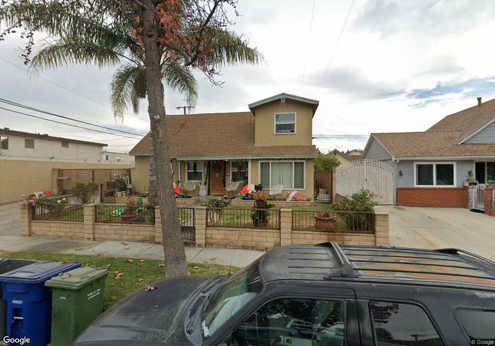
12802 Duffield Ave La Mirada, CA 90638
Estimated Value: $776,000 - $957,239
5
Beds
2
Baths
2,034
Sq Ft
$423/Sq Ft
Est. Value
About This Home
This home is located at 12802 Duffield Ave, La Mirada, CA 90638 and is currently estimated at $860,310, approximately $422 per square foot. 12802 Duffield Ave is a home located in Los Angeles County with nearby schools including Foster Road Elementary School, Reginald M. Benton Middle School, and La Mirada High School.
Ownership History
Date
Name
Owned For
Owner Type
Purchase Details
Closed on
Feb 11, 2014
Sold by
Macnider Rosita
Bought by
White Joy Catherine H
Current Estimated Value
Home Financials for this Owner
Home Financials are based on the most recent Mortgage that was taken out on this home.
Original Mortgage
$360,000
Outstanding Balance
$273,412
Interest Rate
4.47%
Mortgage Type
Seller Take Back
Estimated Equity
$586,898
Purchase Details
Closed on
Jun 18, 2009
Sold by
Whealy Dennis and Whealy Yolanda
Bought by
Macnider Harold
Purchase Details
Closed on
Apr 4, 1994
Sold by
Bonnin George R and Bonnin Marta A
Bought by
Whealy Dennis
Home Financials for this Owner
Home Financials are based on the most recent Mortgage that was taken out on this home.
Original Mortgage
$173,850
Interest Rate
7.87%
Create a Home Valuation Report for This Property
The Home Valuation Report is an in-depth analysis detailing your home's value as well as a comparison with similar homes in the area
Home Values in the Area
Average Home Value in this Area
Purchase History
| Date | Buyer | Sale Price | Title Company |
|---|---|---|---|
| White Joy Catherine H | $360,000 | Wfg | |
| Macnider Harold | $385,000 | None Available | |
| Whealy Dennis | $183,000 | Gateway Title Company |
Source: Public Records
Mortgage History
| Date | Status | Borrower | Loan Amount |
|---|---|---|---|
| Open | White Joy Catherine H | $360,000 | |
| Previous Owner | Whealy Dennis | $173,850 |
Source: Public Records
Tax History
| Year | Tax Paid | Tax Assessment Tax Assessment Total Assessment is a certain percentage of the fair market value that is determined by local assessors to be the total taxable value of land and additions on the property. | Land | Improvement |
|---|---|---|---|---|
| 2025 | $1,782 | $102,901 | $37,475 | $65,426 |
| 2024 | $1,782 | $100,885 | $36,741 | $64,144 |
| 2023 | $1,735 | $98,908 | $36,021 | $62,887 |
| 2022 | $1,704 | $96,969 | $35,315 | $61,654 |
| 2021 | $1,669 | $95,069 | $34,623 | $60,446 |
| 2019 | $1,625 | $92,251 | $33,597 | $58,654 |
| 2018 | $1,483 | $90,443 | $32,939 | $57,504 |
| 2016 | $1,398 | $86,933 | $31,661 | $55,272 |
| 2015 | $1,384 | $85,628 | $31,186 | $54,442 |
| 2014 | $1,316 | $83,952 | $30,576 | $53,376 |
Source: Public Records
Map
Nearby Homes
- 13007 Duffield Ave
- 14000 Lake View Dr
- 14036 Lake View Dr Unit 143
- 14020 Lake Crest Dr Unit 84
- 14044 Lake Glen Dr Unit 38
- 13718 Busby Dr
- 14041 Lakeside Dr Unit 130
- 14055 Lake View Dr
- 12707 Lake Forest Way Unit 135
- 12726 Lake Forest Ave Unit 25
- 13703 Placid Dr
- 13224 Sunnybrook Ln
- 13857 Leffingwell Rd
- 11827 Loma Dr Unit 15
- 13432 Bona Vista Ln
- 13515 Bona Vista Ln
- 14332 Valeda Dr
- 12205 Colima Rd
- 11902 Leland Ave
- 11819 Corley Dr
- 12808 Duffield Ave
- 12803 El Moro Ave
- 12812 Duffield Ave
- 12809 El Moro Ave
- 12813 El Moro Ave
- 12803 Duffield Ave
- 12809 Duffield Ave
- 12817 El Moro Ave
- 12813 Duffield Ave
- 12822 Duffield Ave
- 12819 Duffield Ave
- 12823 El Moro Ave
- 13926 Ramhurst Dr Unit 14
- 13926 Ramhurst Dr Unit 17
- 13926 Ramhurst Dr Unit 6
- 13926 Ramhurst Dr Unit 23
- 13926 Ramhurst Dr Unit 21
- 13926 Ramhurst Dr Unit 16
- 13926 Ramhurst Dr Unit 26
- 13926 Ramhurst Dr Unit 4
Your Personal Tour Guide
Ask me questions while you tour the home.