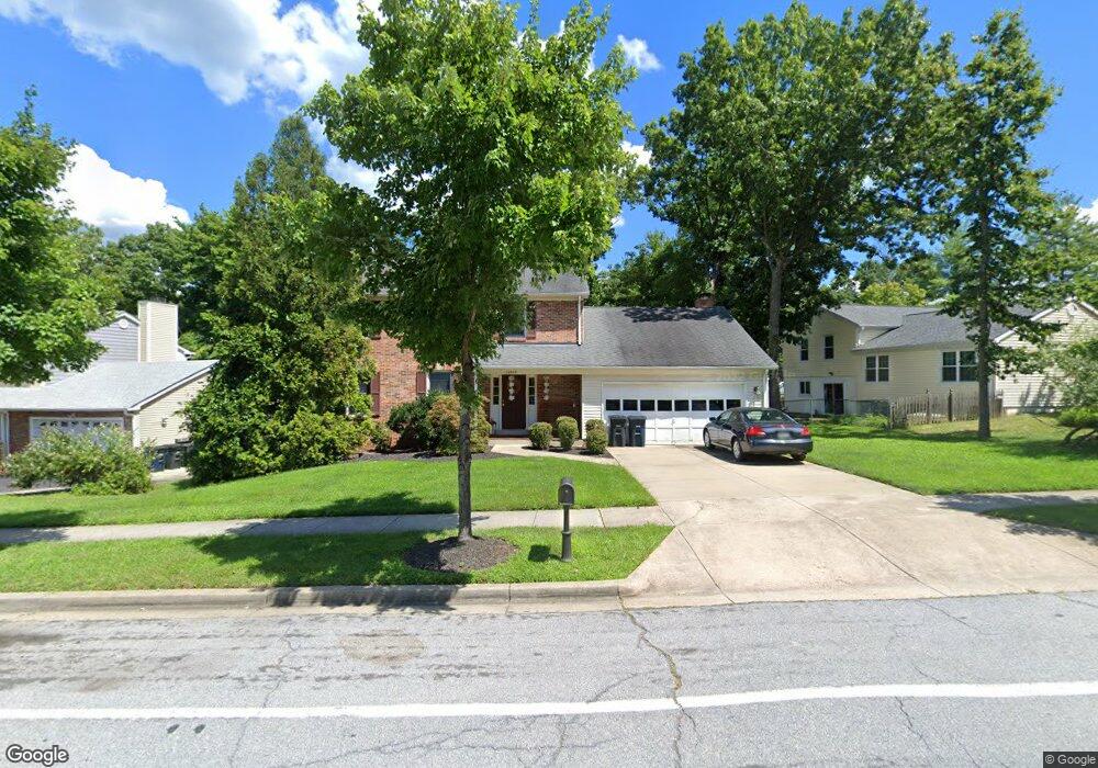
12805 N Point Ln Laurel, MD 20708
South Laurel NeighborhoodEstimated Value: $535,000 - $585,000
Studio
4
Baths
2,044
Sq Ft
$273/Sq Ft
Est. Value
About This Home
This home is located at 12805 N Point Ln, Laurel, MD 20708 and is currently estimated at $558,488, approximately $273 per square foot. 12805 N Point Ln is a home located in Prince George's County with nearby schools including James H. Harrison Elementary School, Dwight D. Eisenhower Middle School, and Laurel High School.
Ownership History
Date
Name
Owned For
Owner Type
Purchase Details
Closed on
Nov 10, 2014
Sold by
Mcdougal Jolan
Bought by
Ellis Diana
Current Estimated Value
Purchase Details
Closed on
Apr 26, 2006
Sold by
Sherwood John P
Bought by
Ellis Diana
Home Financials for this Owner
Home Financials are based on the most recent Mortgage that was taken out on this home.
Original Mortgage
$87,000
Interest Rate
6.28%
Mortgage Type
Stand Alone Second
Purchase Details
Closed on
Mar 30, 2006
Sold by
Sherwood John P
Bought by
Ellis Diana
Home Financials for this Owner
Home Financials are based on the most recent Mortgage that was taken out on this home.
Original Mortgage
$87,000
Interest Rate
6.28%
Mortgage Type
Stand Alone Second
Purchase Details
Closed on
Oct 29, 1980
Sold by
Miller and Miller Minogue
Bought by
Sherwood John P and Sherwood Arlene
Create a Home Valuation Report for This Property
The Home Valuation Report is an in-depth analysis detailing your home's value as well as a comparison with similar homes in the area
Home Values in the Area
Average Home Value in this Area
Purchase History
| Date | Buyer | Sale Price | Title Company |
|---|---|---|---|
| Ellis Diana | -- | None Available | |
| Ellis Diana | $435,000 | -- | |
| Ellis Diana | $435,000 | -- | |
| Sherwood John P | $113,000 | -- |
Source: Public Records
Mortgage History
| Date | Status | Borrower | Loan Amount |
|---|---|---|---|
| Previous Owner | Ellis Diana | $87,000 | |
| Previous Owner | Ellis Diana | $348,000 | |
| Previous Owner | Ellis Diana | $348,000 |
Source: Public Records
Tax History Compared to Growth
Tax History
| Year | Tax Paid | Tax Assessment Tax Assessment Total Assessment is a certain percentage of the fair market value that is determined by local assessors to be the total taxable value of land and additions on the property. | Land | Improvement |
|---|---|---|---|---|
| 2025 | $6,635 | $528,500 | $126,100 | $402,400 |
| 2024 | $6,635 | $488,000 | -- | -- |
| 2023 | $6,324 | $447,500 | $0 | $0 |
| 2022 | $5,949 | $407,000 | $101,100 | $305,900 |
| 2021 | $5,751 | $401,233 | $0 | $0 |
| 2020 | $5,689 | $395,467 | $0 | $0 |
| 2019 | $5,595 | $389,700 | $100,500 | $289,200 |
| 2018 | $5,388 | $367,033 | $0 | $0 |
| 2017 | $5,215 | $344,367 | $0 | $0 |
| 2016 | -- | $321,700 | $0 | $0 |
| 2015 | $4,971 | $314,200 | $0 | $0 |
| 2014 | $4,971 | $306,700 | $0 | $0 |
Source: Public Records
Map
Nearby Homes
- 8415 Snowden Oaks Place
- 0 Larchdale Rd Unit MDPG2054450
- 8493 Snowden Oaks Place
- 13100 Golden Oak Dr
- 8491 Imperial Dr
- 8604 Imperial Dr
- 13400 Oaklands Manor Dr
- 8908 Eastbourne Ln
- 12927 Brickyard Blvd
- 12600 Cedarbrook Ln
- 12703 Cedarbrook Ln
- 12825 Brickyard Blvd
- 12710 Rustic Rock Ln
- 12811 Brickyard Blvd
- 7205 Barrberry Ln
- 7338 Calico Rock Lndg Rd
- 11905 Ellington Dr
- 7207 Maisson Ridge Cir
- 13120 Winding Trail Rd
- 8210 Willow St
- 12807 N Point Ln
- 8400 Oak Stream Dr
- 8402 Oak Stream Dr
- 8404 Oak Stream Dr
- 12809 N Point Ln
- 12804 N Point Ln
- 12802 N Point Ln
- 12806 N Point Ln
- 8406 Oak Stream Dr
- 12811 N Point Ln
- 12800 N Point Ln
- 12808 N Point Ln
- 8404 Snowden Oaks Place
- 8406 Snowden Oaks Place
- 8402 Snowden Oaks Place
- 8408 Snowden Oaks Place
- 8400 Snowden Oaks Place
- 8410 Snowden Oaks Place
- 8412 Snowden Oaks Place
- 8414 Snowden Oaks Place