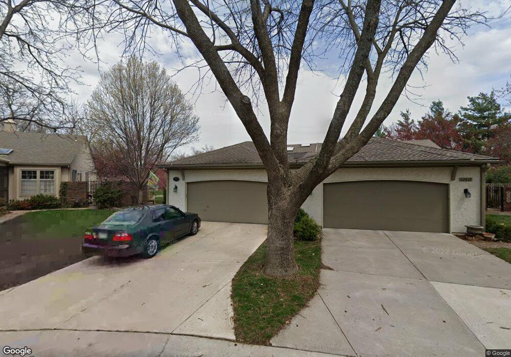
12815 Cambridge Rd Leawood, KS 66209
Estimated Value: $433,763 - $452,000
4
Beds
3
Baths
1,636
Sq Ft
$271/Sq Ft
Est. Value
About This Home
This home is located at 12815 Cambridge Rd, Leawood, KS 66209 and is currently estimated at $443,691, approximately $271 per square foot. 12815 Cambridge Rd is a home located in Johnson County with nearby schools including Leawood Elementary School, Leawood Middle School, and Blue Valley North High School.
Ownership History
Date
Name
Owned For
Owner Type
Purchase Details
Closed on
Dec 21, 2020
Sold by
Gangel Michael G and Gangel Susan M
Bought by
Michael G Gangel Trust
Current Estimated Value
Purchase Details
Closed on
Dec 16, 2020
Sold by
Gangel Michael G and Gangel Susan M
Bought by
Michael G Gangel Trust
Purchase Details
Closed on
Jan 24, 2020
Sold by
Ballesteros Marice Whitson and Ballesteros Galo Richardo
Bought by
Gangel Michael G and Gangel Susan M
Purchase Details
Closed on
Jul 11, 2002
Sold by
Stubbs Ann D
Bought by
Whitson Merle E and Whitson Marlene C
Home Financials for this Owner
Home Financials are based on the most recent Mortgage that was taken out on this home.
Original Mortgage
$178,900
Interest Rate
6.53%
Create a Home Valuation Report for This Property
The Home Valuation Report is an in-depth analysis detailing your home's value as well as a comparison with similar homes in the area
Home Values in the Area
Average Home Value in this Area
Purchase History
| Date | Buyer | Sale Price | Title Company |
|---|---|---|---|
| Michael G Gangel Trust | -- | None Available | |
| Michael G Gangel Trust | -- | None Listed On Document | |
| Gangel Michael G | -- | Mccaffree Short Title Co | |
| Whitson Merle E | -- | Chicago Title Insurance Co |
Source: Public Records
Mortgage History
| Date | Status | Borrower | Loan Amount |
|---|---|---|---|
| Previous Owner | Whitson Merle E | $178,900 |
Source: Public Records
Tax History Compared to Growth
Tax History
| Year | Tax Paid | Tax Assessment Tax Assessment Total Assessment is a certain percentage of the fair market value that is determined by local assessors to be the total taxable value of land and additions on the property. | Land | Improvement |
|---|---|---|---|---|
| 2024 | $4,890 | $44,517 | $6,555 | $37,962 |
| 2023 | $4,282 | $38,341 | $6,555 | $31,786 |
| 2022 | $4,044 | $35,455 | $5,704 | $29,751 |
| 2021 | $3,677 | $30,660 | $5,187 | $25,473 |
| 2020 | $3,492 | $28,544 | $5,187 | $23,357 |
| 2019 | $3,505 | $28,106 | $4,715 | $23,391 |
| 2018 | $2,788 | $22,057 | $4,100 | $17,957 |
| 2017 | $2,685 | $20,896 | $3,565 | $17,331 |
| 2016 | $2,625 | $20,459 | $3,565 | $16,894 |
| 2015 | $2,574 | $19,826 | $3,565 | $16,261 |
| 2013 | -- | $18,124 | $3,565 | $14,559 |
Source: Public Records
Map
Nearby Homes
- 12768 Overbrook Rd
- 2218 Condolea Terrace
- 12854 Cambridge Terrace
- 12763 Overbrook Rd
- 2229 Condolea Terrace
- 12851 Pembroke Cir
- 12854 Pembroke Cir
- 703 Tam-O-shanter Dr
- 12716 Oakmont Dr
- 2313 W 127th St
- 708 W 131st Place
- 12815 Pembroke Cir
- 13201 Summit St
- 12501 Sagamore Rd
- 302 Duke Gibson Dr
- 2549 W 132nd Terrace
- 719 W 132nd Terrace
- 13312 Pennsylvania Ct
- 12725 High Dr
- 1985 W 123rd Place
- 12817 Cambridge Rd
- 12811 Cambridge Rd
- 12809 Cambridge Rd
- 12819 Cambridge Rd
- 12807 Cambridge Rd
- 12821 Cambridge Rd
- 12805 Cambridge Rd
- 12823 Cambridge Rd
- 12808 Cambridge Rd
- 12901 State Line Rd
- 12803 Cambridge Rd
- 12804 Cambridge Rd
- 12810 Cambridge Rd
- 12825 Cambridge Rd
- 12802 Cambridge Rd
- 12801 Cambridge Rd
- 12827 Cambridge Rd
- 12843 State Line Rd
- 12829 Cambridge Rd
- 12719 Cambridge Ln