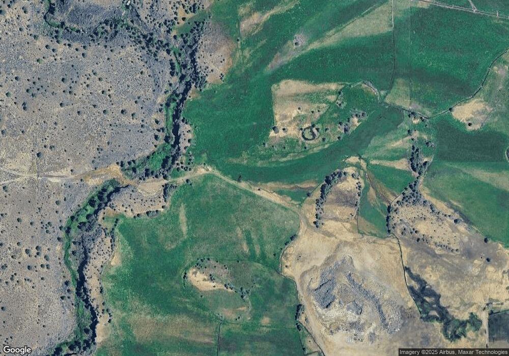
12815 S West Cornett Loop Powell Butte, OR 97753
--
Bed
--
Bath
--
Sq Ft
141.13
Acres
About This Home
This home is located at 12815 S West Cornett Loop, Powell Butte, OR 97753. 12815 S West Cornett Loop is a home located in Crook County with nearby schools including Crooked River Elementary School, Crook County Middle School, and Crook County High School.
Ownership History
Date
Name
Owned For
Owner Type
Purchase Details
Closed on
Feb 22, 2022
Sold by
Mark And Ann Malott Llc
Bought by
Malott Mark W and Malott Ann M
Purchase Details
Closed on
Jul 10, 2014
Sold by
Moss Land & Cattle Llc
Bought by
Malott Mark and Malott Ann
Home Financials for this Owner
Home Financials are based on the most recent Mortgage that was taken out on this home.
Original Mortgage
$5,300,000
Interest Rate
4.07%
Mortgage Type
Purchase Money Mortgage
Purchase Details
Closed on
Jul 18, 2013
Sold by
Wren Paul
Bought by
Moss Group Llc
Purchase Details
Closed on
Jan 25, 2010
Sold by
High Desert Investments Llc
Bought by
Wren Paul
Purchase Details
Closed on
May 24, 2006
Sold by
High Desert Investment Company Llc
Bought by
Shaw John and Shaw Gail
Purchase Details
Closed on
May 22, 2006
Sold by
Batlan Michael B and Estate Of Robert Leroy Johnnie
Bought by
High Desert Investment Company Llc
Create a Home Valuation Report for This Property
The Home Valuation Report is an in-depth analysis detailing your home's value as well as a comparison with similar homes in the area
Home Values in the Area
Average Home Value in this Area
Purchase History
| Date | Buyer | Sale Price | Title Company |
|---|---|---|---|
| Malott Mark W | $99,000 | Western Title | |
| Malott Mark | $5,300,000 | Amerititle | |
| Moss Group Llc | -- | Amerititle | |
| Wren Paul | $624,845 | Amerititle | |
| Shaw John | $500,000 | Multiple | |
| High Desert Investment Company Llc | $952,000 | Amerititle |
Source: Public Records
Mortgage History
| Date | Status | Borrower | Loan Amount |
|---|---|---|---|
| Previous Owner | Malott Mark | $5,300,000 |
Source: Public Records
Tax History Compared to Growth
Tax History
| Year | Tax Paid | Tax Assessment Tax Assessment Total Assessment is a certain percentage of the fair market value that is determined by local assessors to be the total taxable value of land and additions on the property. | Land | Improvement |
|---|---|---|---|---|
| 2025 | $575 | $47,294 | -- | -- |
| 2024 | $562 | $46,034 | -- | -- |
| 2023 | $544 | $44,811 | $0 | $0 |
| 2022 | $528 | $43,560 | $0 | $0 |
| 2021 | $530 | $42,420 | $0 | $0 |
| 2020 | $516 | $41,310 | $0 | $0 |
| 2019 | $498 | $39,010 | $0 | $0 |
| 2018 | $487 | $39,010 | $0 | $0 |
| 2017 | $423 | $33,420 | $0 | $0 |
| 2016 | $405 | $31,770 | $0 | $0 |
| 2015 | $389 | $31,770 | $0 | $0 |
| 2013 | -- | $30,240 | $0 | $0 |
Source: Public Records
Map
Nearby Homes
- 12512 SW Cornett Loop
- 502 SW Bent Loop
- 0 NW Hwy Unit 220204519
- NW Oneil (Tl 105) Hwy
- 165 SW Bent Loop
- 1814 Remington Ranch Dr
- 15333 NW Oneil Hwy
- 12855 SW Ayres Ln
- 0 NW Mcdaniel Rd
- 3068 SW Reif Rd
- 1164 SW Parrish Ln
- 11311 SW Fleming Rd
- 0 Parrish Ln Unit 597528286
- 10934 SW Fleming Rd
- 0 SW Parrish Ln Unit 416136612
- 8790 NW Campbell Ranch Rd
- 20799 NW O'Neil Hwy
- 5910 NE 41st St
- 13501 SW Riggs Rd
- 3295 NE 37th St
- 0 S West Lark Meadow Ln
- 12917 S West Lark Meadow Ln
- 12917 Larkmeadow Ln
- 885 SW Bent Loop
- 12913 Larkmeadow Ln
- 12913 S West Lark Meadow Ln
- 811 SW Bent Loop
- 12993 SW Cornett Loop
- 12837 SW Cornett Loop
- 959 SW Bent Loop
- 961 SW Bent Loop
- 933 SW Bent Loop
- 00 SW O'Neil Hwy
- 711 SW Bent Loop
- 13717 SW Houston Lake Rd
- 13703 SW Houston Lake Rd
- 979 SW Bent Loop
- 0 O'Neil Hwy Unit 220154851
- 673 SW Bent Loop
- 902 S Bent Loop
