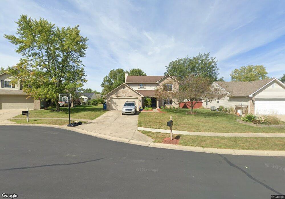
12818 Patrick Ct Fishers, IN 46038
Estimated Value: $322,000 - $344,000
3
Beds
3
Baths
1,694
Sq Ft
$195/Sq Ft
Est. Value
About This Home
This home is located at 12818 Patrick Ct, Fishers, IN 46038 and is currently estimated at $329,686, approximately $194 per square foot. 12818 Patrick Ct is a home located in Hamilton County with nearby schools including Cumberland Road Elementary School, Fishers Junior High School, and Sand Creek Intermediate School.
Ownership History
Date
Name
Owned For
Owner Type
Purchase Details
Closed on
Sep 15, 2005
Sold by
Nguyen Bao D
Bought by
Spitzer Christopher E and Spitzer Lisa E
Current Estimated Value
Home Financials for this Owner
Home Financials are based on the most recent Mortgage that was taken out on this home.
Original Mortgage
$100,000
Outstanding Balance
$53,043
Interest Rate
6.01%
Mortgage Type
Fannie Mae Freddie Mac
Estimated Equity
$276,643
Purchase Details
Closed on
Apr 30, 2002
Sold by
Shadoan Michael T and Stradtner Tonya J
Bought by
Nguyen Bao D
Home Financials for this Owner
Home Financials are based on the most recent Mortgage that was taken out on this home.
Original Mortgage
$128,750
Interest Rate
6.87%
Mortgage Type
Purchase Money Mortgage
Create a Home Valuation Report for This Property
The Home Valuation Report is an in-depth analysis detailing your home's value as well as a comparison with similar homes in the area
Home Values in the Area
Average Home Value in this Area
Purchase History
| Date | Buyer | Sale Price | Title Company |
|---|---|---|---|
| Spitzer Christopher E | -- | -- | |
| Nguyen Bao D | -- | -- |
Source: Public Records
Mortgage History
| Date | Status | Borrower | Loan Amount |
|---|---|---|---|
| Open | Spitzer Christopher E | $100,000 | |
| Previous Owner | Nguyen Bao D | $128,750 |
Source: Public Records
Tax History
| Year | Tax Paid | Tax Assessment Tax Assessment Total Assessment is a certain percentage of the fair market value that is determined by local assessors to be the total taxable value of land and additions on the property. | Land | Improvement |
|---|---|---|---|---|
| 2024 | $2,693 | $267,700 | $36,200 | $231,500 |
| 2023 | $2,693 | $255,100 | $36,200 | $218,900 |
| 2022 | $2,734 | $234,400 | $36,200 | $198,200 |
| 2021 | $2,246 | $196,600 | $36,200 | $160,400 |
| 2020 | $1,948 | $175,700 | $36,200 | $139,500 |
| 2019 | $1,855 | $168,900 | $32,500 | $136,400 |
| 2018 | $1,703 | $158,700 | $32,500 | $126,200 |
| 2017 | $1,574 | $151,300 | $32,500 | $118,800 |
| 2016 | $1,478 | $150,000 | $32,500 | $117,500 |
| 2014 | $1,259 | $140,400 | $34,700 | $105,700 |
| 2013 | $1,259 | $141,600 | $34,700 | $106,900 |
Source: Public Records
Map
Nearby Homes
- 12791 Longleaf Ln
- 12991 Wingstem Ct
- 12791 Brewton St
- 11798 & 11842 E 131st St
- 13069 Sinclair Place
- 13022 Saint Andrews Way
- 12903 Turnham Dr
- 10150 Beresford Ct
- 12966 Pleasant View Ln
- 12364 Blue Sky Dr
- 10175 Pamona Ct
- 13270 Summerwood Ln
- 10480 Creektree Ln
- 12638 Granite Ridge Cir
- 9080 Teaneck Dr
- 12783 Granite Ridge Cir
- 12662 Granite Ridge Cir
- 12807 Granite Ridge Cir
- 12650 Granite Ridge Cir
- 12687 Granite Ridge Cir
- 12822 Patrick Ct
- 12814 Patrick Ct
- 12757 Sovereign Ln
- 12751 Sovereign Ln
- 12826 Patrick Ct
- 12763 Sovereign Ln
- 12747 Sovereign Ln
- 12810 Patrick Ct
- 12817 Patrick Ct
- 12821 Patrick Ct
- 12832 Patrick Ct
- 12829 Sovereign Ln
- 12739 Sovereign Ln
- 12809 Patrick Ct
- 12813 Patrick Ct
- 12825 Patrick Ct
- 12825 Patrick Ct Unit 2
- 9860 Glenburr Ct
- 12837 Sovereign Ln
- 12731 Sovereign Ln
Your Personal Tour Guide
Ask me questions while you tour the home.