Estimated Value: $204,000 - $293,000
4
Beds
1
Bath
1,696
Sq Ft
$140/Sq Ft
Est. Value
About This Home
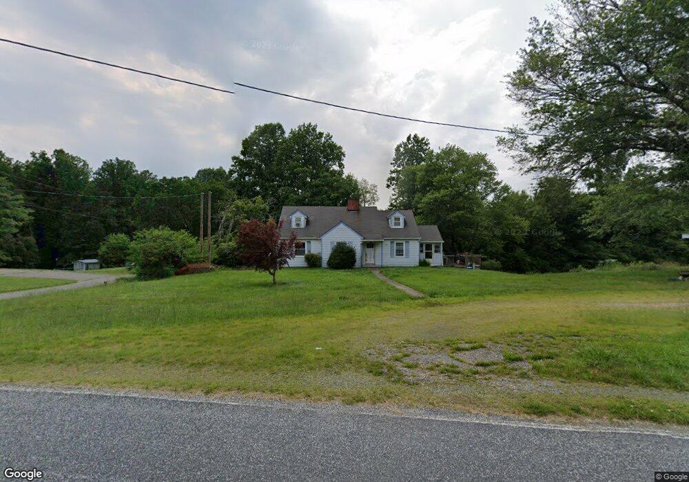
This home is located at 1282 Flynt Rd, King, NC 27021 and is currently estimated at $238,033, approximately $140 per square foot. 1282 Flynt Rd is a home located in Stokes County with nearby schools including Mount Olive Elementary School, Chestnut Grove Middle, and West Stokes High.
Ownership History
Date
Name
Owned For
Owner Type
Purchase Details
Closed on
Mar 19, 2015
Sold by
Norman Julie C
Bought by
Norman Daniel Andrew
Current Estimated Value
Home Financials for this Owner
Home Financials are based on the most recent Mortgage that was taken out on this home.
Original Mortgage
$72,000
Outstanding Balance
$55,287
Interest Rate
3.75%
Mortgage Type
New Conventional
Estimated Equity
$182,746
Create a Home Valuation Report for This Property
The Home Valuation Report is an in-depth analysis detailing your home's value as well as a comparison with similar homes in the area
Home Values in the Area
Average Home Value in this Area
Purchase History
| Date | Buyer | Sale Price | Title Company |
|---|---|---|---|
| Norman Daniel Andrew | $80,000 | None Available |
Source: Public Records
Mortgage History
| Date | Status | Borrower | Loan Amount |
|---|---|---|---|
| Open | Norman Daniel Andrew | $72,000 |
Source: Public Records
Tax History
| Year | Tax Paid | Tax Assessment Tax Assessment Total Assessment is a certain percentage of the fair market value that is determined by local assessors to be the total taxable value of land and additions on the property. | Land | Improvement |
|---|---|---|---|---|
| 2025 | $1,130 | $158,100 | $36,000 | $122,100 |
| 2024 | $1,130 | $119,500 | $27,700 | $91,800 |
| 2023 | $968 | $119,500 | $27,700 | $91,800 |
| 2022 | $884 | $119,500 | $27,700 | $91,800 |
| 2021 | $884 | $119,500 | $27,700 | $91,800 |
| 2020 | $810 | $109,500 | $26,700 | $82,800 |
| 2019 | $810 | $109,500 | $26,700 | $82,800 |
| 2018 | $810 | $109,500 | $26,700 | $82,800 |
| 2017 | $805 | $109,500 | $26,700 | $82,800 |
| 2016 | $758 | $103,100 | $26,700 | $76,400 |
| 2015 | $753 | $103,100 | $26,700 | $76,400 |
| 2014 | $773 | $103,100 | $26,700 | $76,400 |
Source: Public Records
Map
Nearby Homes
- 1208 Kentland Dr
- 0 Nance Rd
- 1129 Kentland Dr
- 1034 Kentland Dr
- 5149 N Carolina 66
- 3125 YMcA Camp Rd
- 1040 Breezeway Dr
- 113 Ravenwood Ct
- 101 Ravenwood Ct
- 100 Ridgecrest Dr
- 1880 Chestnut Grove Rd
- 1831 Chestnut Grove Rd
- 327 Weatherford Dr
- Lot 10 Brown Rd
- Lot 9 Brown Rd
- 1025 Wilburn Ln
- 1739 Denny Rd
- 00 Covington Rd
- 2186 Covington Rd
- 1065 Reid Rd
- 1302 Flynt Rd
- 1286 Flynt Rd
- 1337 Flynt Rd
- 1348 Flynt Rd
- 1362 Flynt Rd
- 1060 Tobacco Pride Rd
- 1080 Tobacco Pride Rd
- Lot A Flynt Rd
- Lot B Flynt Rd
- 1372 Flynt Rd
- 1383 Flynt Rd
- 1374 Flynt Rd
- 1418 Flynt Rd
- 1133 Flynt Rd
- 1126 Flynt Rd
- 1460 Flynt Rd
- 1121 Flynt Rd
- 1496 Flynt Rd
- 1542 Lunsford Rd
- 1118 Flynt Rd
Your Personal Tour Guide
Ask me questions while you tour the home.