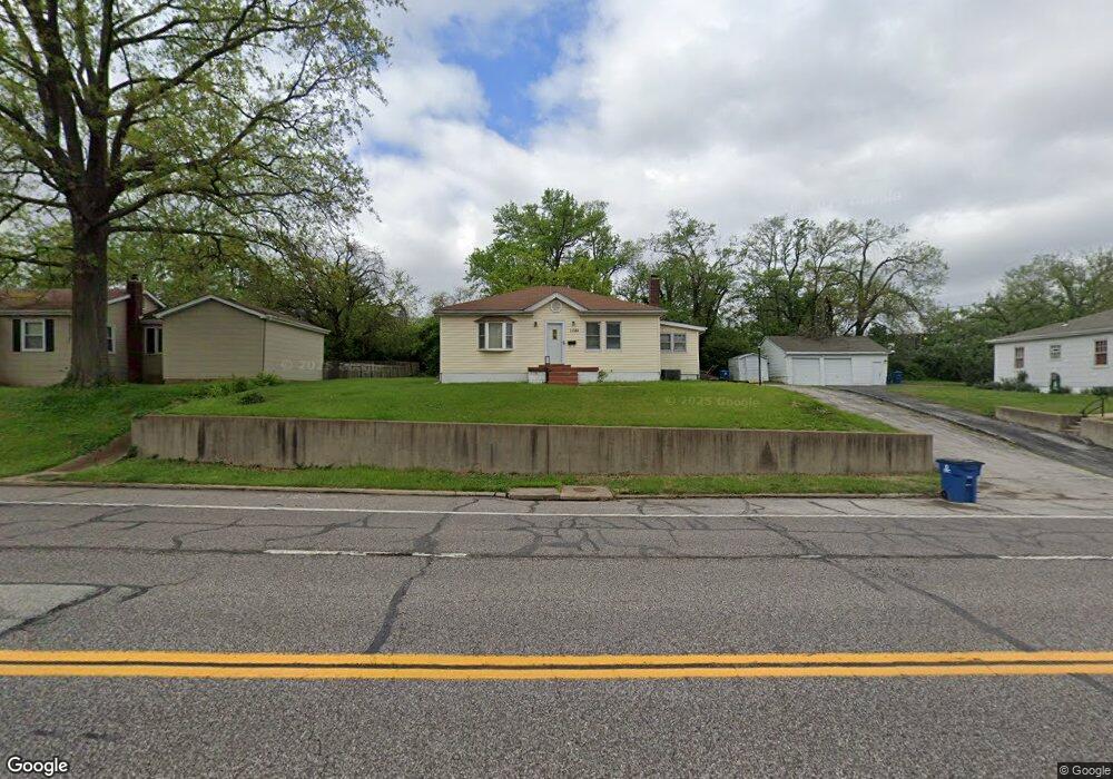
1282 Reavis Barracks Rd Saint Louis, MO 63125
Mehlville NeighborhoodEstimated Value: $174,194 - $219,000
2
Beds
1
Bath
1,103
Sq Ft
$177/Sq Ft
Est. Value
About This Home
This home is located at 1282 Reavis Barracks Rd, Saint Louis, MO 63125 and is currently estimated at $195,299, approximately $177 per square foot. 1282 Reavis Barracks Rd is a home located in St. Louis County with nearby schools including Forder Elementary School, Margaret Buerkle Middle School, and Mehlville High School.
Ownership History
Date
Name
Owned For
Owner Type
Purchase Details
Closed on
Mar 21, 2003
Sold by
Goewert Jennifer E and Goewert John C
Bought by
Cantrell Jacob A
Current Estimated Value
Home Financials for this Owner
Home Financials are based on the most recent Mortgage that was taken out on this home.
Original Mortgage
$81,350
Outstanding Balance
$34,845
Interest Rate
5.83%
Mortgage Type
FHA
Estimated Equity
$160,454
Purchase Details
Closed on
Jul 24, 1997
Sold by
Hagemann Walter M and Hagemann Ann Shirley
Bought by
Barlow Jennifer E
Create a Home Valuation Report for This Property
The Home Valuation Report is an in-depth analysis detailing your home's value as well as a comparison with similar homes in the area
Home Values in the Area
Average Home Value in this Area
Purchase History
| Date | Buyer | Sale Price | Title Company |
|---|---|---|---|
| Cantrell Jacob A | $82,000 | -- | |
| Barlow Jennifer E | -- | -- |
Source: Public Records
Mortgage History
| Date | Status | Borrower | Loan Amount |
|---|---|---|---|
| Open | Cantrell Jacob A | $81,350 |
Source: Public Records
Tax History Compared to Growth
Tax History
| Year | Tax Paid | Tax Assessment Tax Assessment Total Assessment is a certain percentage of the fair market value that is determined by local assessors to be the total taxable value of land and additions on the property. | Land | Improvement |
|---|---|---|---|---|
| 2025 | $2,030 | $33,190 | $17,100 | $16,090 |
| 2024 | $2,030 | $29,780 | $11,120 | $18,660 |
| 2023 | $2,005 | $29,780 | $11,120 | $18,660 |
| 2022 | $1,856 | $25,580 | $11,120 | $14,460 |
| 2021 | $1,648 | $25,580 | $11,120 | $14,460 |
| 2020 | $1,568 | $23,130 | $11,120 | $12,010 |
| 2019 | $1,564 | $23,130 | $11,120 | $12,010 |
| 2018 | $1,354 | $18,040 | $6,350 | $11,690 |
| 2017 | $1,352 | $18,040 | $6,350 | $11,690 |
| 2016 | $1,185 | $15,120 | $5,490 | $9,630 |
| 2015 | $1,112 | $15,120 | $5,490 | $9,630 |
| 2014 | $1,203 | $16,230 | $5,780 | $10,450 |
Source: Public Records
Map
Nearby Homes
- 1275 Gardens Circle Dr Unit A
- 1153 Calley Dr Unit 1153
- 2460 Lampong Dr Unit 100C
- 2216 Apple Bud Ln
- 2215 Apple Bud Ln
- 669 Vista Conn Dr
- 645 Vista Conn Dr
- 1800 Deborah Dr
- 2105 Telford Dr
- 32 Buckley Meadows Dr
- 2669 Jonathan Dr
- 1716 Mayenne Ct Unit E
- 2245 Pecan Dr
- 2414 Via Miralesta Dr
- 846 Dumont Place
- 3809 Tahquitz Dr
- 2444 Via Miralesta Dr
- 800 Dumont Place Unit B
- 1745 Herault Place Unit E
- 1725 Herault Place Unit G
- 1274 Reavis Barracks Rd
- 1290 Reavis Barracks Rd
- 1206 Reavis Barracks Rd
- 1281 Reavis Barracks Rd
- 1285 Reavis Barracks Rd
- 1285 Reavis Barracks Rd
- 1285 Reavis Barracks Rd Unit 5
- 1285 Reavis Barracks Rd Unit 1
- 1285 Reavis Barracks Rd Unit 2
- 1285 Reavis Barracks Rd Unit 3
- 1298 Reavis Barracks Rd
- 1200 Reavis Barracks Rd
- 1201 Reavis Barracks Rd
- 1293 Reavis Barracks Rd
- 1136 Reavis Barracks Rd
- 2229 Doran Dr
- 1297 Reavis Barracks Rd Unit 1
- 1297 Reavis Barracks Rd
- 1297 Reavis Barracks Rd Unit 4