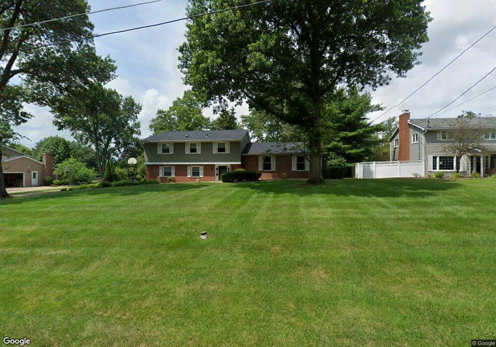
1282 Rosedale Dr Mansfield, OH 44906
Estimated Value: $281,282 - $318,000
4
Beds
3
Baths
2,111
Sq Ft
$140/Sq Ft
Est. Value
About This Home
This home is located at 1282 Rosedale Dr, Mansfield, OH 44906 and is currently estimated at $296,071, approximately $140 per square foot. 1282 Rosedale Dr is a home located in Richland County with nearby schools including Mansfield Christian School, Discovery School, and Mansfield Seventh-day Adventist School.
Ownership History
Date
Name
Owned For
Owner Type
Purchase Details
Closed on
Aug 25, 2010
Sold by
Gardner Raymond J and Gardner Barbara A
Bought by
Williams Patrick D
Current Estimated Value
Home Financials for this Owner
Home Financials are based on the most recent Mortgage that was taken out on this home.
Original Mortgage
$110,000
Outstanding Balance
$73,224
Interest Rate
4.6%
Mortgage Type
New Conventional
Estimated Equity
$222,847
Purchase Details
Closed on
Feb 16, 1990
Create a Home Valuation Report for This Property
The Home Valuation Report is an in-depth analysis detailing your home's value as well as a comparison with similar homes in the area
Home Values in the Area
Average Home Value in this Area
Purchase History
| Date | Buyer | Sale Price | Title Company |
|---|---|---|---|
| Williams Patrick D | $137,500 | Barrister Lawyers Title | |
| -- | $116,000 | -- |
Source: Public Records
Mortgage History
| Date | Status | Borrower | Loan Amount |
|---|---|---|---|
| Open | Williams Patrick D | $110,000 |
Source: Public Records
Tax History Compared to Growth
Tax History
| Year | Tax Paid | Tax Assessment Tax Assessment Total Assessment is a certain percentage of the fair market value that is determined by local assessors to be the total taxable value of land and additions on the property. | Land | Improvement |
|---|---|---|---|---|
| 2024 | $3,117 | $66,560 | $13,810 | $52,750 |
| 2023 | $3,117 | $66,560 | $13,810 | $52,750 |
| 2022 | $3,155 | $56,470 | $12,240 | $44,230 |
| 2021 | $3,177 | $56,470 | $12,240 | $44,230 |
| 2020 | $3,249 | $56,470 | $12,240 | $44,230 |
| 2019 | $3,052 | $47,860 | $10,370 | $37,490 |
| 2018 | $3,010 | $47,860 | $10,370 | $37,490 |
| 2017 | $2,983 | $47,860 | $10,370 | $37,490 |
| 2016 | $3,038 | $48,140 | $10,370 | $37,770 |
| 2015 | $3,038 | $48,140 | $10,370 | $37,770 |
| 2014 | $2,864 | $48,140 | $10,370 | $37,770 |
| 2012 | $1,091 | $48,140 | $10,370 | $37,770 |
Source: Public Records
Map
Nearby Homes
- 1332 Springbrook Dr
- 1201 W Cook Rd
- 1505 Brookpark Dr
- 240 Whippoorwill Ln Unit 240
- 1314 Bridgewater Way N
- 1452 W Cook Rd
- 1564 Bridgewater Way S
- 1691 Willowick Rd
- 1624 Hidden Oak Trail
- 818 Red Oak Trail
- 823 1/2 Red Oak Trail
- 823 1 2 Red Oak Trail
- 1515 Oak Run Ct
- 1690 Riva Ridge Dr Unit 1690
- 1696 Riva Ridge Dr
- 1490 Royalwood Ct Lot 23097
- 1500 Royalwood Ct Lot 23096
- 1510 Royalwood Ct Lot 23095
- 1520 Royalwood Ct Lot 23094
- 1294 Rosedale Dr
- 1270 Rosedale Dr
- 1281 Springbrook Dr
- 1260 Rosedale Dr
- 1310 Rosedale Dr
- 1291 Springbrook Dr
- 1269 Springbrook Dr
- 1281 Rosedale Dr
- 1299 Rosedale Dr
- 1275 Rosedale Dr
- 1301 Springbrook Dr
- 1257 Springbrook Dr
- 1305 Rosedale Dr
- 1250 Rosedale Dr
- 1326 Rosedale Dr
- 1245 Springbrook Dr
- 1325 Springbrook Dr
- 1247 Rosedale Dr
- 1236 Rosedale Dr
- 1284 Springbrook Dr