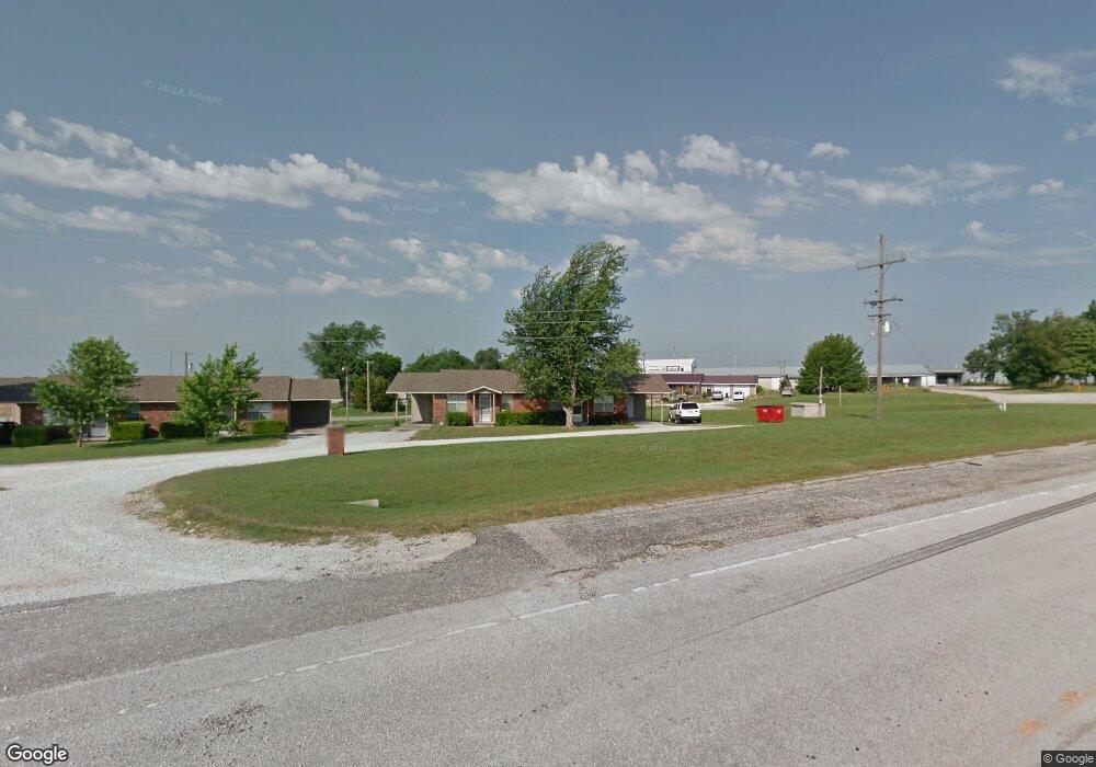
12820 Keith Ln Neosho, MO 64850
Estimated Value: $86,000 - $343,000
6
Beds
--
Bath
3,900
Sq Ft
$55/Sq Ft
Est. Value
About This Home
This home is located at 12820 Keith Ln, Neosho, MO 64850 and is currently estimated at $214,500, approximately $55 per square foot. 12820 Keith Ln is a home with nearby schools including Neosho High School, Ozark Christian Academy, and Neosho Christian Schools.
Ownership History
Date
Name
Owned For
Owner Type
Purchase Details
Closed on
Dec 8, 2022
Sold by
Nelson Robin E
Bought by
Olde Joplin Properties
Current Estimated Value
Purchase Details
Closed on
Jun 1, 2021
Sold by
Easley John D and Easley Sally A
Bought by
Olde Joplin Properties Llc
Home Financials for this Owner
Home Financials are based on the most recent Mortgage that was taken out on this home.
Original Mortgage
$1,000,000
Interest Rate
3%
Mortgage Type
Seller Take Back
Purchase Details
Closed on
Jul 15, 2019
Sold by
Wright Erik J and Wright Penni J
Bought by
Wright Leslie Ann
Create a Home Valuation Report for This Property
The Home Valuation Report is an in-depth analysis detailing your home's value as well as a comparison with similar homes in the area
Home Values in the Area
Average Home Value in this Area
Purchase History
| Date | Buyer | Sale Price | Title Company |
|---|---|---|---|
| Olde Joplin Properties | -- | -- | |
| Olde Joplin Properties Llc | $1,330,000 | None Listed On Document | |
| Wright Leslie Ann | -- | None Listed On Document |
Source: Public Records
Mortgage History
| Date | Status | Borrower | Loan Amount |
|---|---|---|---|
| Previous Owner | Olde Joplin Properties Llc | $1,000,000 |
Source: Public Records
Tax History Compared to Growth
Tax History
| Year | Tax Paid | Tax Assessment Tax Assessment Total Assessment is a certain percentage of the fair market value that is determined by local assessors to be the total taxable value of land and additions on the property. | Land | Improvement |
|---|---|---|---|---|
| 2024 | $1,429 | $25,840 | -- | -- |
| 2023 | $1,429 | $25,840 | $2,052 | $23,788 |
| 2022 | $1,429 | $25,360 | -- | -- |
| 2021 | $1,399 | $25,360 | $0 | $0 |
| 2020 | $1,363 | $24,860 | $0 | $0 |
| 2019 | $1,245 | $24,860 | $0 | $0 |
| 2018 | $1,257 | $24,860 | $0 | $0 |
| 2017 | $1,422 | $24,860 | $0 | $0 |
| 2016 | $1,422 | $28,220 | $0 | $0 |
| 2015 | -- | $27,960 | $0 | $0 |
| 2014 | -- | $27,960 | $0 | $0 |
Source: Public Records
Map
Nearby Homes
- TR 4 Swc 86 Hwy & Kodiak Rd
- Tract 4 SW Swc 86 Highway & Kodiak Rd
- TR 5A Swc 86 Hwy & Kodiak Rd
- Tr 5a Swc 86 Highway & Kodiak
- TR 2 Swc 86 Hwy & Kodiak Rd
- Tr 5b Swc 86 Highway & Kodiak
- Tract 2 SW Swc 86 Highway & Kodiak Rd
- 12735 Lynn Ln
- 12735 Lynn Ln Unit 3.5AC
- 12735 Lynn Dr
- 13194 Kirkwood Ln
- 12882 Larissa Dr
- 13225 Oakwood Trail Rd
- 12228 Lauren Ln
- 1700 Rosewood Dr
- 1701 Radcliff Dr
- 1306 Marion Dr
- 1094 N Business 49
- 12629 Kentucky Rd
- 13844 Jay Dr
- Corner Gateway & Business 49
- Corner Hwy 49 & Gateway
- Tr 4 Rd
- 12766 Gateway Dr
- Swc 86 Highway & Kodiak Road 1-5
- 12742 E Highway 86
- Tr 5 Swc 86 Highway & Kodiak Rd
- Tr 2 Swc 86 Hwy & Kodiak Rd
- 12742 State Highway 86
- Swc 86 Highway & Kodiak Rd Tract 5
- Tr 4 Swc 86 Hwy & Kodiak Rd
- 12710 & 12742 E Highway 86
- 12710 & 12742 E Highway 86 N A
- 12710-42 Highway 86 N A
- Swc 86 Highway & Kodiak Road Tr 4
- Tr 5 86 Hwy
- 12710 E Highway 86
- SWC 86 Hwy & Kodiak Rd Tr 1-5
- 12710 E Highway 86
- 12710 E Highway 86