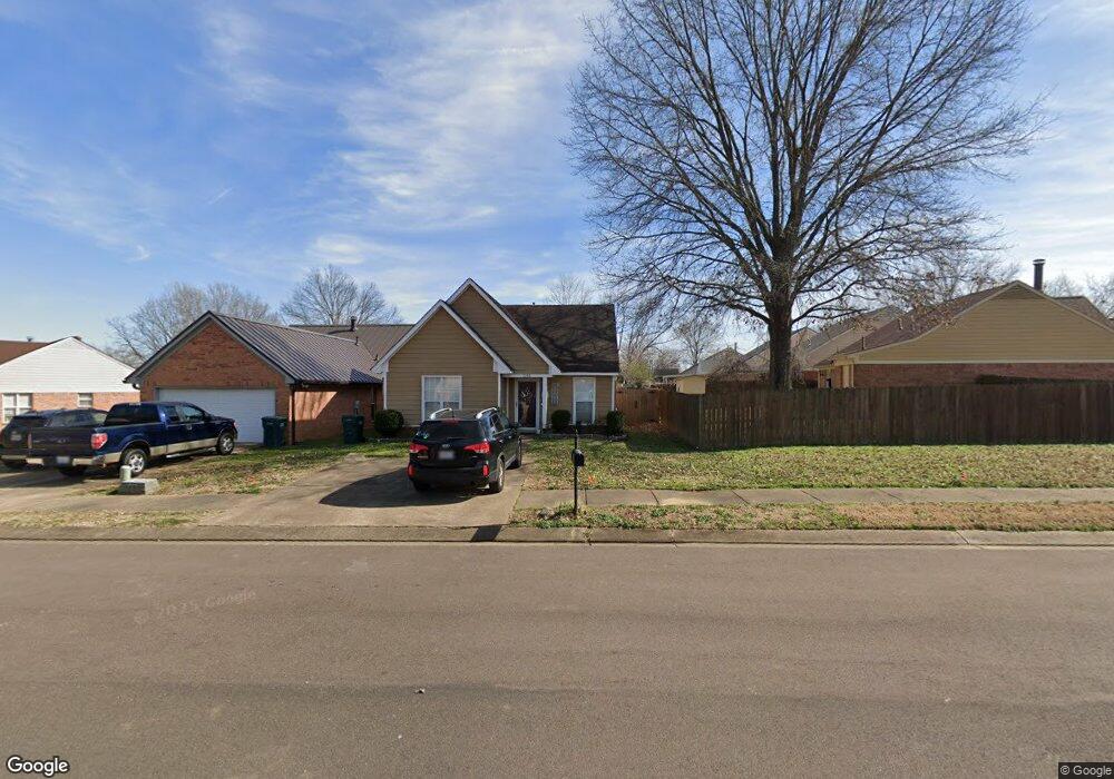
1283 Payton Dr N Southaven, MS 38671
Estimated Value: $179,000 - $212,000
2
Beds
2
Baths
1,098
Sq Ft
$176/Sq Ft
Est. Value
About This Home
This home is located at 1283 Payton Dr N, Southaven, MS 38671 and is currently estimated at $193,254, approximately $176 per square foot. 1283 Payton Dr N is a home located in DeSoto County with nearby schools including Hope Sullivan Elementary School, Southaven Intermediate School, and Southaven Middle School.
Ownership History
Date
Name
Owned For
Owner Type
Purchase Details
Closed on
Jun 16, 2010
Sold by
Hubbard Rachel and Jones Lloyd Thomas Leroy
Bought by
Hubbard Rachel
Current Estimated Value
Purchase Details
Closed on
Aug 27, 2009
Sold by
Secretary Of Housing & Urban Development
Bought by
Hubbard Rachel and Jones Lloyd Thomas Leroy
Home Financials for this Owner
Home Financials are based on the most recent Mortgage that was taken out on this home.
Original Mortgage
$61,162
Outstanding Balance
$39,898
Interest Rate
5.14%
Mortgage Type
FHA
Estimated Equity
$153,356
Create a Home Valuation Report for This Property
The Home Valuation Report is an in-depth analysis detailing your home's value as well as a comparison with similar homes in the area
Home Values in the Area
Average Home Value in this Area
Purchase History
| Date | Buyer | Sale Price | Title Company |
|---|---|---|---|
| Hubbard Rachel | -- | None Available | |
| Hubbard Rachel | -- | None Available |
Source: Public Records
Mortgage History
| Date | Status | Borrower | Loan Amount |
|---|---|---|---|
| Open | Hubbard Rachel | $61,162 |
Source: Public Records
Tax History Compared to Growth
Tax History
| Year | Tax Paid | Tax Assessment Tax Assessment Total Assessment is a certain percentage of the fair market value that is determined by local assessors to be the total taxable value of land and additions on the property. | Land | Improvement |
|---|---|---|---|---|
| 2024 | $1,120 | $7,684 | $2,500 | $5,184 |
| 2023 | $1,120 | $7,684 | $0 | $0 |
| 2022 | $1,097 | $7,684 | $2,500 | $5,184 |
| 2021 | $1,097 | $7,684 | $2,500 | $5,184 |
| 2020 | $1,038 | $7,269 | $2,500 | $4,769 |
| 2019 | $1,036 | $7,257 | $2,500 | $4,757 |
| 2017 | $1,013 | $11,610 | $7,055 | $4,555 |
| 2016 | $1,013 | $7,055 | $2,500 | $4,555 |
| 2015 | $1,005 | $11,610 | $7,055 | $4,555 |
| 2014 | $1,013 | $7,055 | $0 | $0 |
| 2013 | $1,065 | $7,055 | $0 | $0 |
Source: Public Records
Map
Nearby Homes
- 5381 Peppermill Dr
- 5379 Bradley Dr
- 5298 Russell Dr
- 5330 Kalian Cove
- 5353 Pollard Dr
- 5448 Pollard Dr
- 672 Grant Dr
- 5339 Kristy Ln
- 1652 Thomas St
- 1664 Thomas St
- 1876 Greeno Dr
- 1784 Thomas St
- 1939 Ingleside Cove
- 6275 U S Highway 51
- 5395 Cohay Dr
- 5240 Park Place Dr
- 0 Pepper Chase Dr
- 4900 Pepper Chase Dr
- 4925 Winesap Dr
- 2155 Church Rd
- 1273 Payton Dr N
- 5394 Payton Dr W
- 5384 Payton Dr W
- 1257 Payton Dr N
- 5378 Payton Dr W
- 5372 Payton Dr W
- 1249 Payton Dr N
- 5411 Jackson Cove
- 5364 Payton Dr W
- 1280 Payton Dr N
- 1241 Payton Dr N
- 1240 Mcgowan Dr
- 5356 Payton Dr W
- 1272 Payton Dr N
- 1232 Mcgowan Dr
- 1233 Payton Dr N
- 1246 Mcgowan Dr
- 1266 Payton Dr N
- 1226 Mcgowan Dr
- 1260 Payton Dr N