Estimated Value: $580,517 - $640,000
4
Beds
3
Baths
2,981
Sq Ft
$205/Sq Ft
Est. Value
About This Home
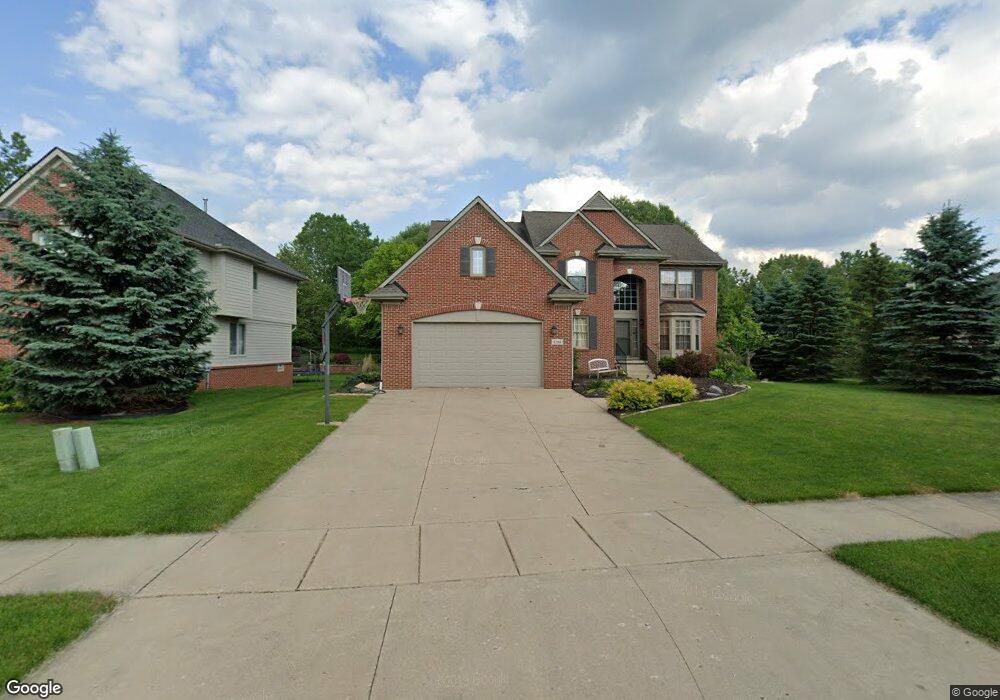
This home is located at 1284 Andover Dr, Wixom, MI 48393 and is currently estimated at $611,379, approximately $205 per square foot. 1284 Andover Dr is a home located in Oakland County with nearby schools including Wixom Elementary School, Sarah G. Banks Middle School, and Walled Lake Western High School.
Ownership History
Date
Name
Owned For
Owner Type
Purchase Details
Closed on
Dec 27, 2016
Sold by
Shingleton Daniel S and Shingleton Leslie E
Bought by
Shingleton Daniel S and Shingleton Leslie E
Current Estimated Value
Purchase Details
Closed on
Dec 10, 2003
Sold by
Singh Loon Lake Woodlands Llc
Bought by
Shingleton Daniel S and Shingleton Leslie E
Home Financials for this Owner
Home Financials are based on the most recent Mortgage that was taken out on this home.
Original Mortgage
$38,848
Interest Rate
6.04%
Mortgage Type
Credit Line Revolving
Create a Home Valuation Report for This Property
The Home Valuation Report is an in-depth analysis detailing your home's value as well as a comparison with similar homes in the area
Home Values in the Area
Average Home Value in this Area
Purchase History
| Date | Buyer | Sale Price | Title Company |
|---|---|---|---|
| Shingleton Daniel S | -- | None Available | |
| Shingleton Daniel S | -- | Transnation Title |
Source: Public Records
Mortgage History
| Date | Status | Borrower | Loan Amount |
|---|---|---|---|
| Closed | Shingleton Daniel S | $38,848 | |
| Previous Owner | Shingleton Daniel S | $310,750 |
Source: Public Records
Tax History
| Year | Tax Paid | Tax Assessment Tax Assessment Total Assessment is a certain percentage of the fair market value that is determined by local assessors to be the total taxable value of land and additions on the property. | Land | Improvement |
|---|---|---|---|---|
| 2025 | $5,953 | $283,000 | $0 | $0 |
| 2024 | $5,596 | $265,700 | $0 | $0 |
| 2023 | $5,301 | $225,050 | $0 | $0 |
| 2022 | $5,325 | $205,640 | $0 | $0 |
| 2021 | $5,279 | $204,940 | $0 | $0 |
| 2020 | $5,096 | $196,040 | $0 | $0 |
| 2019 | $5,303 | $177,640 | $0 | $0 |
| 2018 | $5,381 | $167,210 | $0 | $0 |
| 2017 | $5,332 | $156,970 | $0 | $0 |
| 2016 | $5,295 | $154,630 | $0 | $0 |
| 2015 | -- | $153,390 | $0 | $0 |
| 2014 | -- | $138,500 | $0 | $0 |
| 2011 | -- | $132,810 | $0 | $0 |
Source: Public Records
Map
Nearby Homes
- 1069 Calpernia Unit 48
- 1440 Woodbridge Ln
- 1535 Kings Crown Ct
- 1450 Flamingo
- 882 Natures Cove Ct
- 1369 Flamingo
- 913 Rikki Ann Ct
- 1470 Nightingale
- 802 Red Maple Ln
- 773 Red Maple Ln
- 810 Yorick Path Unit 12
- 2958 Blue Heron Ln
- 2759 Maple Forest Dr Unit 84
- 2225 Silvermaple Ct
- 691 Chestnut Dr Unit 24
- 606 Shady Maple Dr Unit 52
- 1599 Chanticlair Cir
- 8208 Chesapeake Cir Unit 95
- 21105 Chesapeake Cir Unit 243
- 30210 Chesapeake Cir Unit 360
- 1288 Andover Dr
- 1280 Greenbriar Ct
- 1302 Andover Dr
- 1287 Andover Dr
- 1276 Greenbriar Ct
- 1283 Andover Dr
- 1316 Andover Dr
- 1275 Andover Dr
- 1311 Trillium Ct
- 1295 Trillium Ct
- 1272 Greenbriar Ct
- 1267 Andover Dr
- 1264 Andover Dr
- 2430 Potter Rd
- 2424 Potter Rd
- 1268 Greenbriar Ct
- 1299 Trillium Ct
- 1319 Andover Dr
- 1263 Andover Dr
- 1260 Andover Dr
Your Personal Tour Guide
Ask me questions while you tour the home.